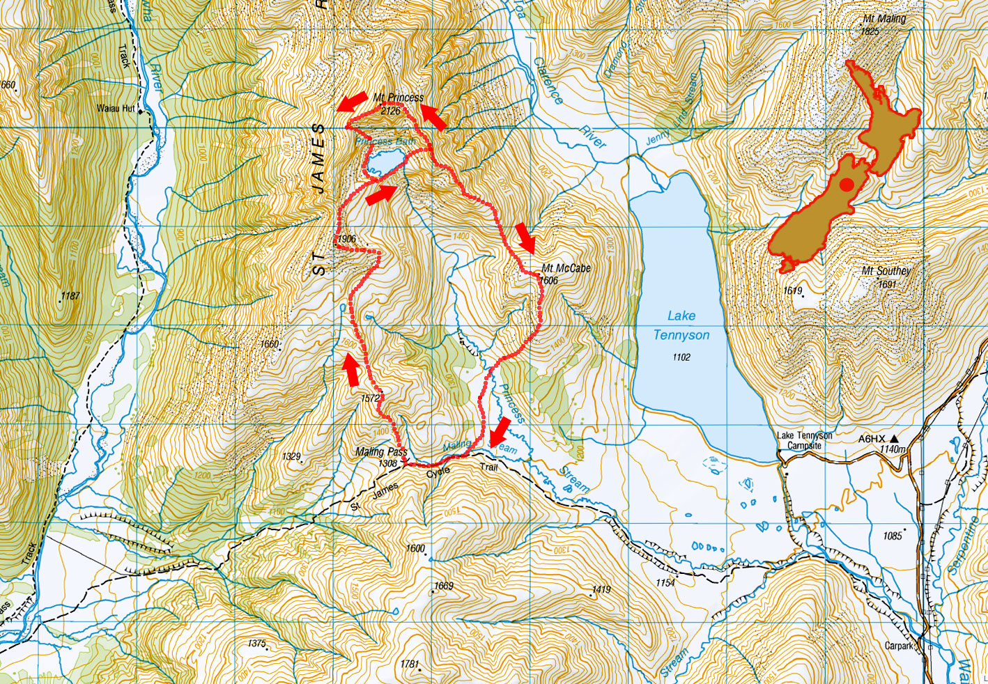
Mt Princess traverse, April 2024

A view up Waiau Uwha River to Mt McCabe (1,606m) and Mt Princess (2,126m) behind

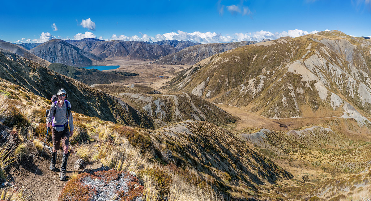
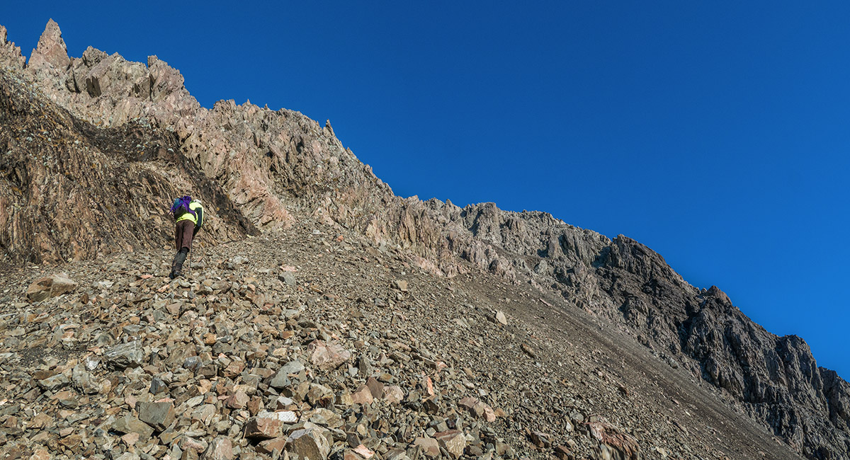
Climbing the ridge from Maling Pass (1,308m), first to Pt 1572

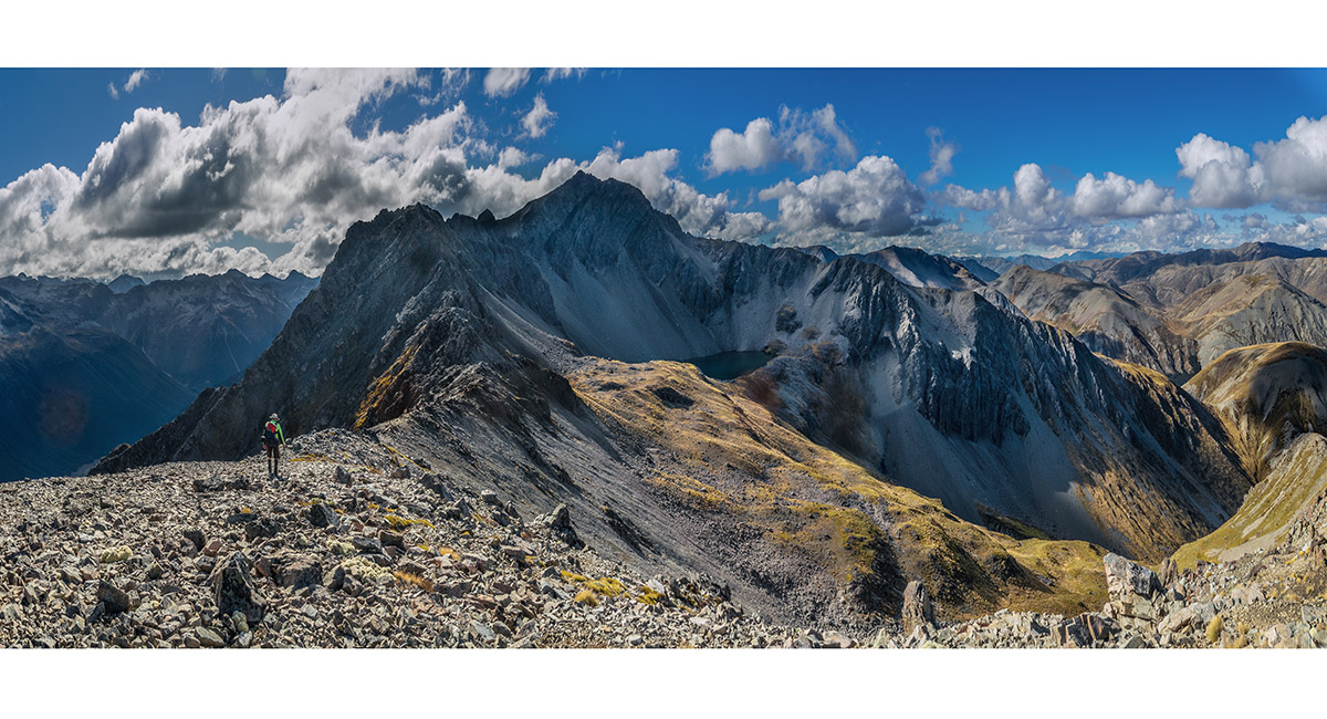
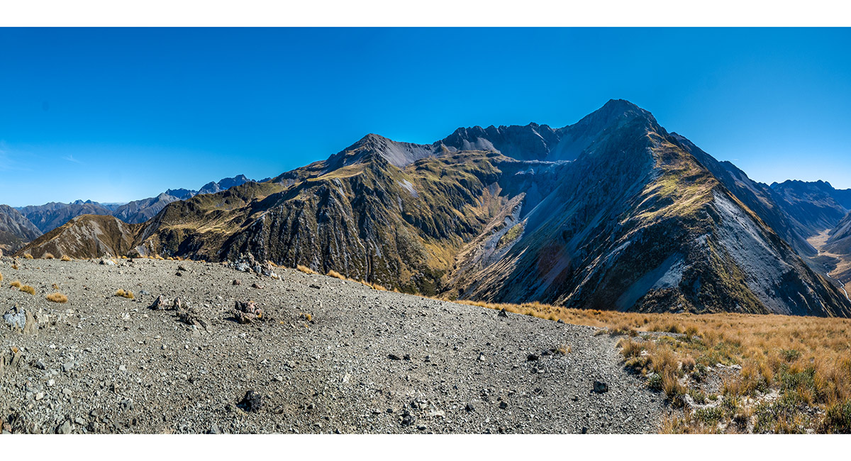
At about 1,600m, with Pt 1906 top left and Mt Princess centre skyline

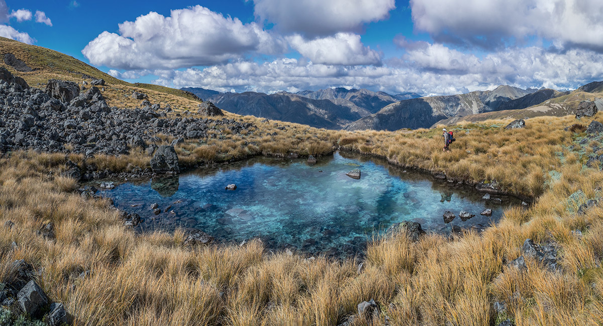
A tarn at 1,680m, beneath and south of Pt 1906


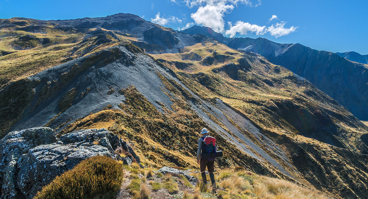
On the ridge just before Pt 1906

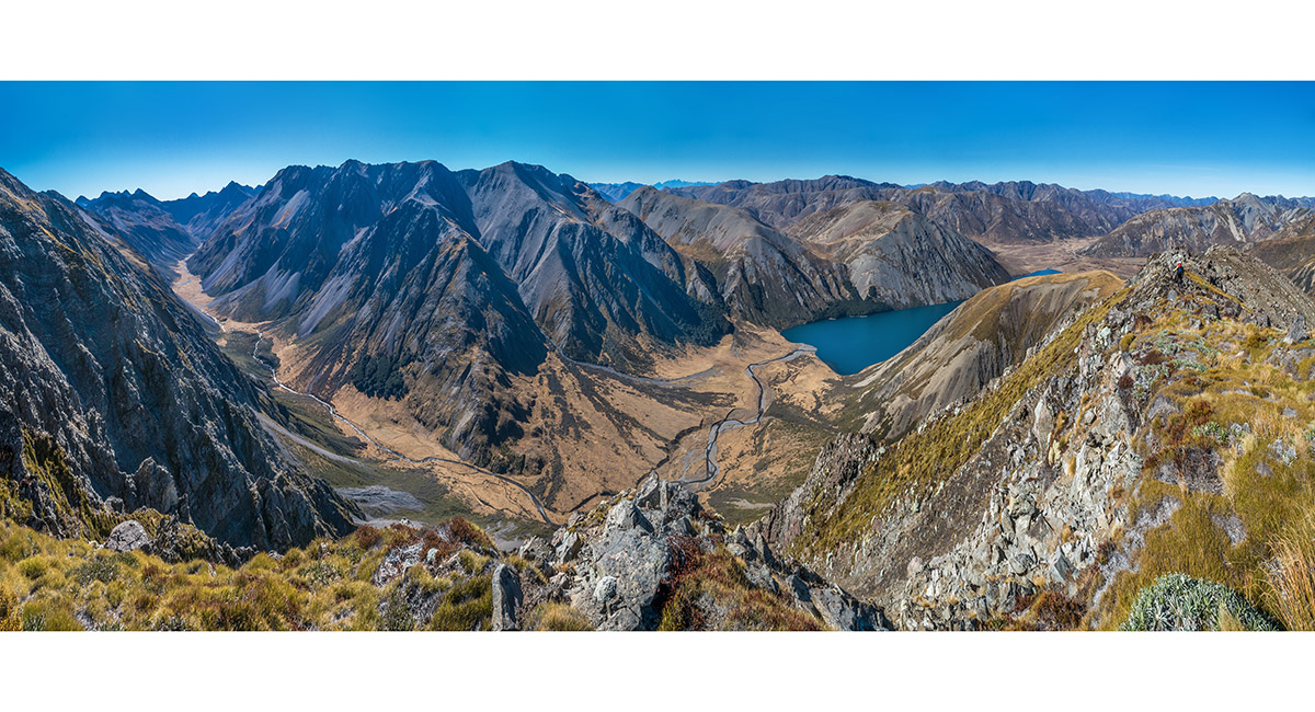
Departing Pt 1906, with Princess Bath (1750m) and Mt Princess ahead. The ridge descending to Mt McCabe drops right from above the tarn

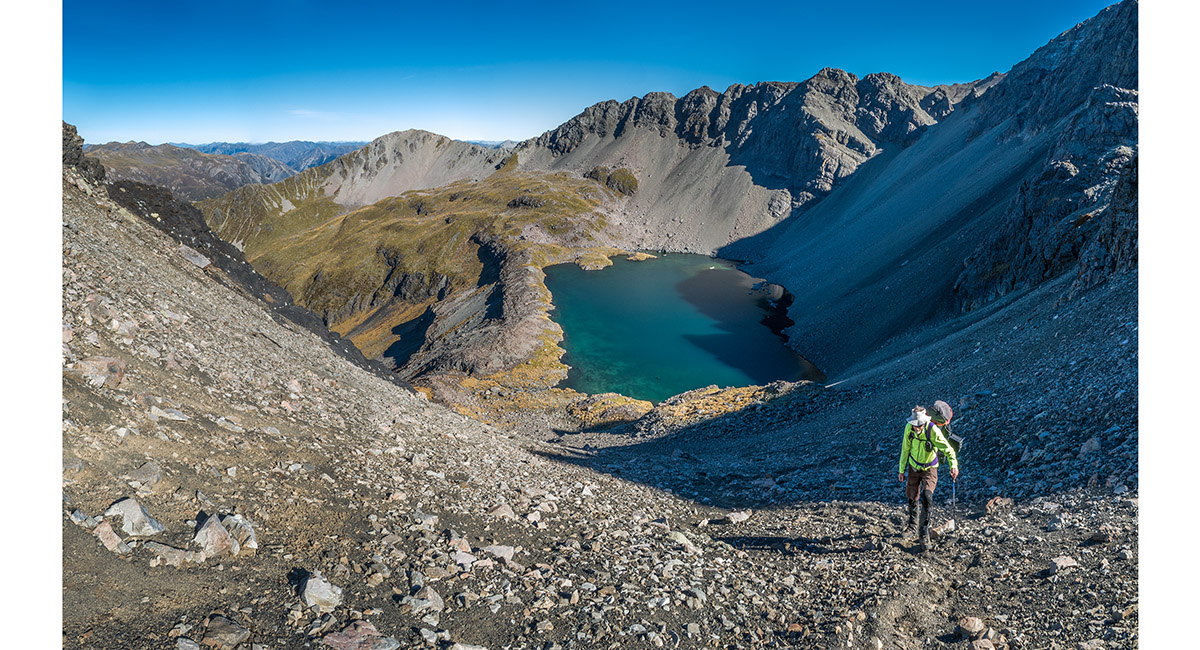
Heading towards Princess Bath

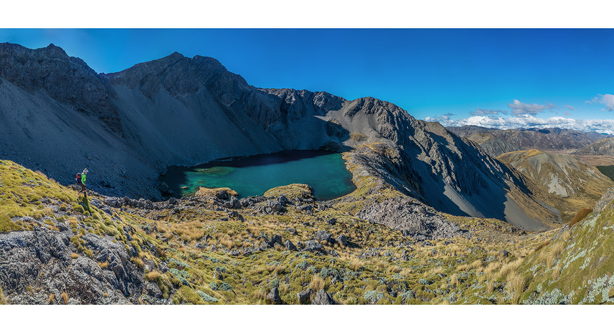
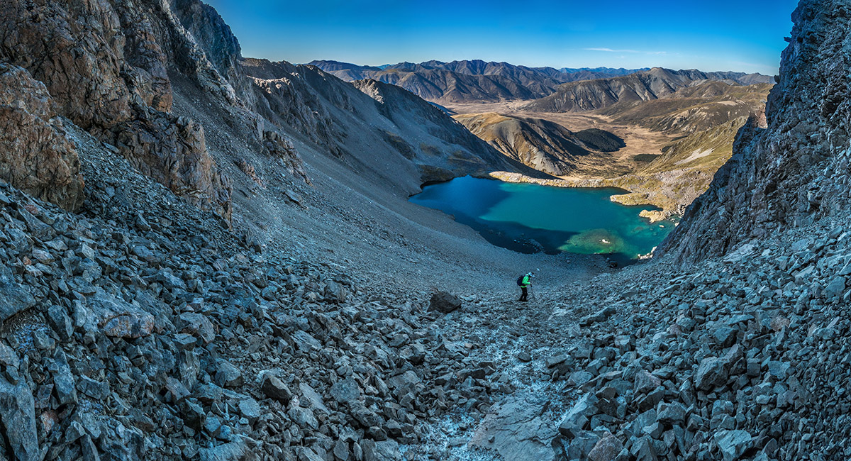
Dropping to Princess Bath. The scree slope giving access to the southeast ridge of Mt Princess is above the right side of the tarn

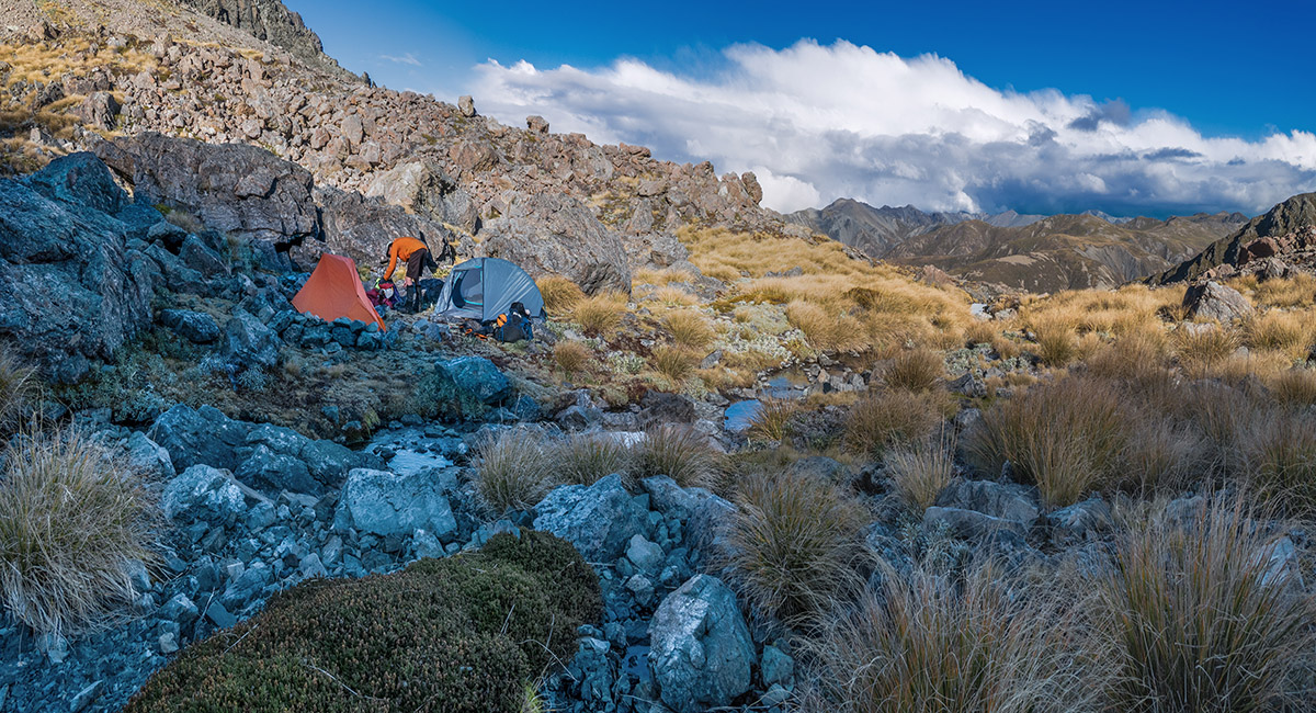
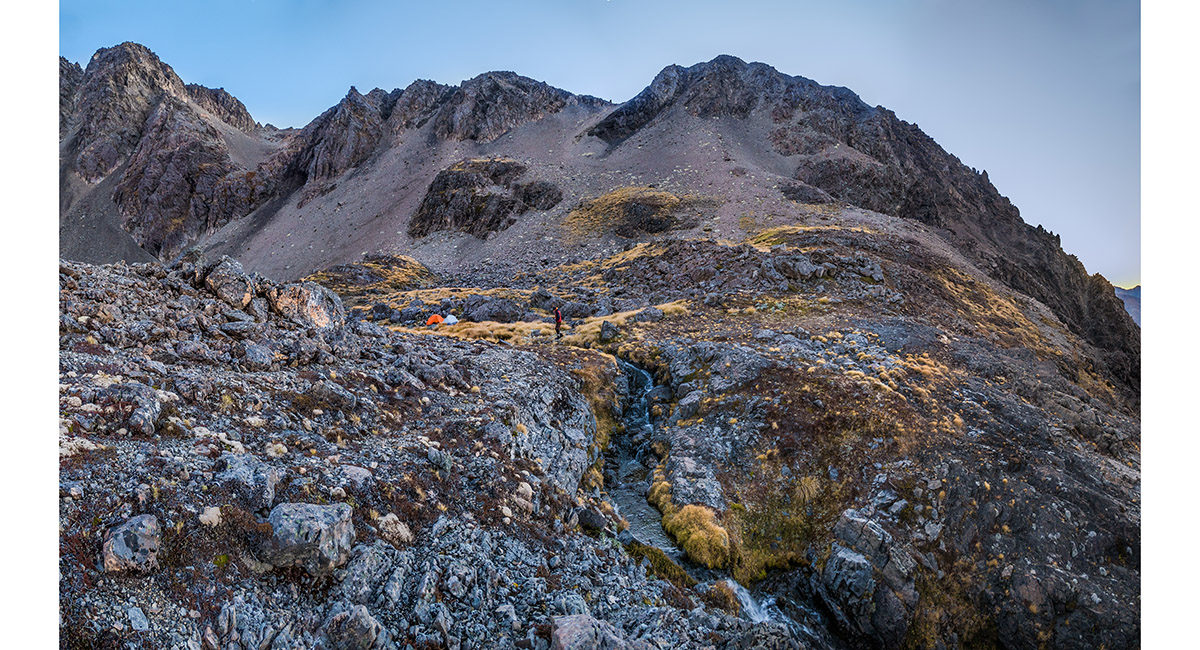
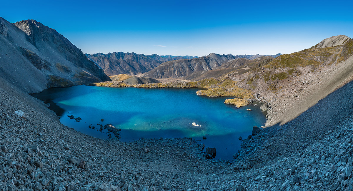
Setting up camp on the northeast side of Princess Bath

Our camp beside Princess Bath

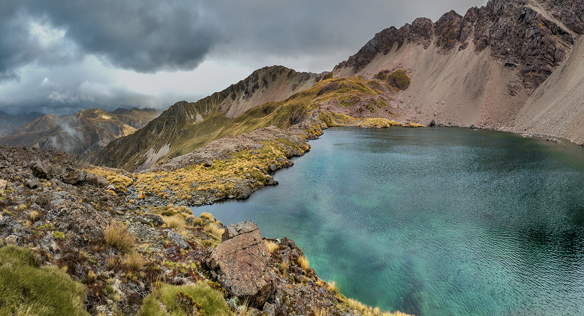
A dawn view across the top of the cliffs to the south of Princess Bath, and the southeast ridge of Mt Princess

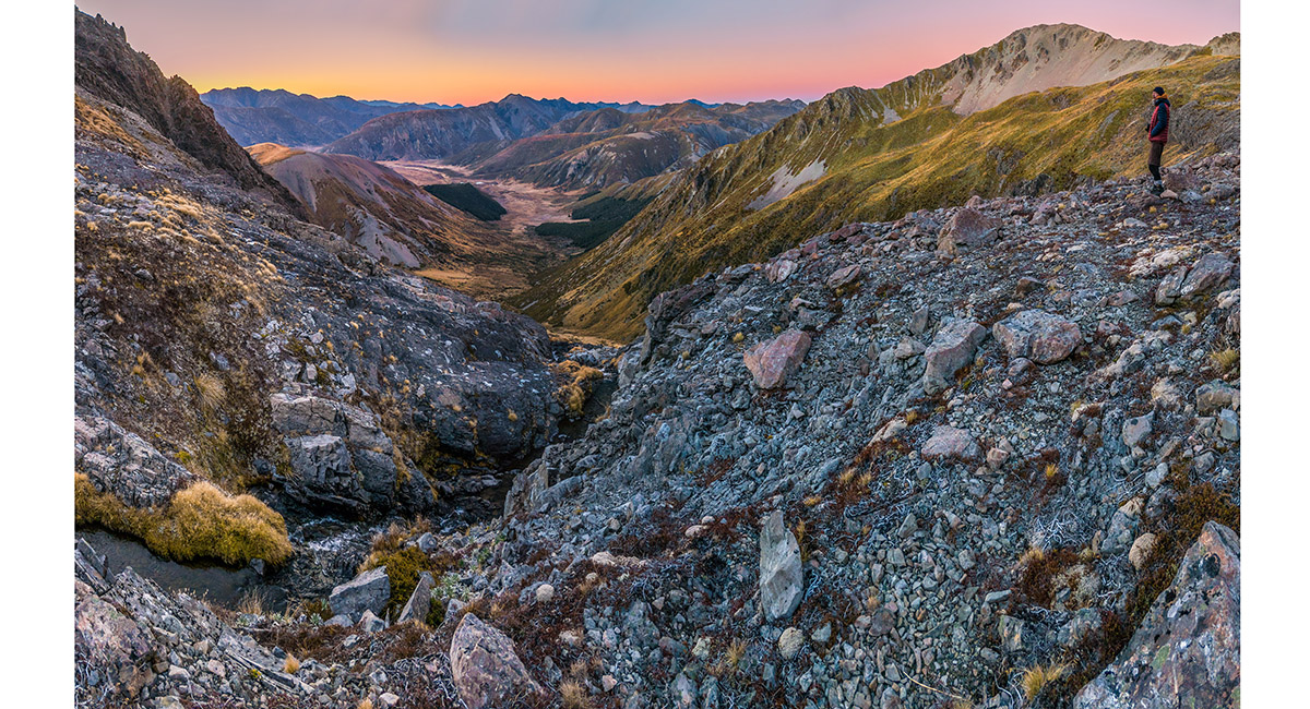
A dawn view south from Princess Bath


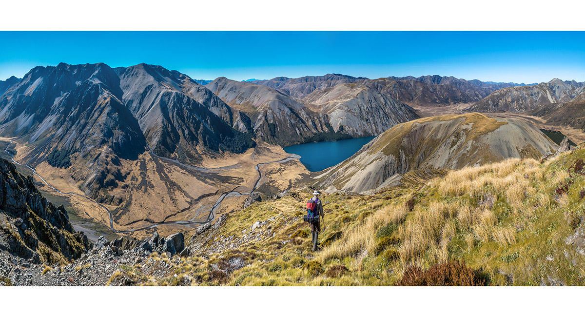
Heading up the scree to access Mt Princess via the southeast ridge. Mt Princess is bathed in morning sunlight


At about 1,940m, looking up the southeast ridge to Mt Princess

Progressing up the southeast ridge to Mt Princess

A view back down the southeast ridge from about 2,000m

On a scree slope on the north side of the southeast ridge that gives access to the summit while avoiding a particularly steep and broken stretch of the ridge


Ascending a steep chute at 2,100m, just beneath the summit


A view looking south along the flat ridgetop of Mt Princess. The descent route is down the sunlit ridge on the far right


A view north from the flat ridgetop of Mt Princess, with the Waiau Toa/Clarence Valley at right

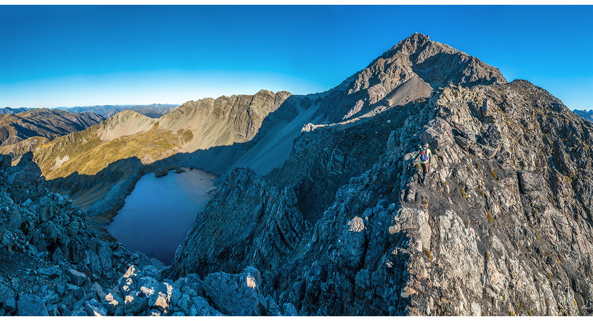
A view west to Mt Una (2,300m) from the summit of Mt Princess


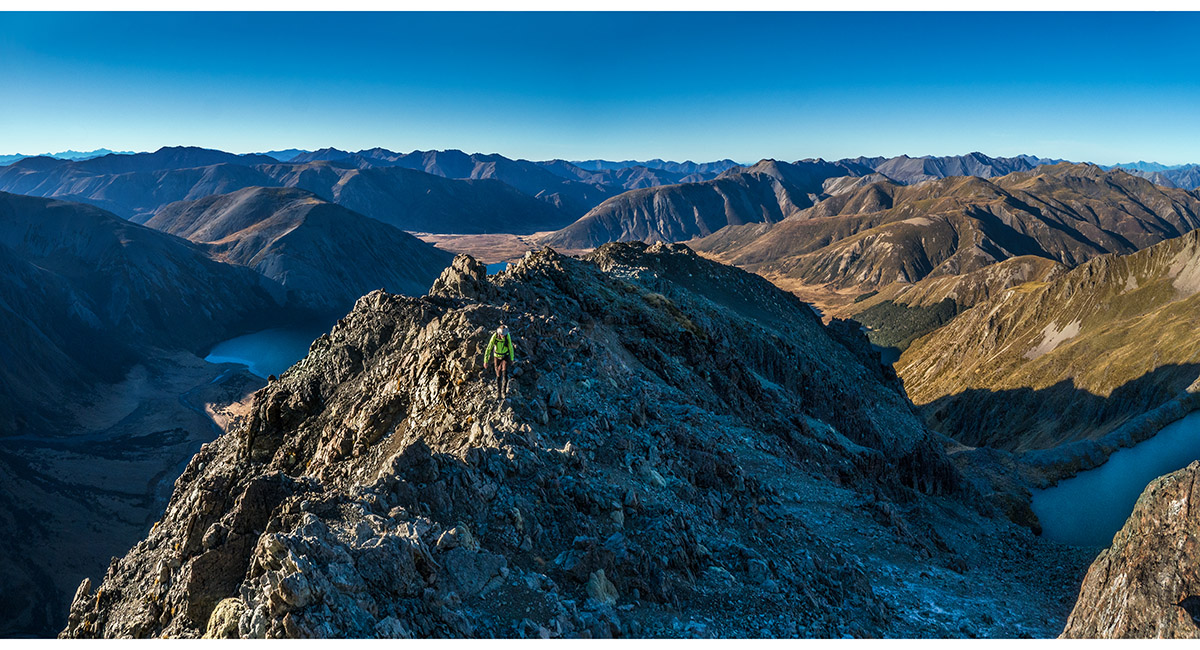
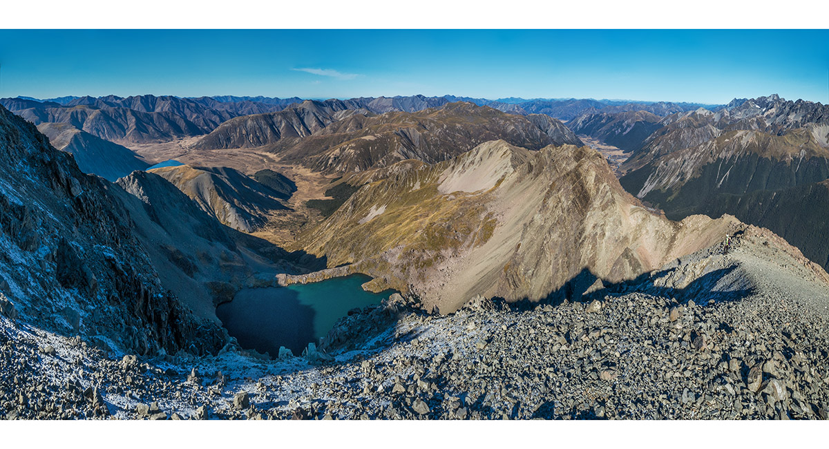
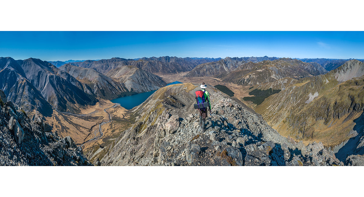
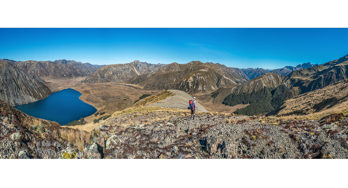
Mt Princess (2,126m) summit view south, with the southeast ridge (ascent) at left and southwest ridge (descent) right. Mt McCabe (1,606m) and Lake Tennyson (1,102m) are top left. This picture takes in almost the entire circuit beginning and ending at Maling Pass

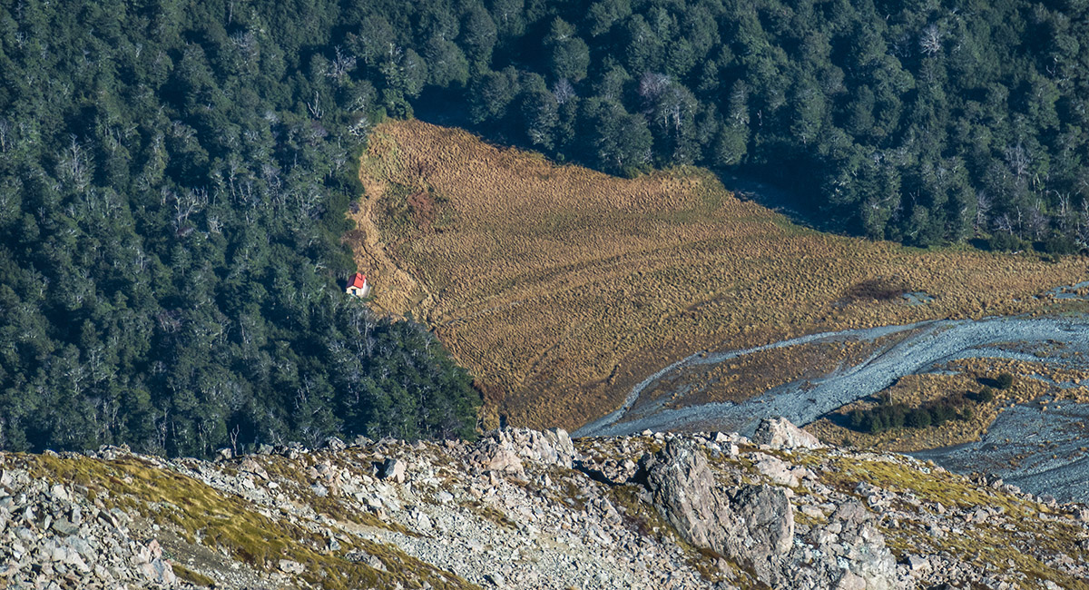
Waiau Hut (850m), viewed from high on Mt Princess

A view down the southwest ridge to Princess Bath


Exiting the southwest ridge at 2,000m to drop down a steep scree slope to Princess Bath

Descending to Princess Bath

Nearing the northwest shore of Princess Bath

After some lunch, setting off again up the scree to access the southeast ridge at 1,940m


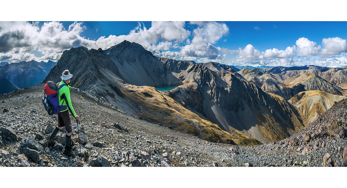
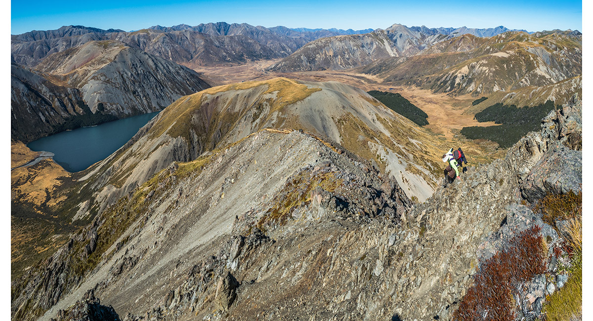
Back on the southeast ridge, looking northwest to Mt Princess

At 1,900m, surveying our route down the southeast ridge to Mt McCabe. Lake Tennyson left

Heading down the southeast ridge, with the Waiau Toa/Clarence headwaters feeding Lake Tennyson at left

At about 1,750m on the southeast ridge descent

At about 1,650m on the southeast ridge descent

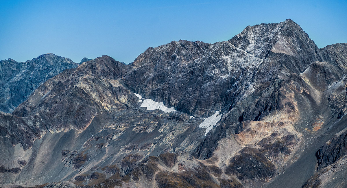
A view from Mt McCabe, back up the southeast ridge to Mt Princess. The cliffs to the south of Princess Bath are clearly visible. Mt Una is on the left skyline

Descending south off Mt McCabe


A view back across tussock wetlands at 1,300m to Mt McCabe at right and Mt Princess left

Read about it Fit for a Princess Wilderness Magazine Dec 2024
To order a print or web resolution file of any image you see in this slide show, just right click the image, click “Copy Image URL” and paste in to the “Your message” box of our Contact Us form. Please also note, for each image, if you want a print or web resolution file. We will get back to you as soon as possible to confirm price and payment details.
Open Contact Us in a new window to paste Image URL(s) easily