Maungamahue bivvy, May 2021
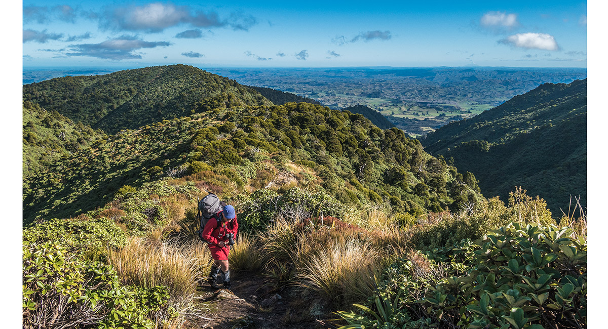
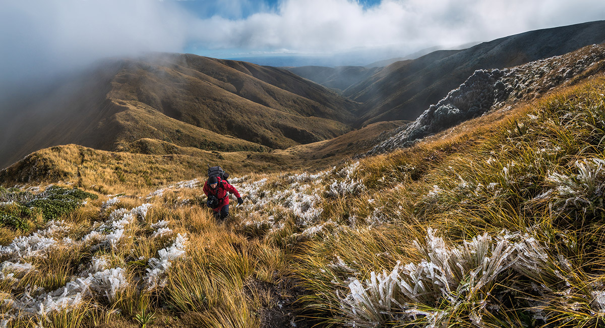
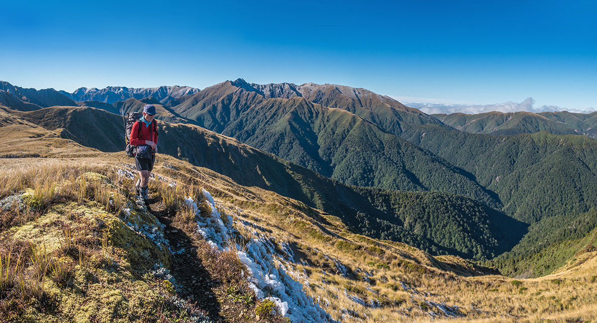
Ascending Deadman's Track, at about 1,000m

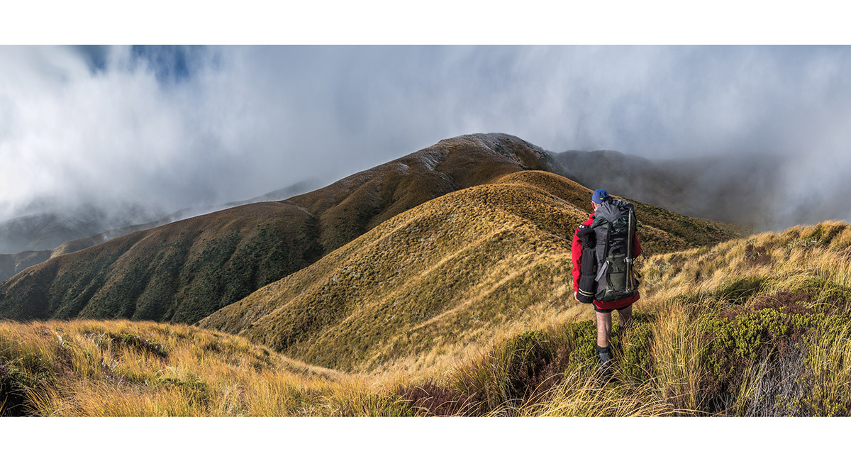
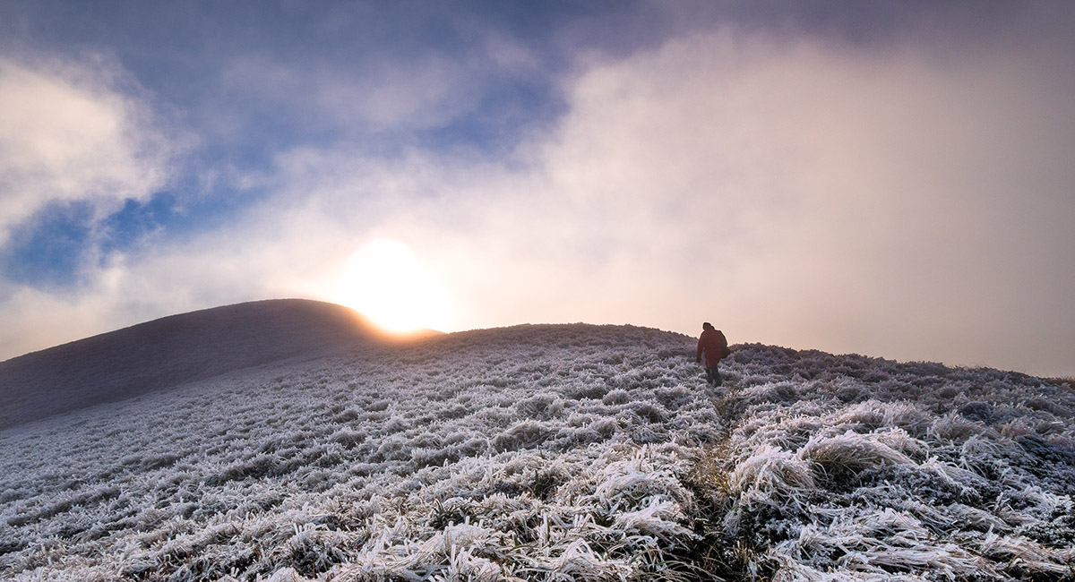
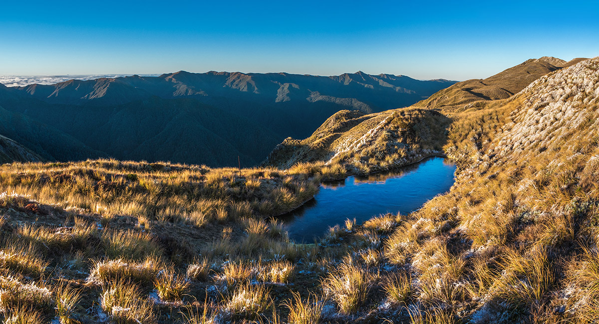
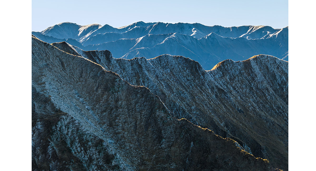
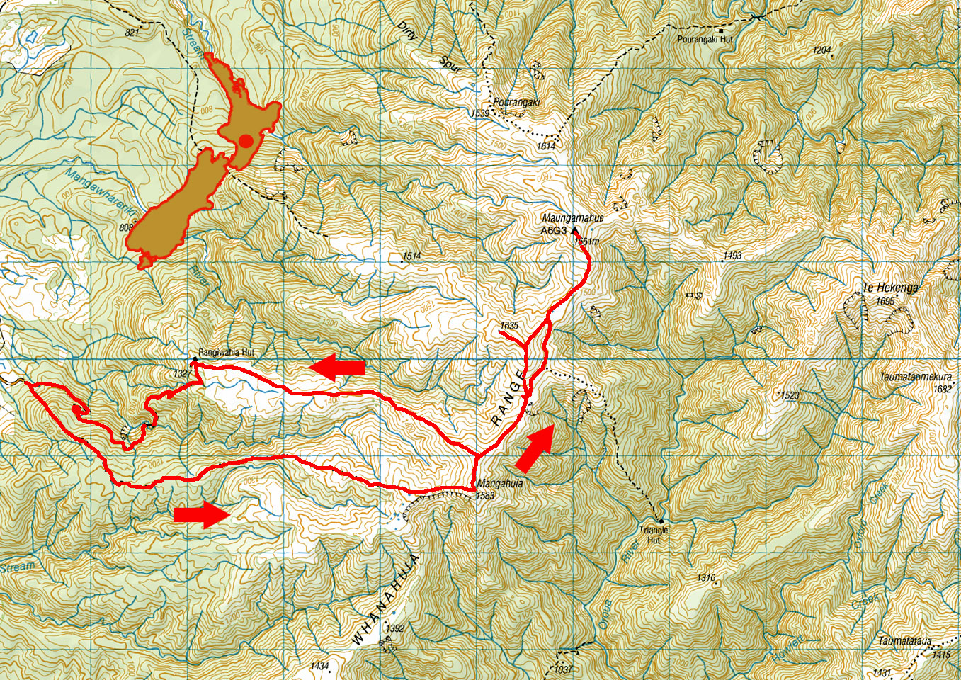
Heading north along the Whanahuia Range towards Mangahuia (1,583m)

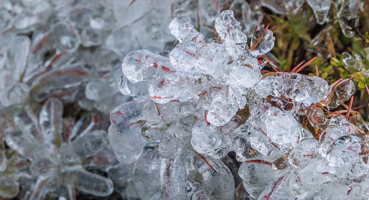
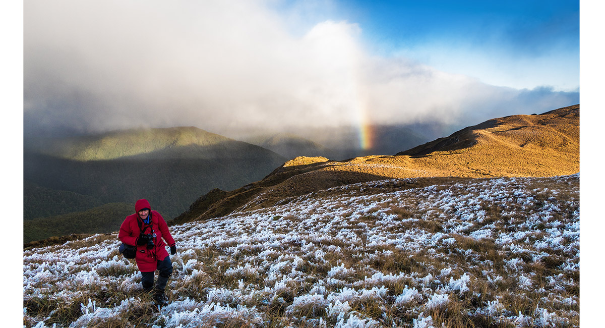
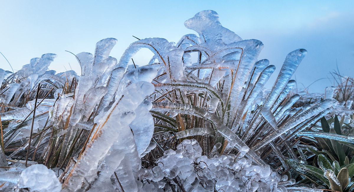
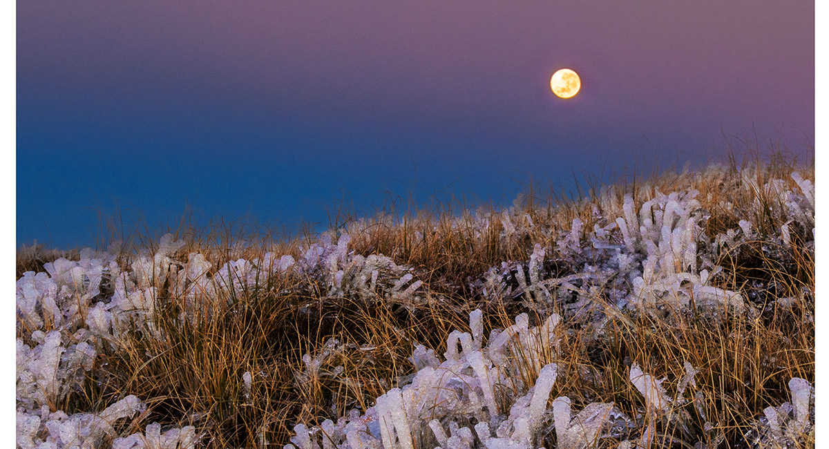
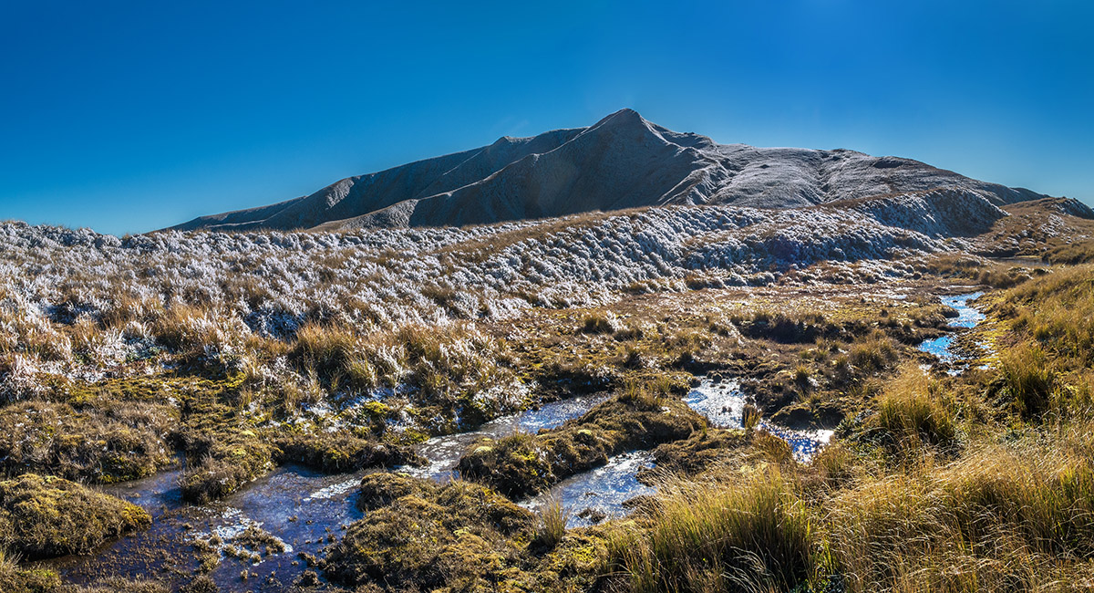
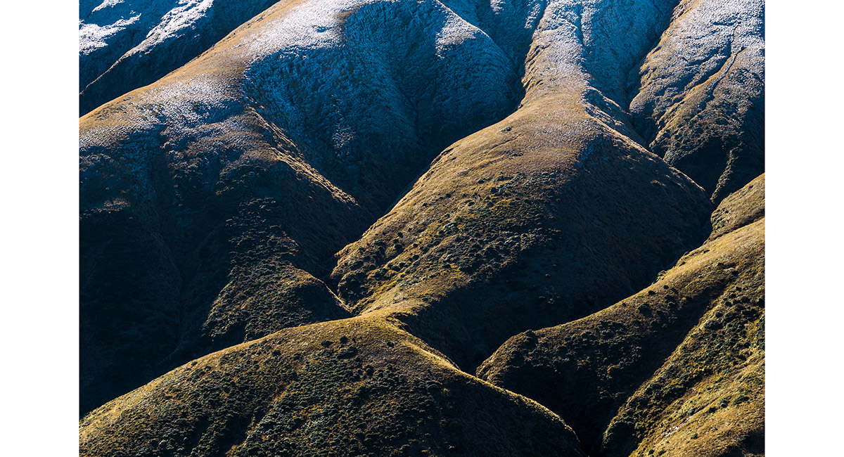
Rime ice at about 1,400m

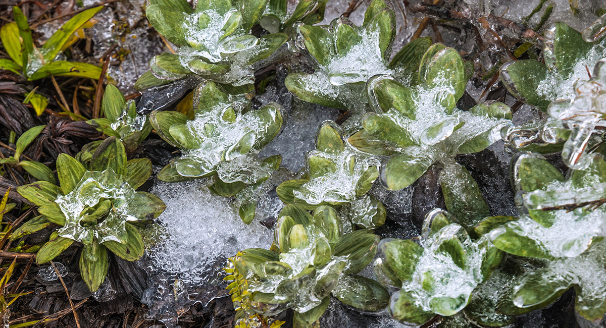
Rime ice at about 1,400m

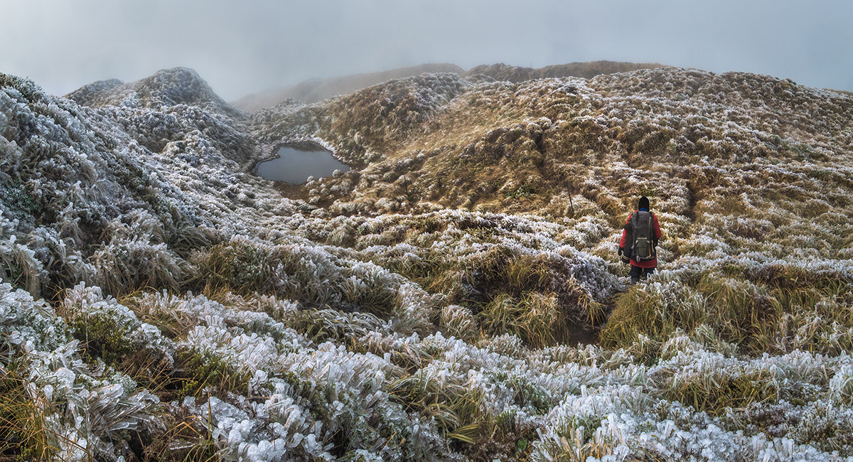
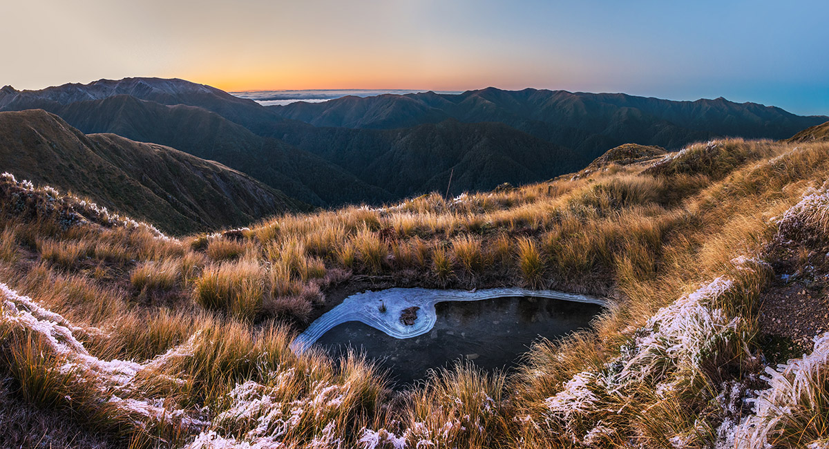
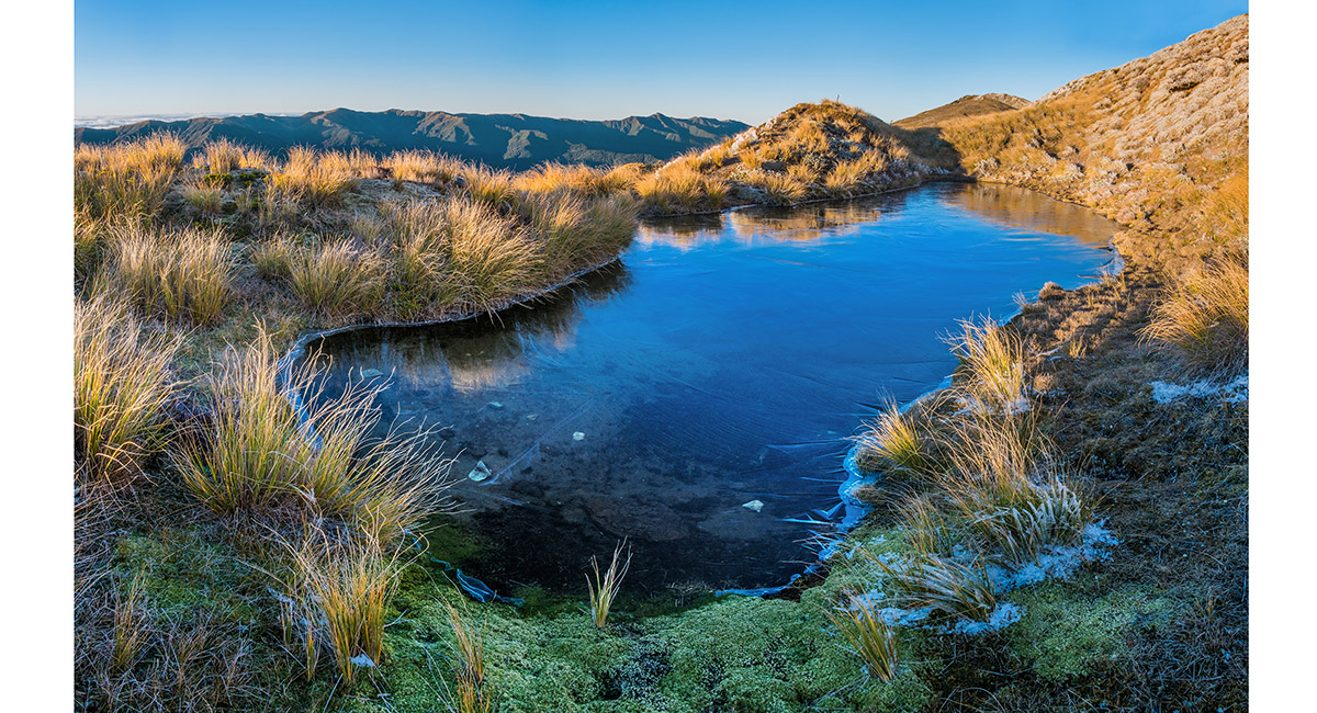
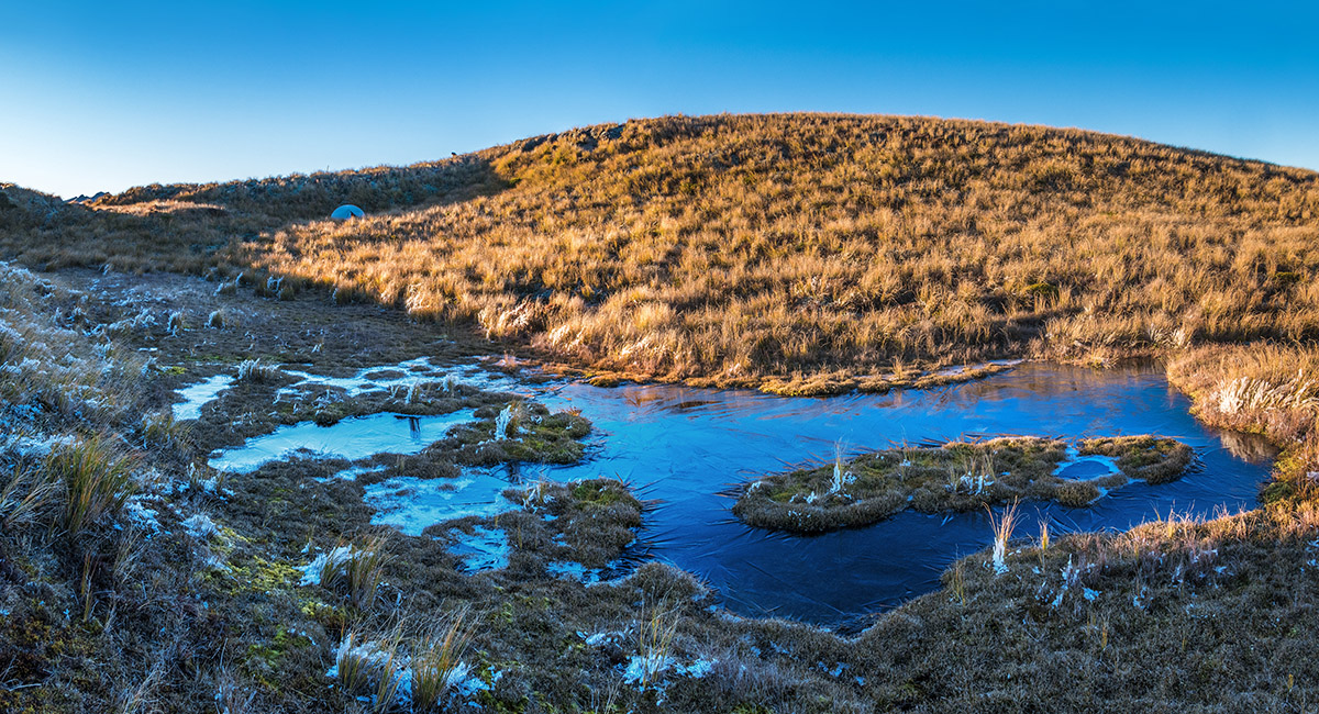
A small tarn west of Mangahuia, at about 1,400m

Heading north along the Whanahuia Range towards Mangahuia (1,583m)

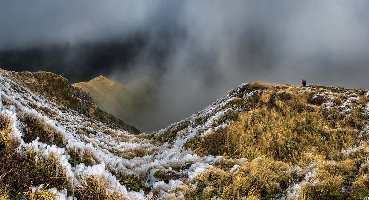
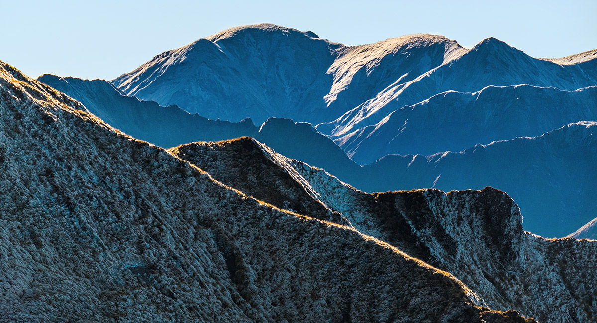
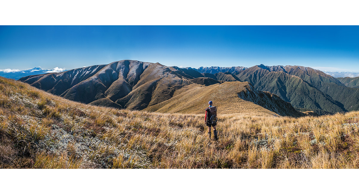
Just west of Mangahuia, at about 1,500m

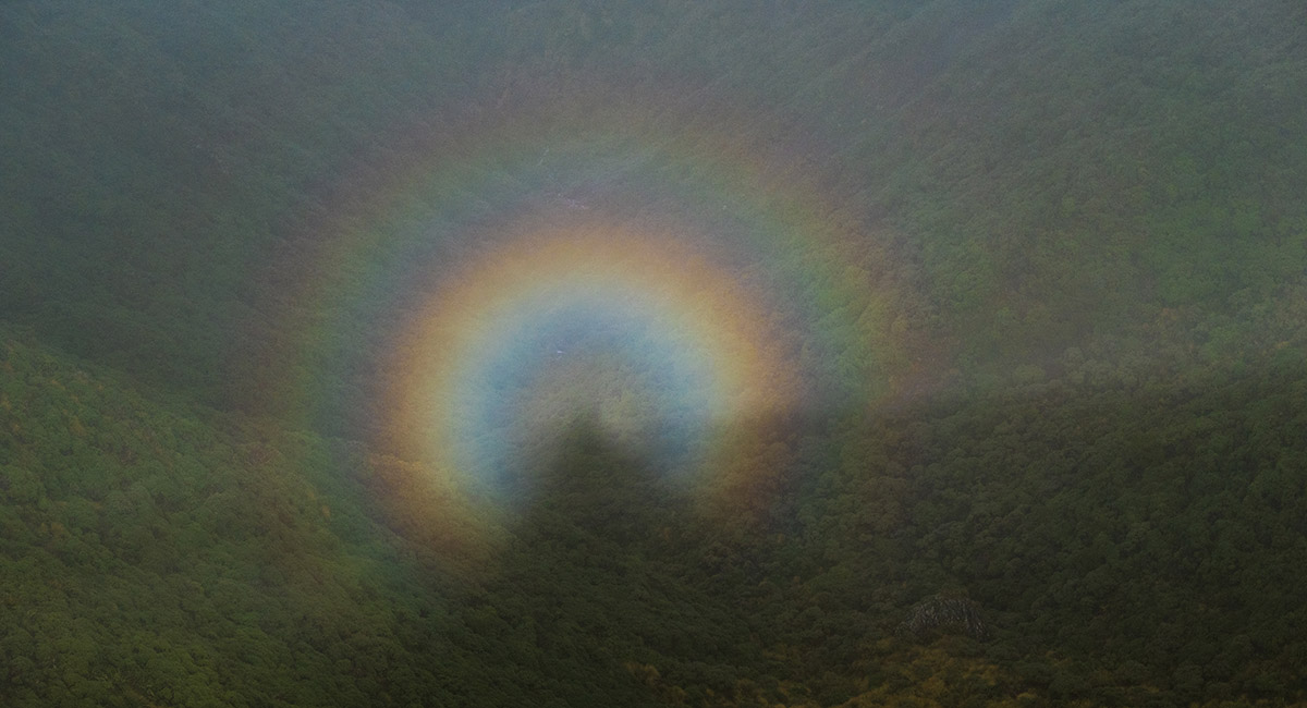
A Brochen spectre, viewed near Mangahuia

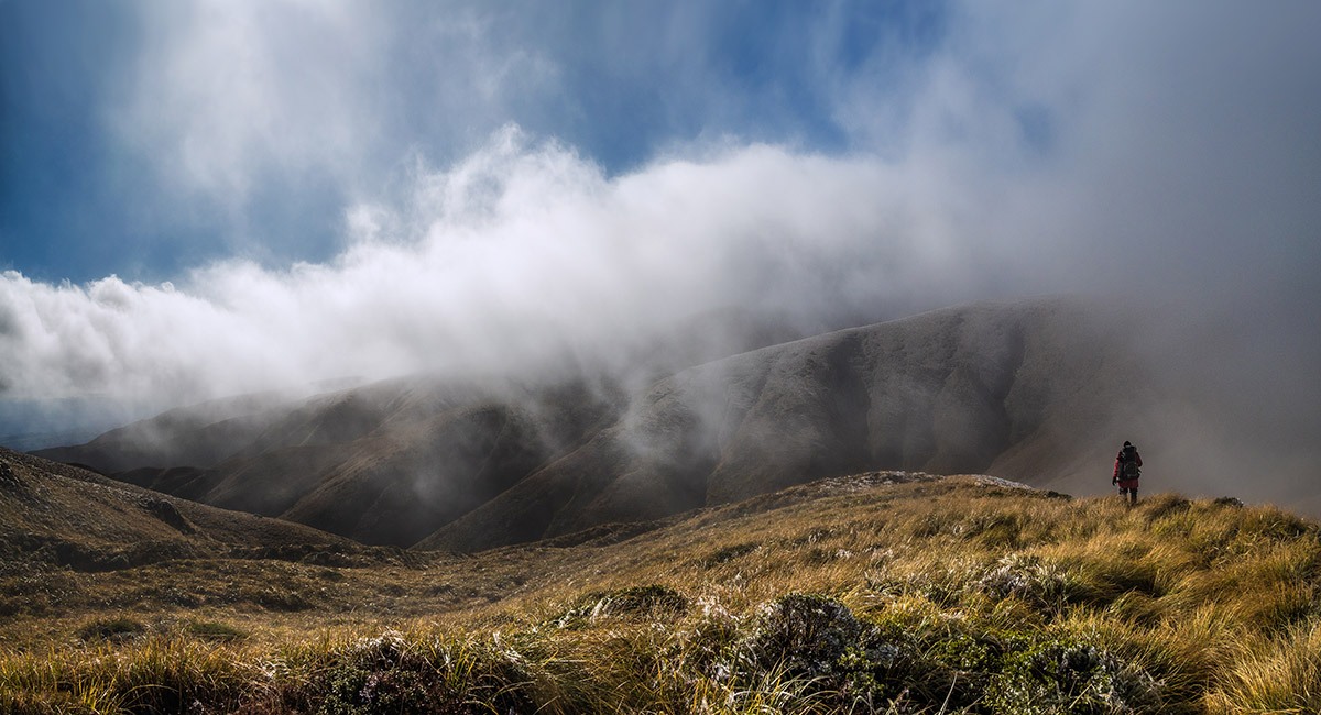
A view west, just below the top of Mangahuia

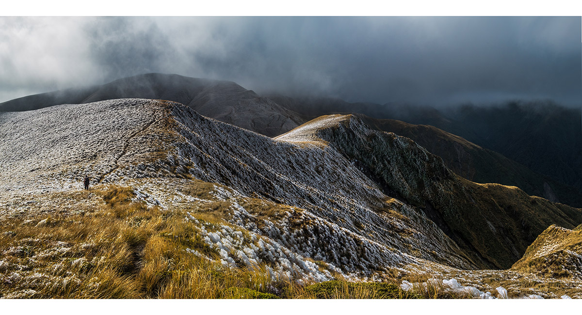
A little north of Mangahuia, at about 1,500m

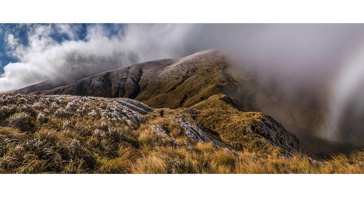
North of Mangahuia


A series of small tarns north of Mangahuia, where we decided to set up camp


Our campsite, at 1,470m beside tarns north of Mangahuia, late afternoon

Climbing above our campsite to the 1,635m high point for sunset

Climbing above our campsite to the 1,635m high point for sunset

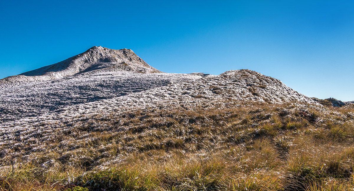
Rime ice, near the top of Point 1,635m


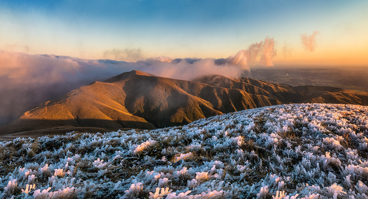
Sunset view northwest from Point 1,635m, to Maungamahue (1,661m)

Sunset view south to Mangahuia, from the 1,635m high point


Rime ice on Point 1,635m, at sunset

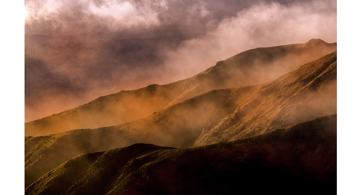
The ridges coming west off Maungamahue, at sunset


Dusk view north to Maungamahue, from the 1,635m high point


Our campsite, beside tarns north of Mangahuia, at dusk


Our campsite, beside tarns north of Mangahuia, before dawn

A small tarn beside the trail to Triangle Hut, at dawn

Blood moon at dawn

A small tarn beside the trail to Triangle Hut, looking southeast at dawn

A small tarn beside the trail to Triangle Hut, looking southeast at dawn

Our campsite, beside tarns north of Mangahuia, sunrise


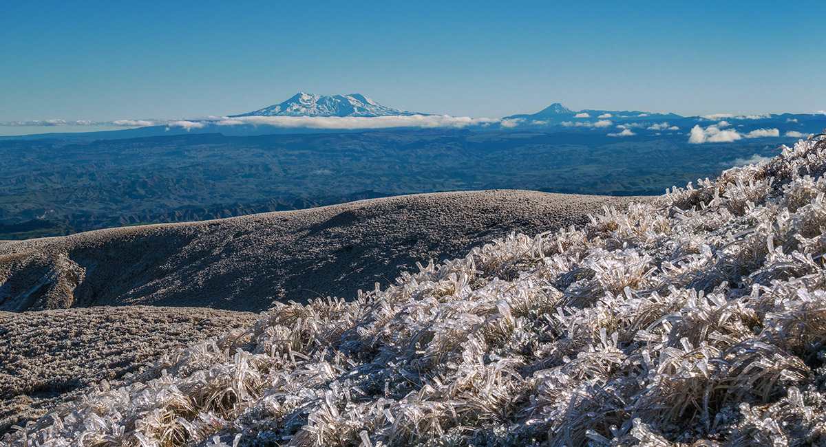
A view northwest to the Volcanoes, from the saddle (1,500m) between Point 1,635m and Maungamahue (1,661m)

On the saddle, looking northeast to Maungamahue

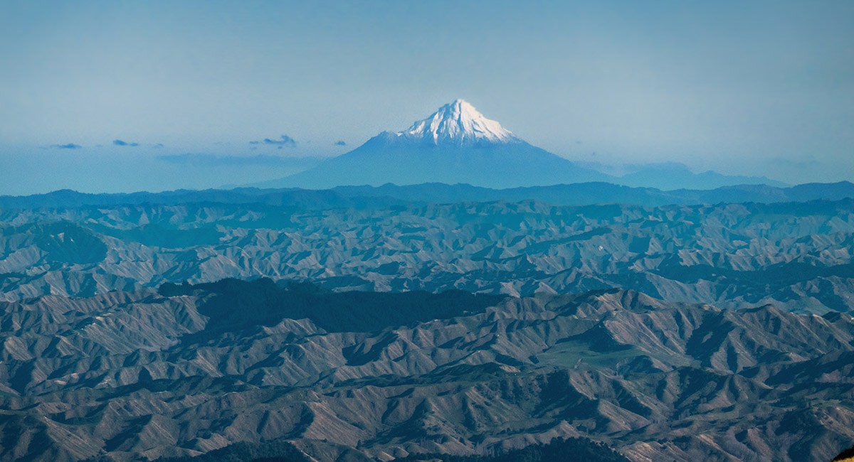
Mt Taranaki, viewed from the saddle beneath Maungamahue

Maungamahue, viewed from the south

An early morning view north from Maungamahue. Mangaweka far left

An early morning view north from Maungamahue to Mangaweka

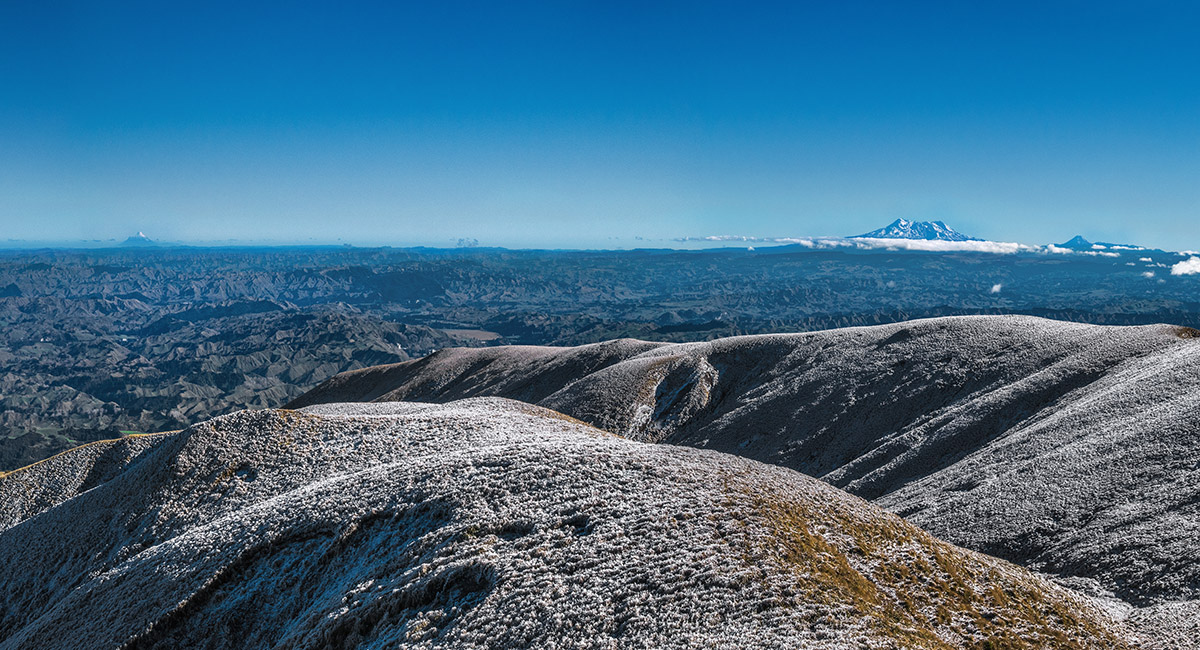
An early morning view northwest to the volcanoes, from Maungamahue


An early morning view north from Maungamahue, Te Hekenga right of centre

Maungamahue summit view, taking in Taranaki (left skyline) and Ruapehu and Ngauruhoe (to the right)


View northeast to Maungamahue (left) and Te Hekenga (right)

Retracing our steps south towards Mangahuia, with Mangaweka left skyline and Te Hekenga left of centre

View northeast from Mangahuia. From left, Mt Ruapehu, Point 1,635m, Mangaweka (centre), Te Hekenga

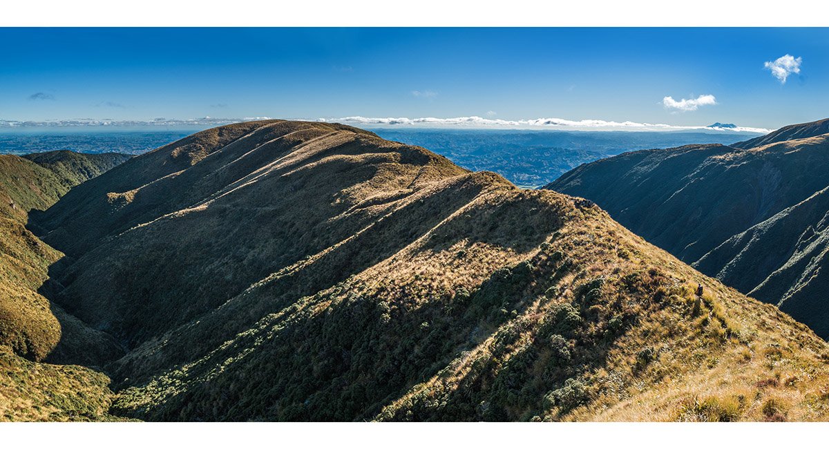
Ridges on the southern side of Point 1,635m

Heading west towards Rangiwahia Hut

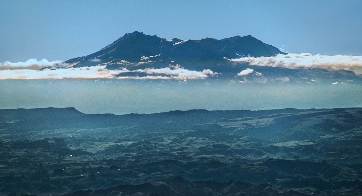
A levitating Ruapehu, viewed from the trail to Rangiwahia Hut

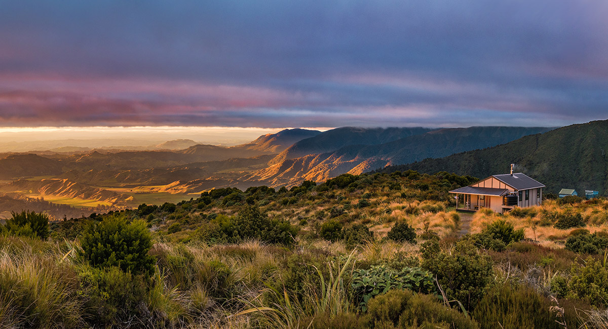
A view north at sunset of Rangiwahia Hut (1,327m)

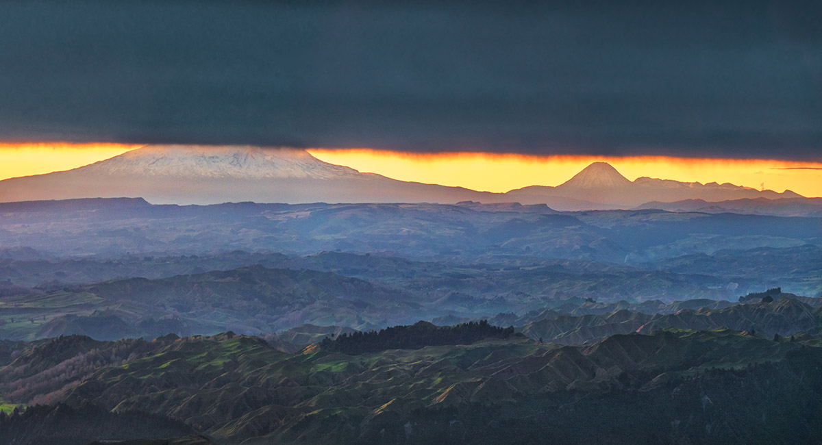
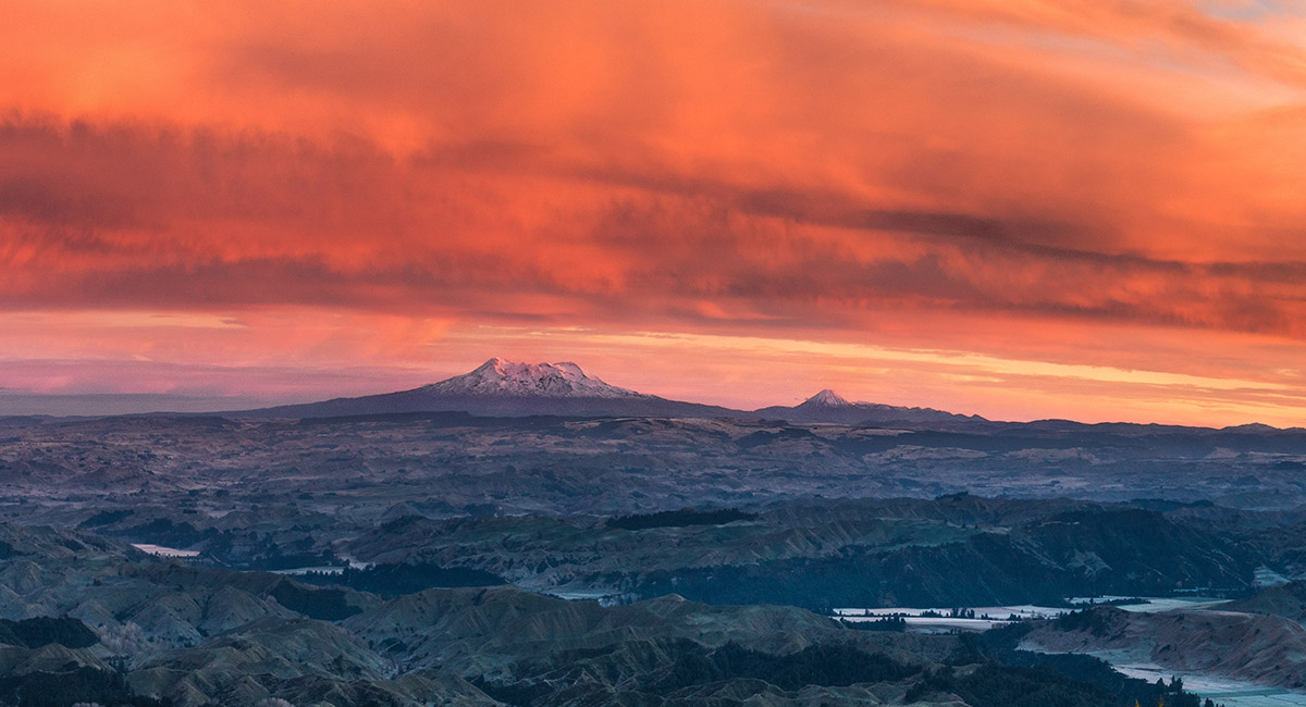
Sunset view northwest to the Volcanoes, from Rangiwahia Hut

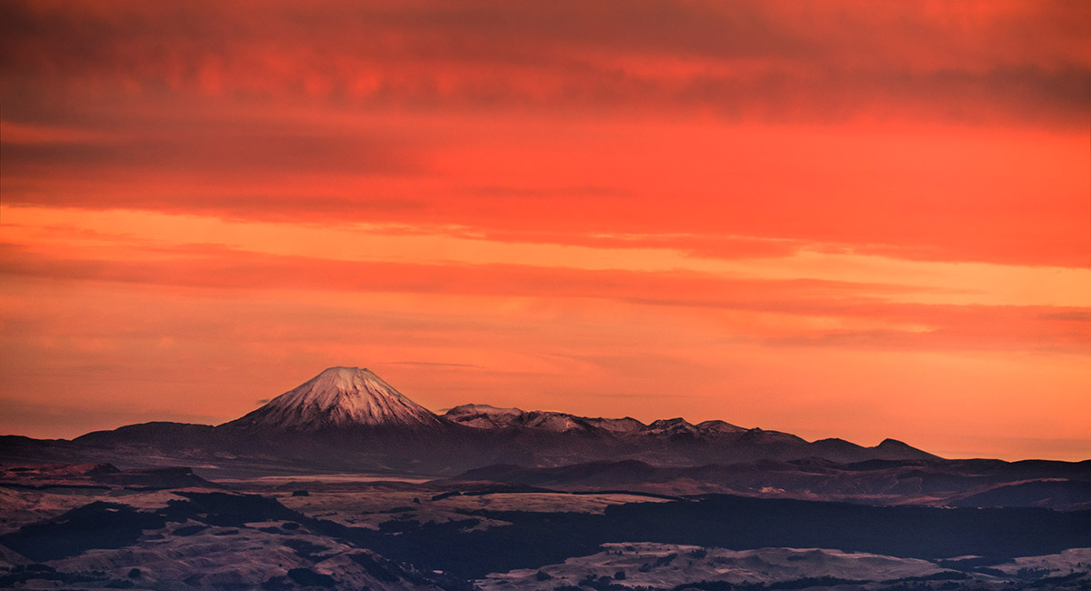
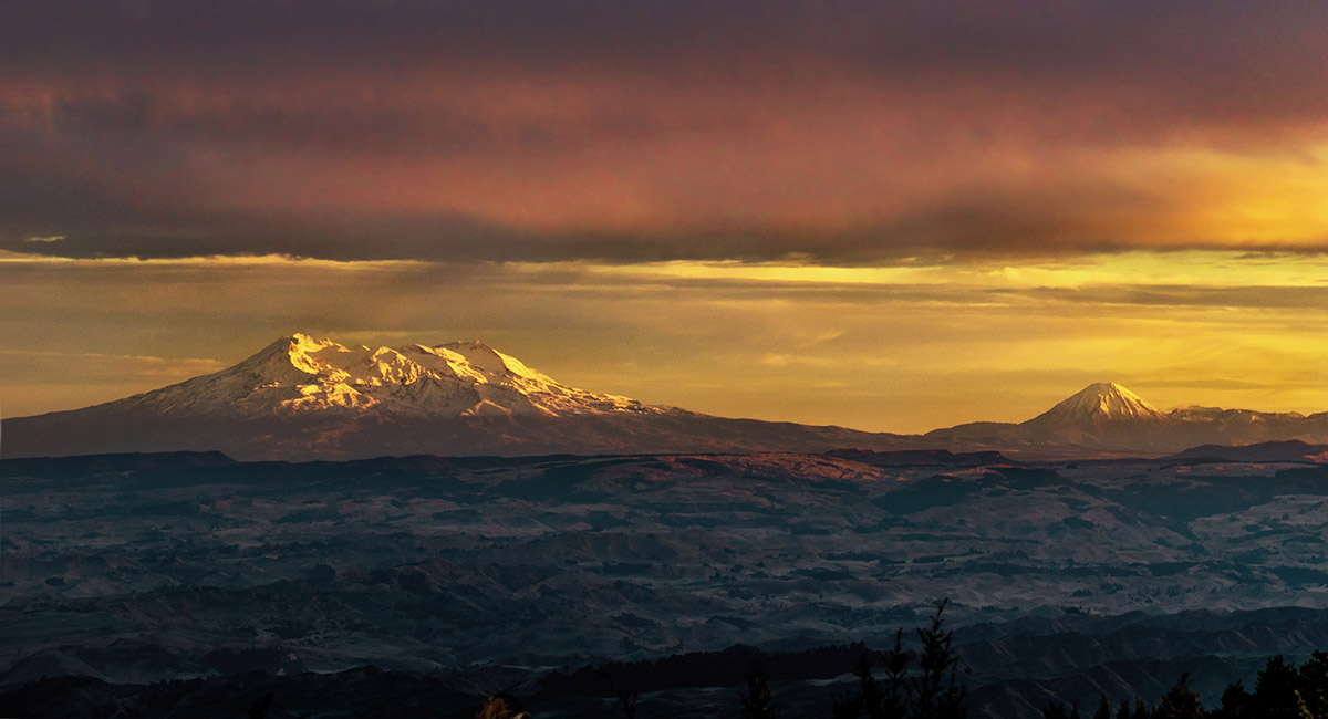
Sunrise view northwest to Ngauruhoe, from Rangiwahia Hut

Sunrise view west, from Rangiwahia Hut

Sunrise view west, from Rangiwahia Hut

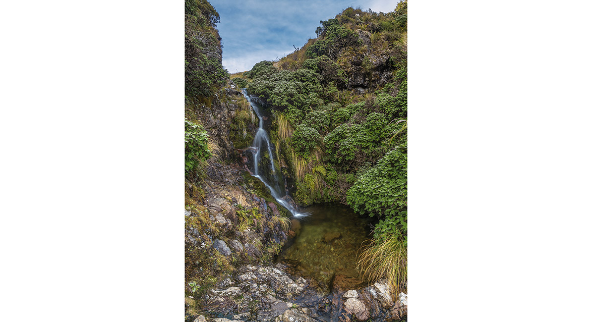
A small waterfall below Rangiwahia Hut

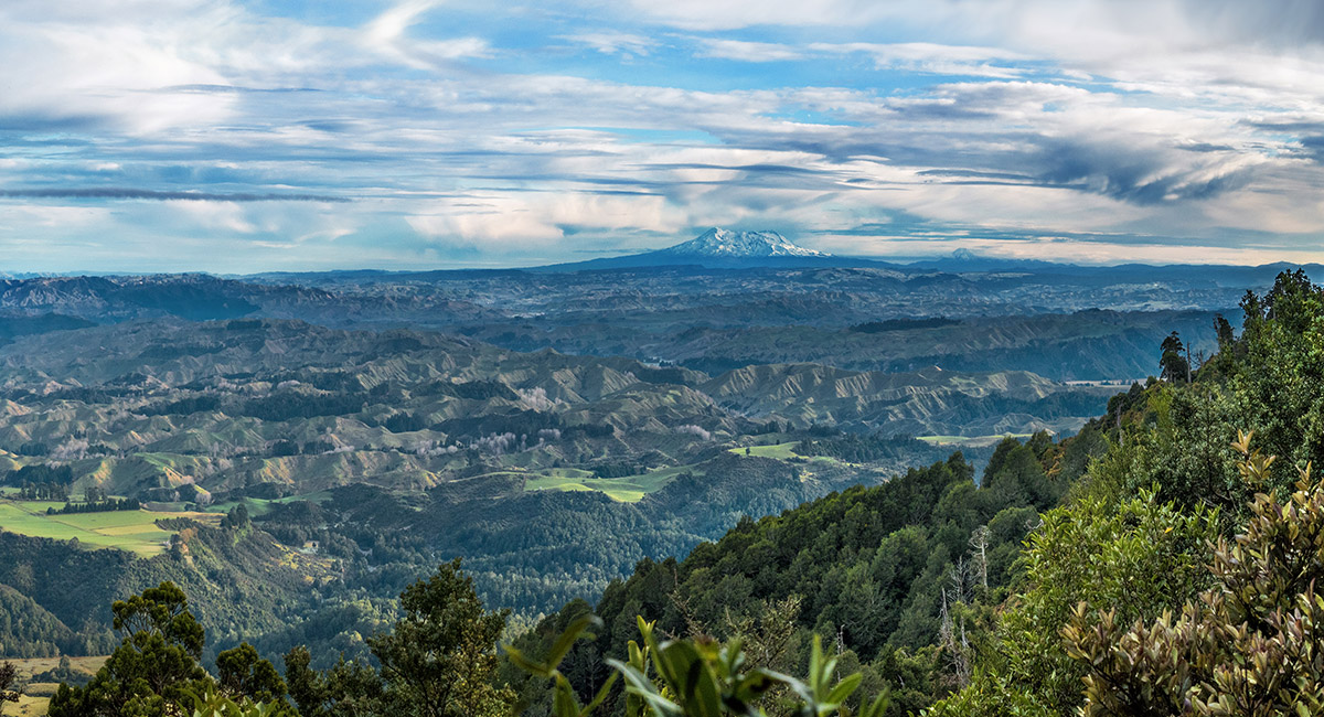
A view northwest, on the descent from Rangiwahia Hut

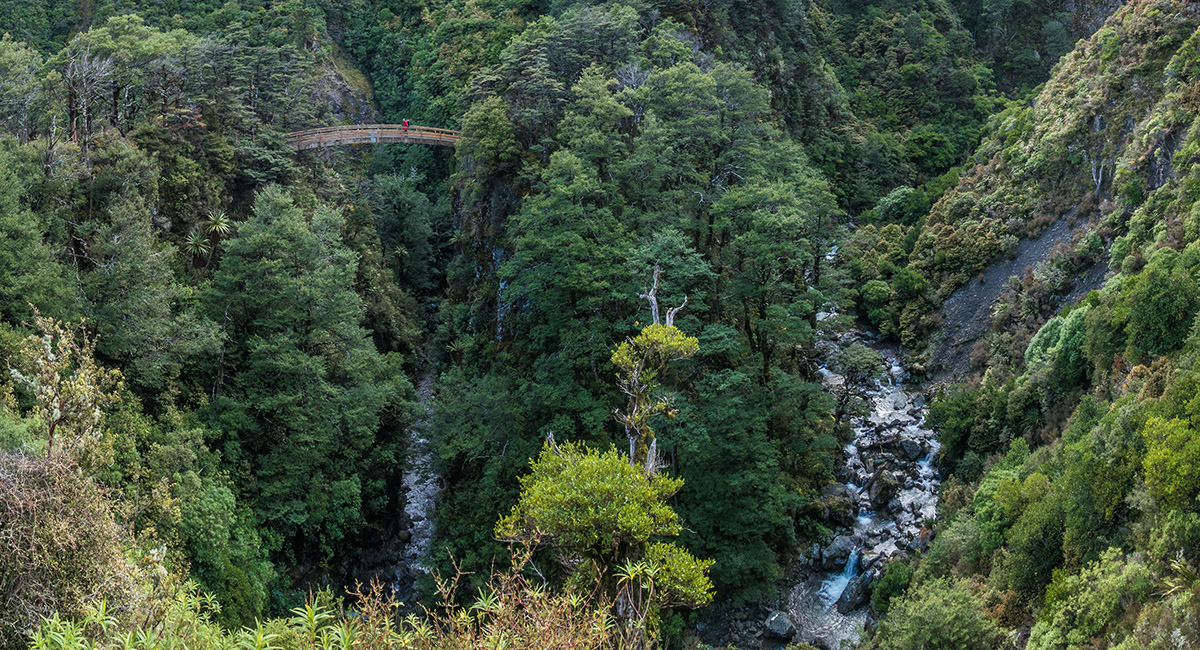
The archway bridge below Rangiwahia Hut


Back below the bushline

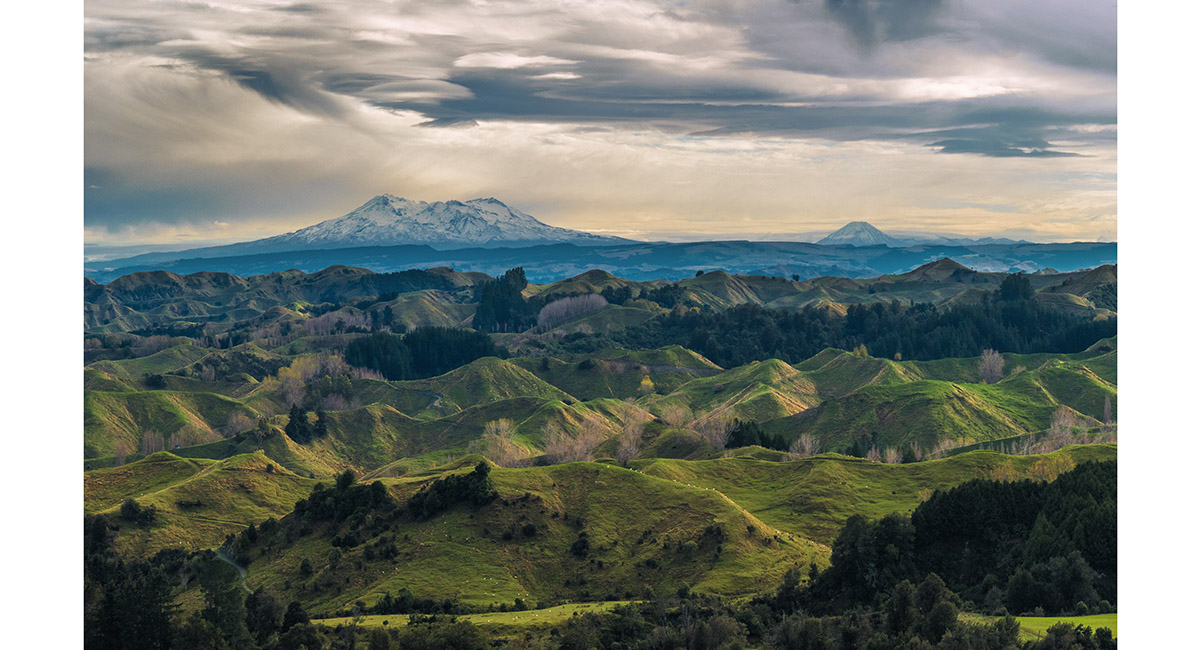
Road-side view northwest to the volcanoes from near Rangiwahia

Read about it Wild Trip Wilderness Magazine Jun 22 Worth sweating for # 25 (Rangiwahia Hut, Ruahines) Captivating Photography Apr 24
To order a print or web resolution file of any image you see in this slide show, just right click the image, click “Copy Image URL” and paste in to the “Your message” box of our Contact Us form. Please also note, for each image, if you want a print or web resolution file. We will get back to you as soon as possible to confirm price and payment details.
Open Contact Us in a new window to paste Image URL(s) easily