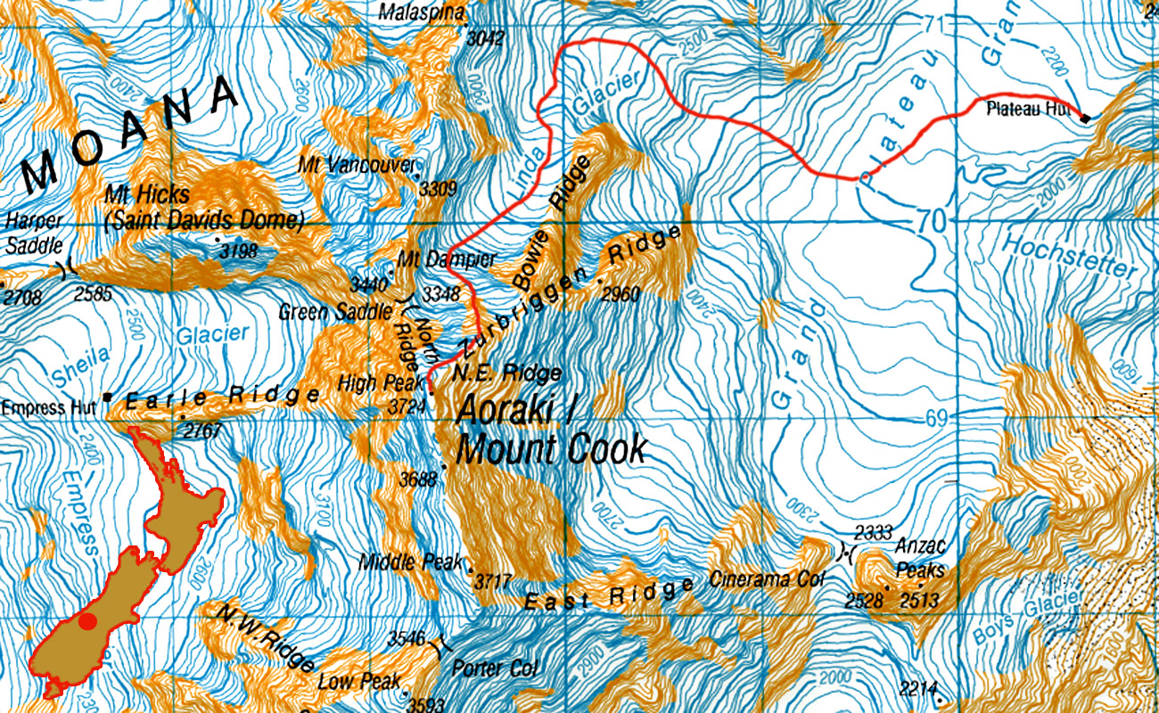
Aoraki Mt Cook via Linda Glacier, Dec 2012
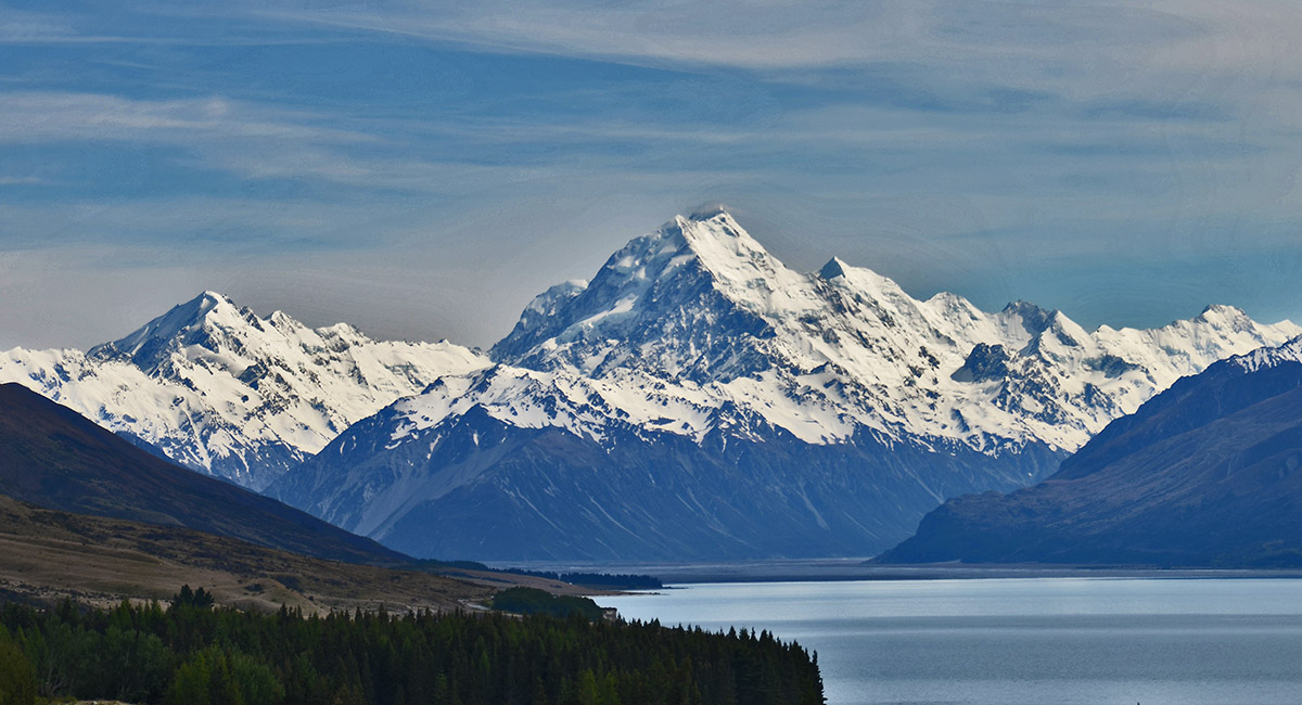
The classic view from Lake Pukaki on the approach to Mount Cook Village

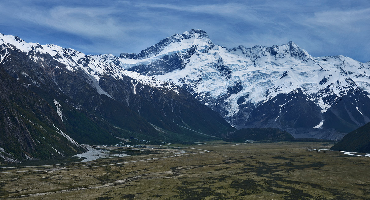
Mt Sefton and The Footstool, towering over Mount Cook Village

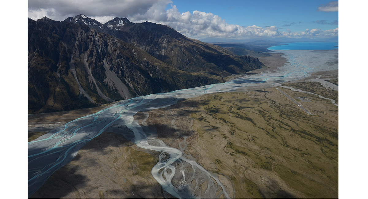
Chopper view of braided rivers feeding Lake Pukaki


Elie De Beaumont ahead, on the approach to Plateau Hut


The gigantic Caroline Face, with Cinerama Col far right

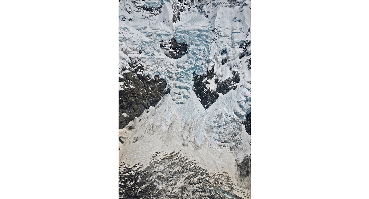
Icefalls on the Caroline Face


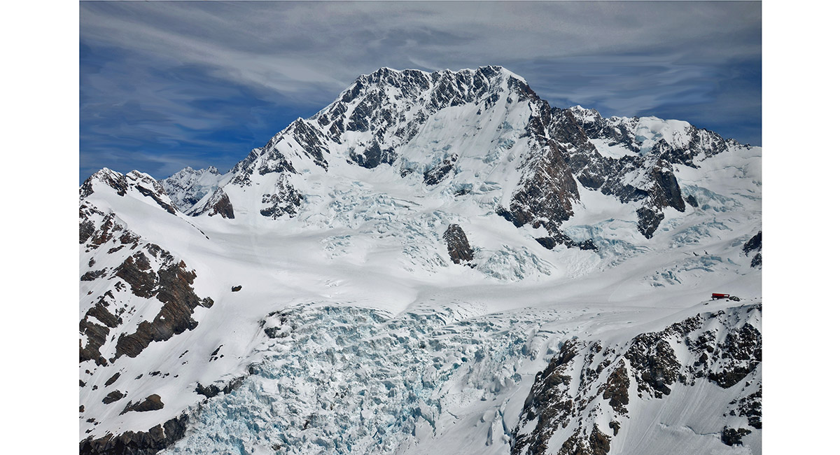
Hochstetter Icefall, with Mt Tasman and Silberhorn looming above. Plateau Hut is the dot on the right, with the pyramid of Mt Dixon above


Another view of Plateau Hut (2,200m)

The East Face of Aoraki Mt Cook with the Hochstetter Icefall in the foreground. Zubriggen Ridge is the rock on the right side leading to the main summit. The East ridge is on the left in profile


A view down the Hochstetter Icefall to the Tasman Glacier and Lake Pukaki beyond

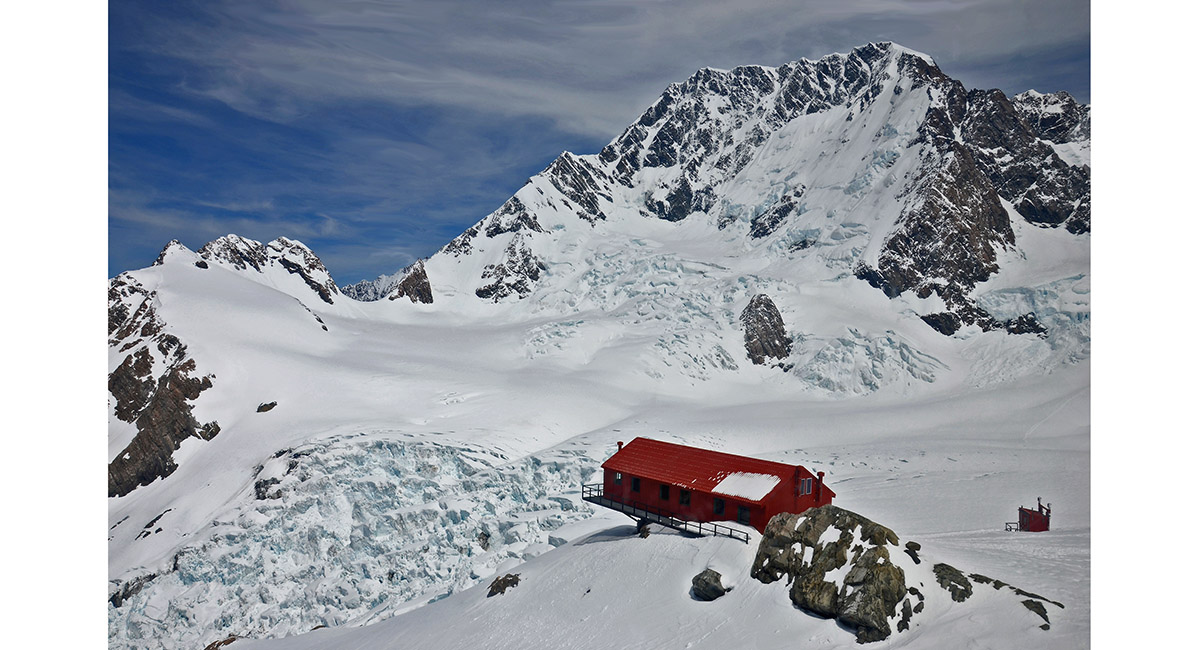
Plateau Hut and separate Throne room with Aoraki behind and the ANZAC Peaks/Cinerama Col at left

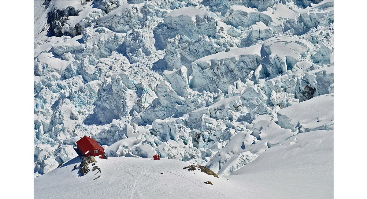
The Hochstetter Icefall and Plateau Hut

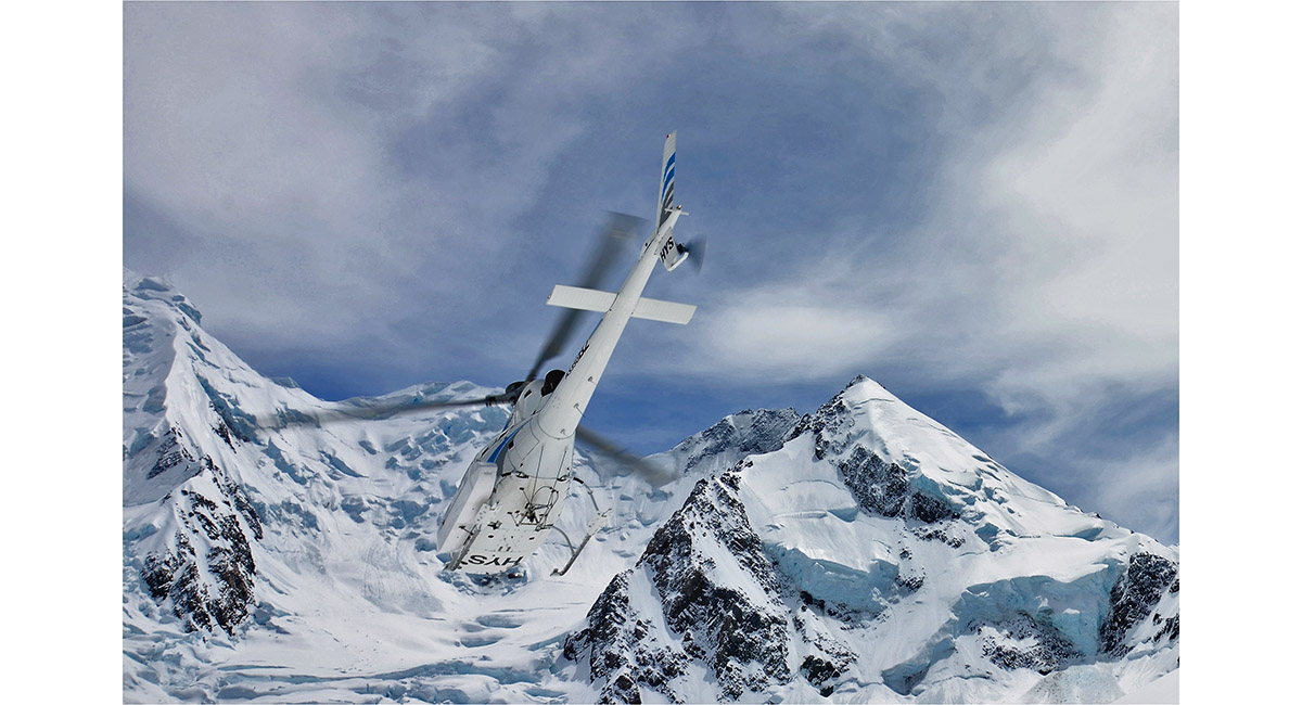
Our upward taxi to Plateau Hut departs


Inside Plateau Hut


2 climbers descend the Linda Glacier. Mt Dampier (3,440m) looms directly above them and the Summit Rocks lead up to the summit icecap of Aoraki above left


Climbers returning across the Grand Plateau


The east face of Aoraki, with Cinerama Col separating the ANZAC Peaks left and the East Ridge


Malte Brun (3,199m)

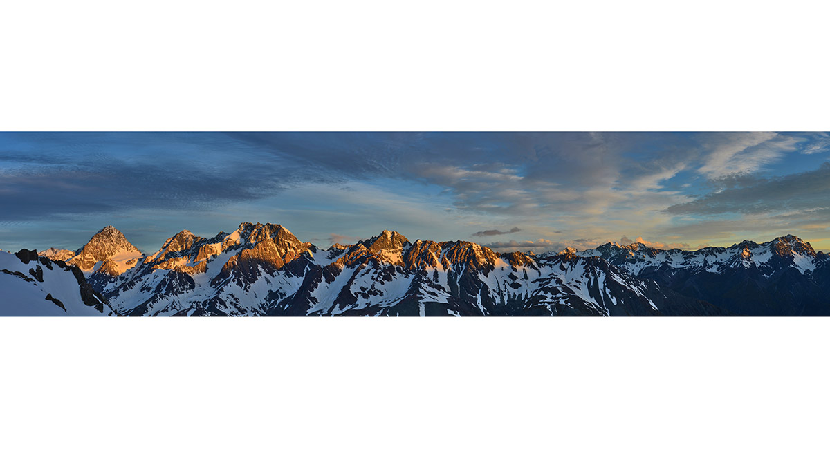
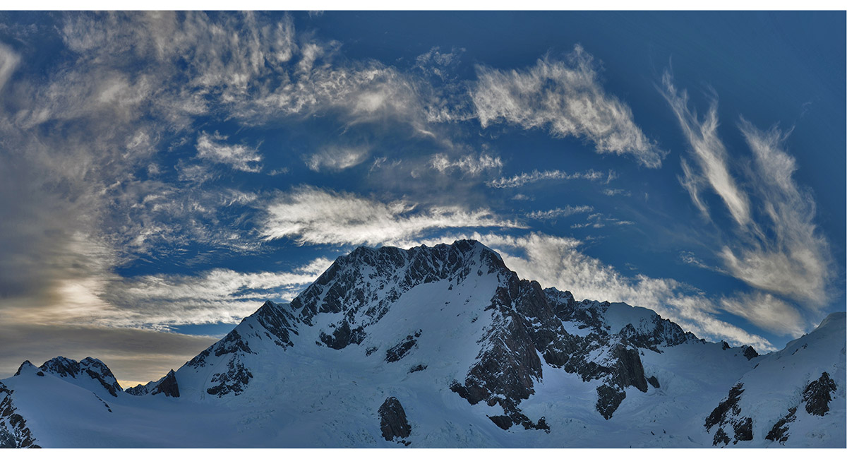
The Malte Brun range at sunset

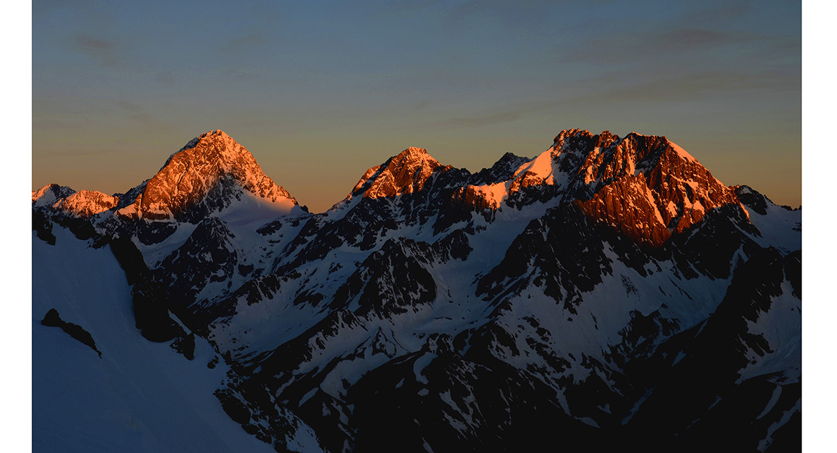
Malte Brun at sunset

Malte Brun range at dawn


Aoraki, Silberhorn and Tasman dominate this dawn scene

Aoraki at dawn


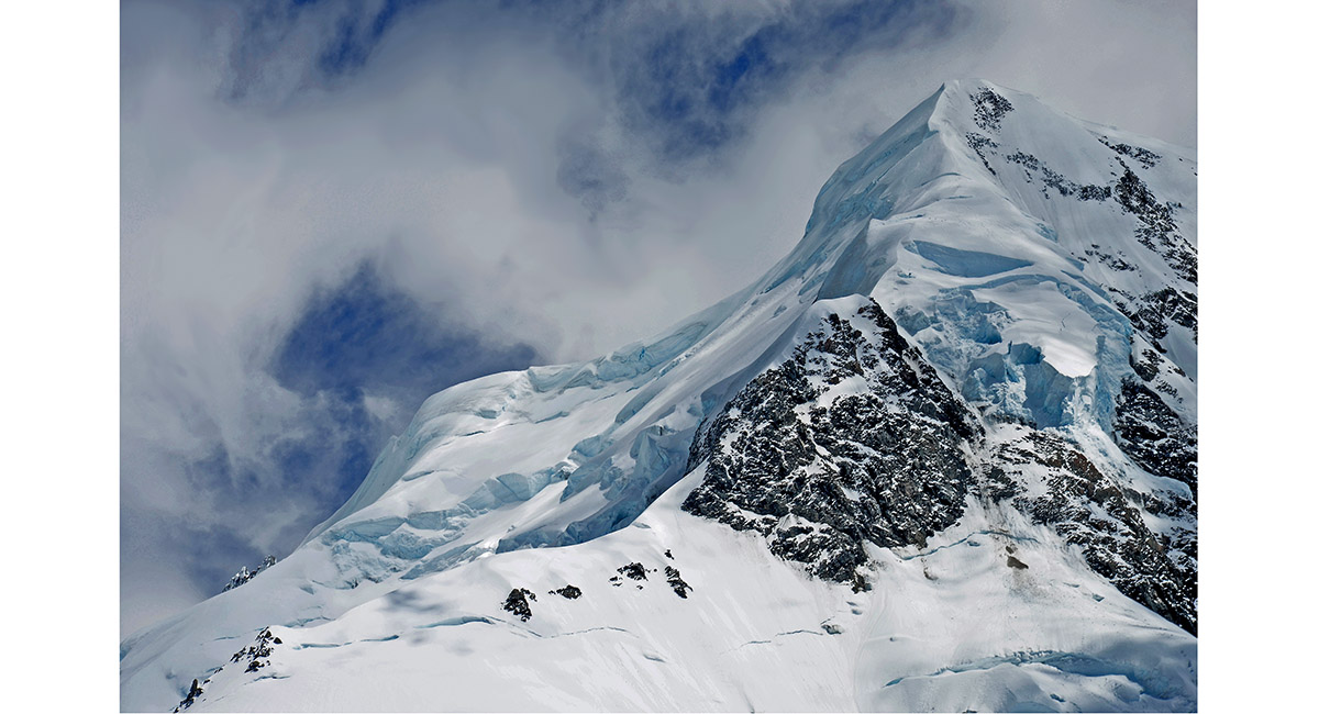
Clouds swirling over Silberhorn (3,300m) and Tasman (3,497m)

Silberhorn (3,300m)


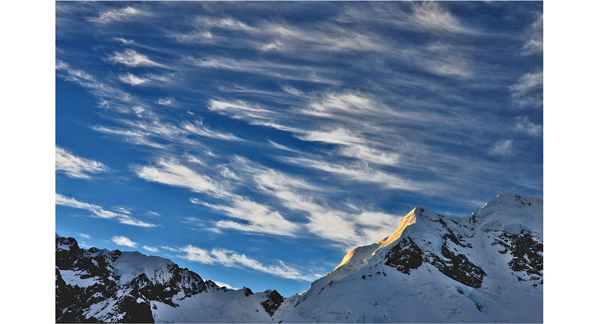
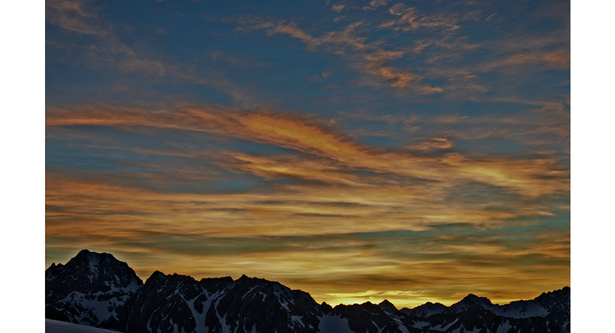
Cirrus clouds warning of an impending weather change


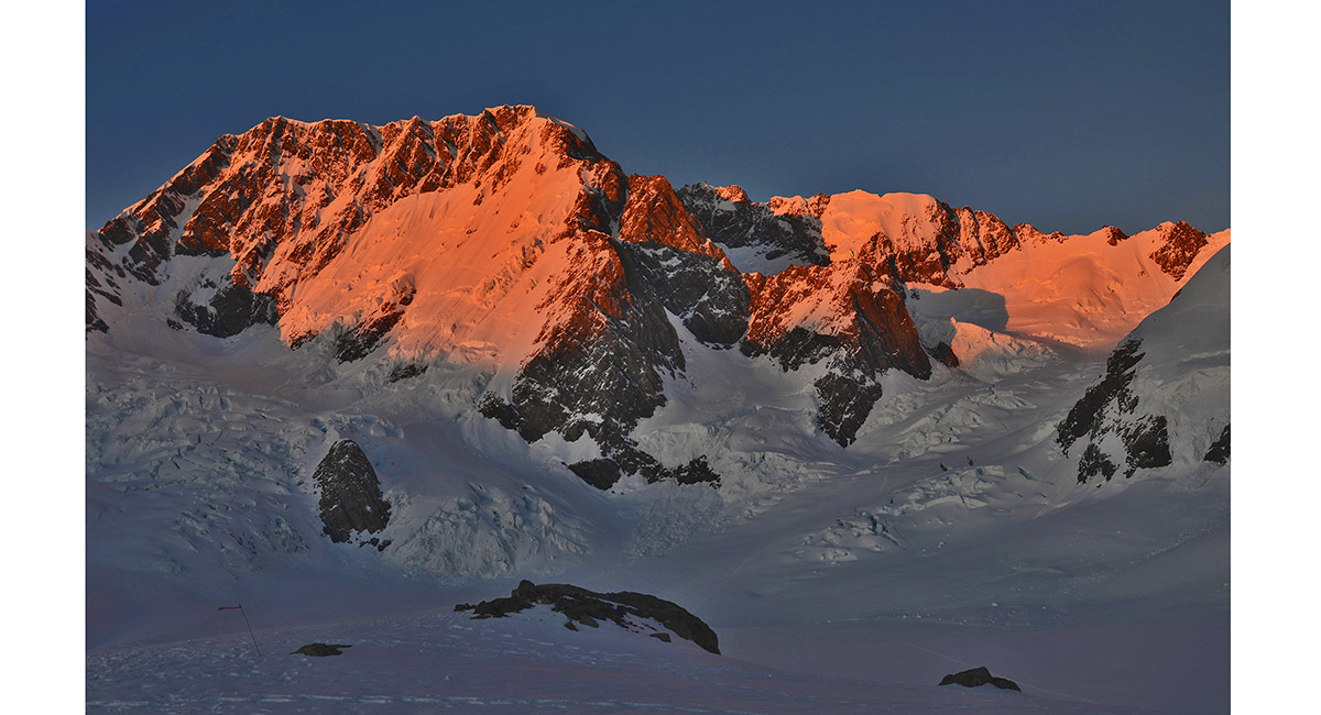
Silberhorn at sunset


A sunset worth pausing for

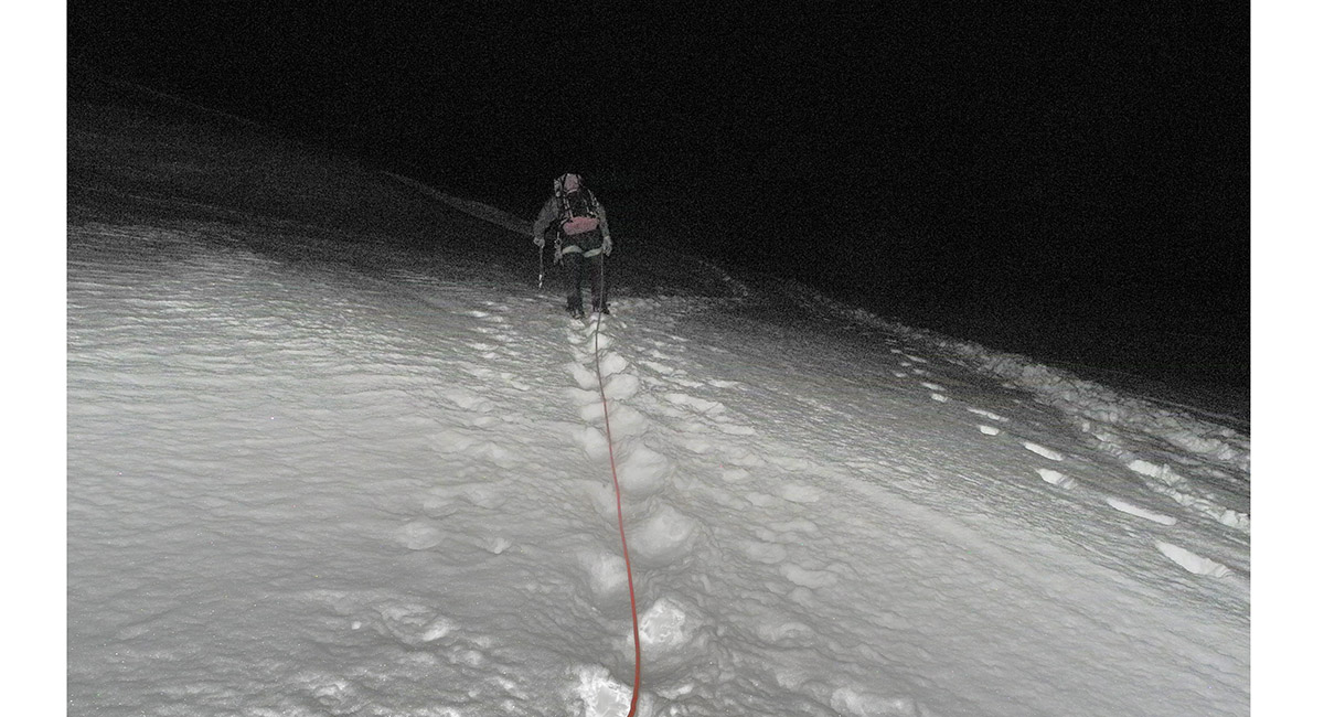
After departing Plateau Hut at 2am, here we are on the lower section of the Linda Glacier, about 2,400m


A dawn view of Mt Tasman below the Linda Shelf, about 3,000m


The sunset just got better and better, just before setting off up the Linda Shelf

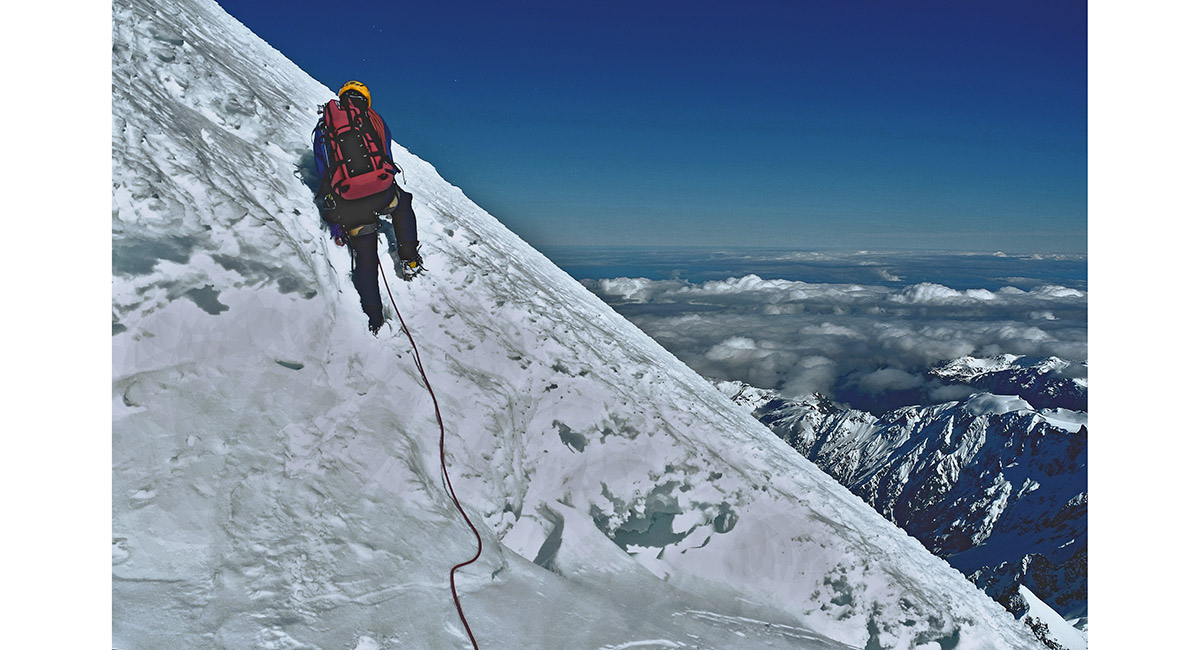
Gary leading up the Linda Shelf

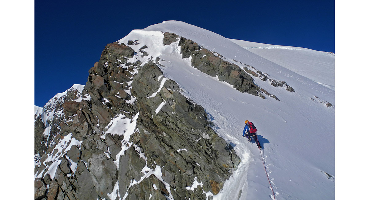
Reaching the ridge above the Linda Shelf below the Summit Rocks, about 3,200m

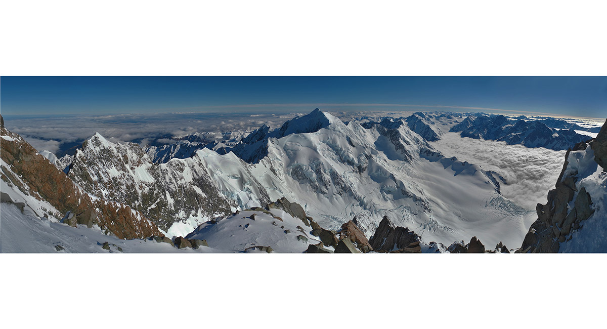
The view east from below the Summit Rocks

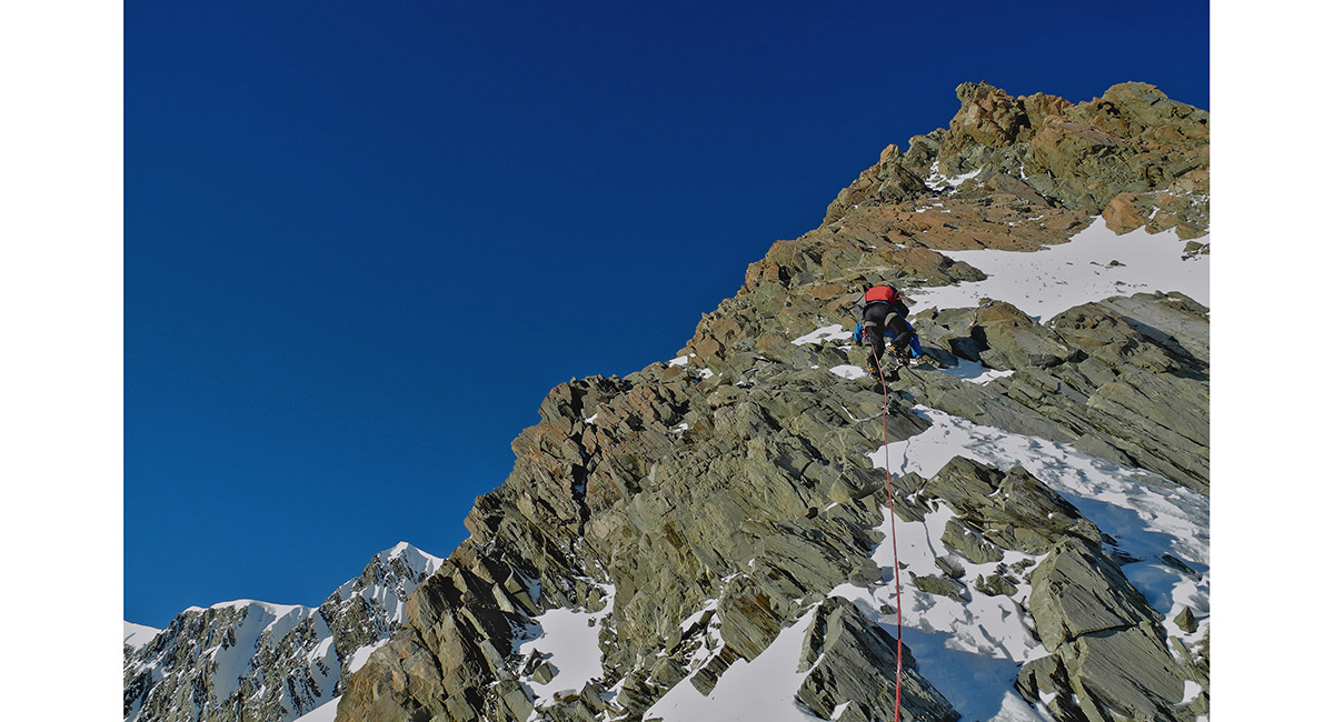
Nearing the Summit rocks

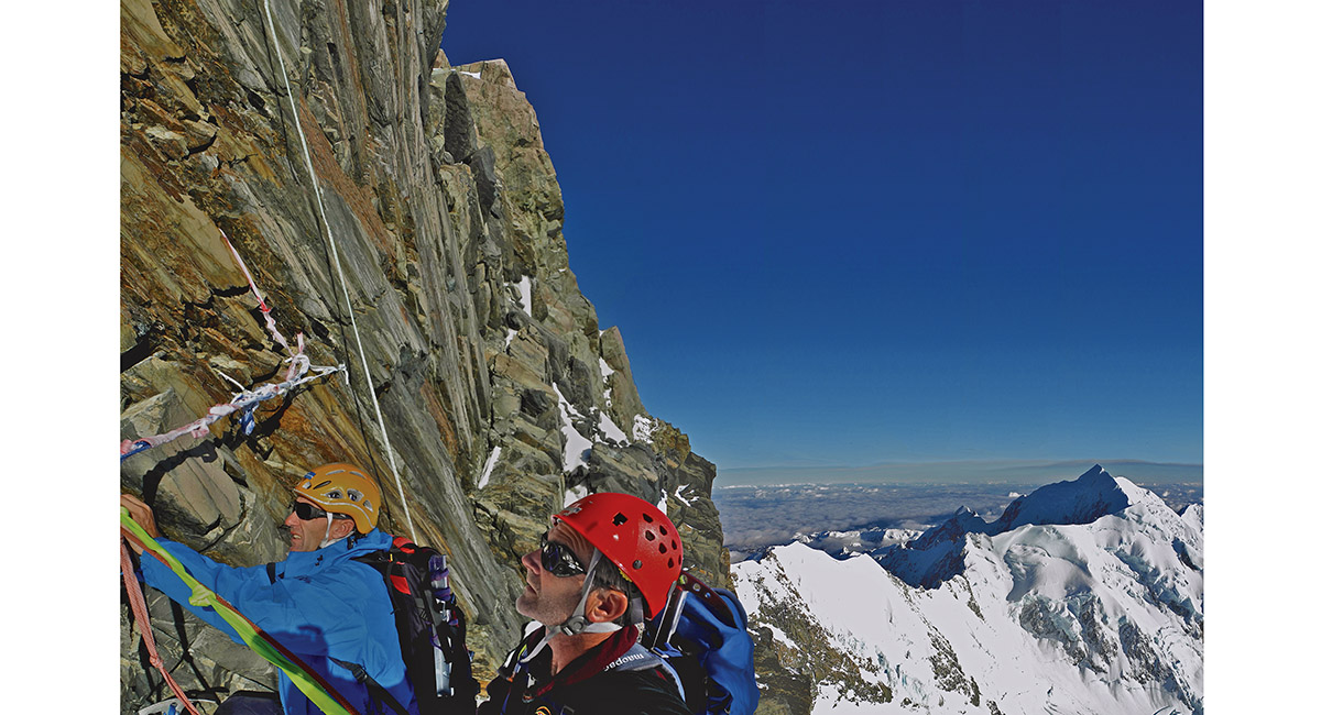
Setting up protection at the base of the Summit Rocks, about 3,350m


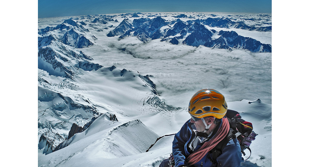
Selfie from above the Summit Rocks, looking north. The top of the Hochstetter Icefall and the tiny dot of Plateau Hut are near the bottom right

View from about 3,550m to Mt Tasman

Approaching the summit icecap at about 3,600m


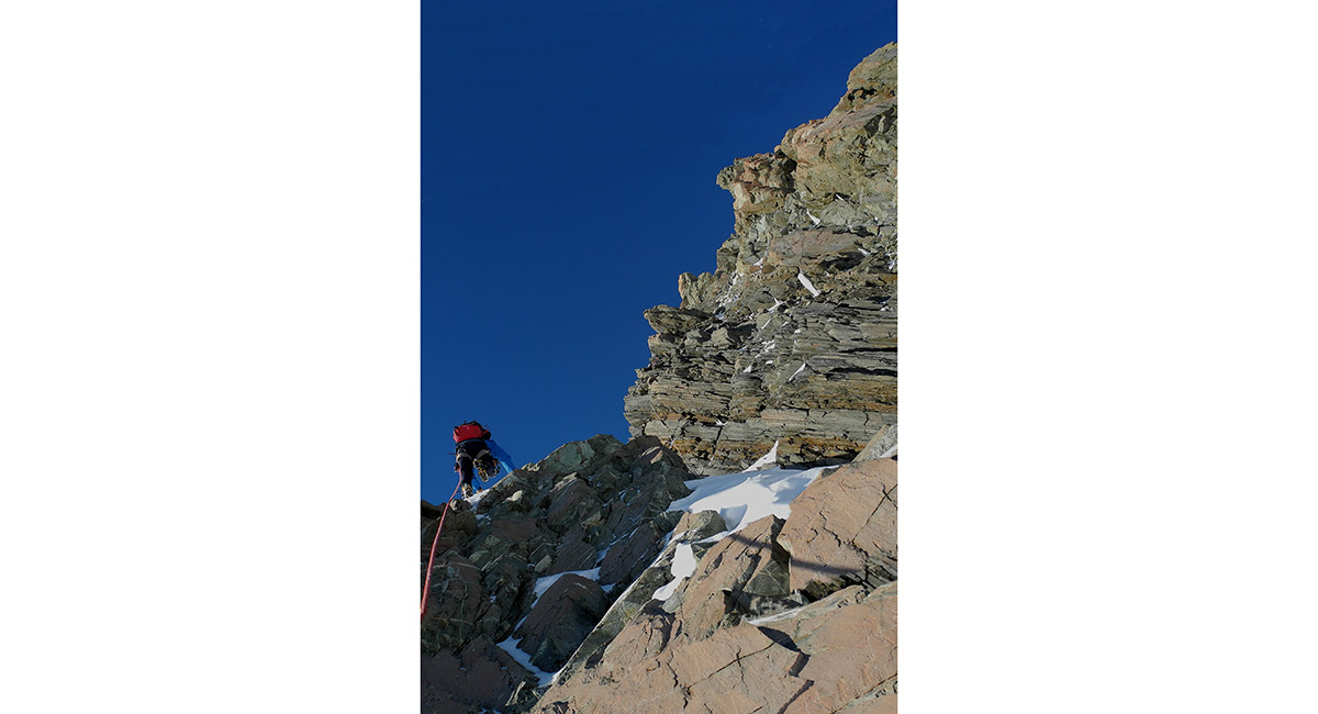
On the ridge above the Summit rocks, with the Malte Brun range below

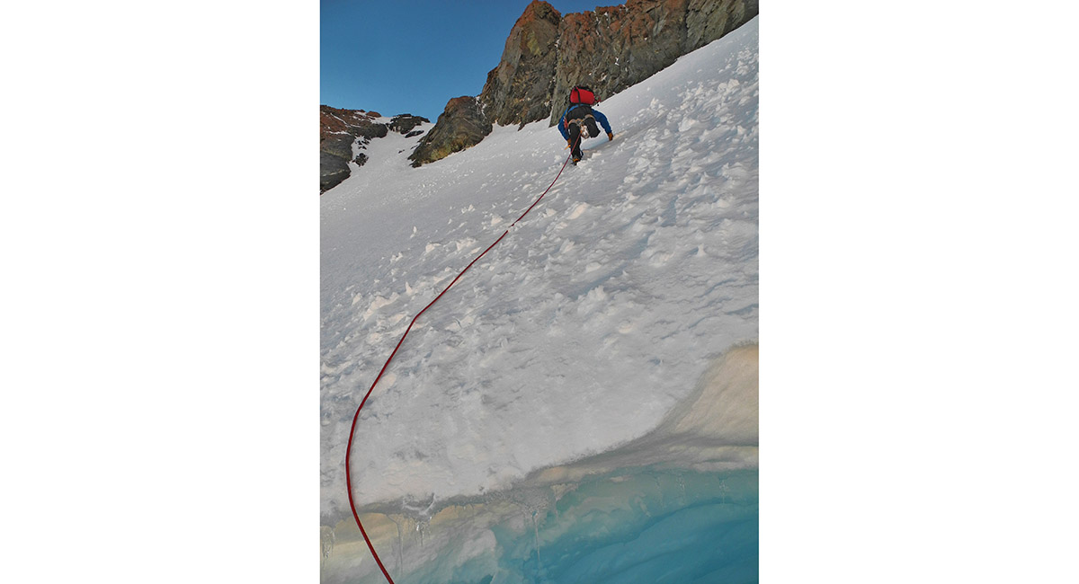
Crossing the schrund on to the summit icecap at about 3,650m


Ascending the icecap - north end of the summit ridge dead ahead

On the summit ridge, looking north, at 3,719m (using the new official height). The true summit is about 50 meters south and 5 metres higher than this point along the icey summit ridge

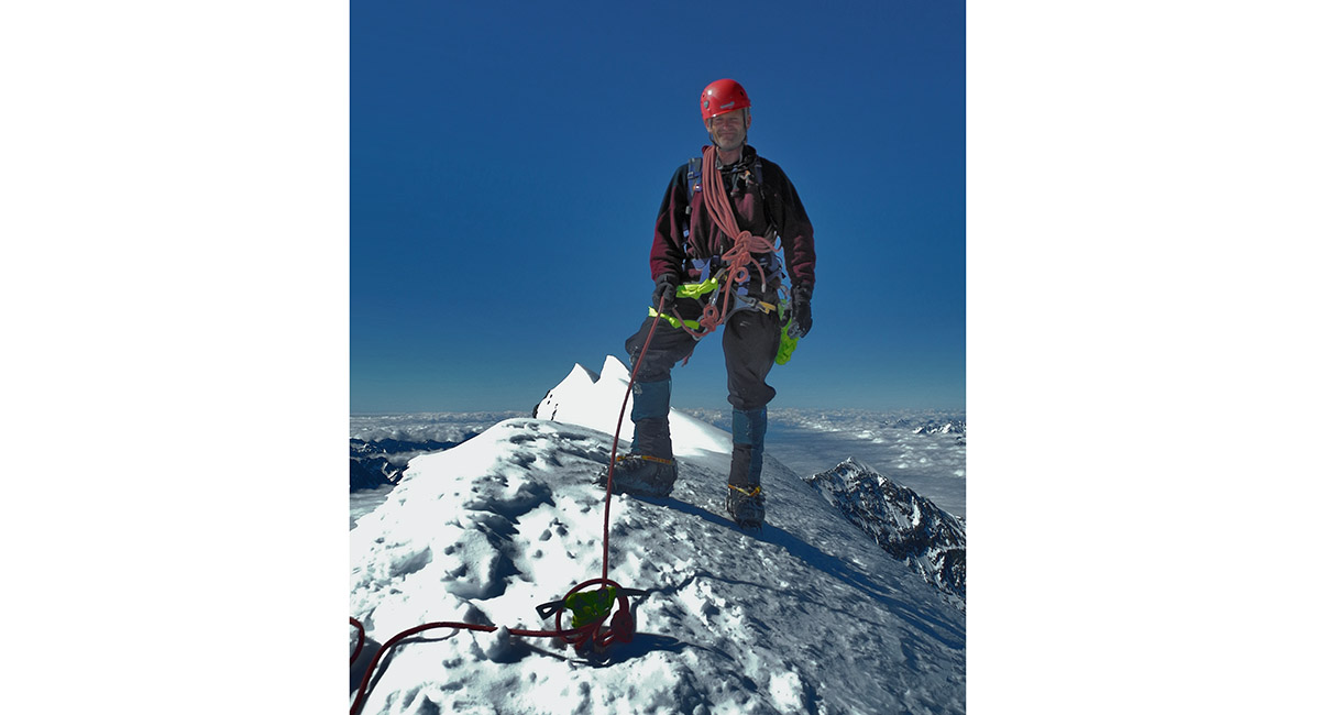
Had to be done - the official "I was there" shot, looking south at 10am


Looking south along the summit ridge to the true summit (3,724m), middle (3,717m) and low peaks (3,593m)

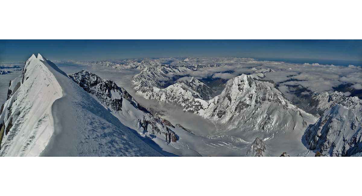
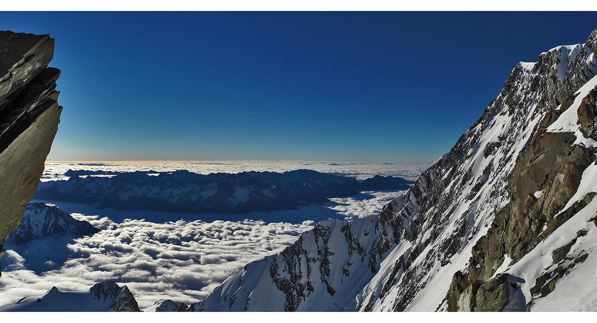
A wider summit view south with La Perouse, Sefton and the main divide stretching away into the distance


Another view near the Summit Rocks looking north towards the Tasman Saddle


A crevass in the Linda Glacier on the descent

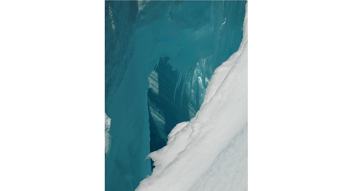
Crevass on the Linda Glacier

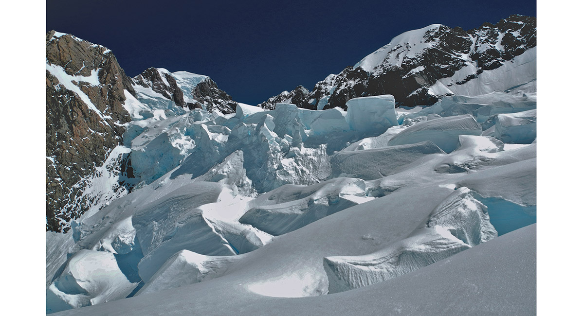
Seracs on the Linda Glacier

To order a print or web resolution file of any image you see in this slide show, just right click the image, click “Copy Image URL” and paste in to the “Your message” box of our Contact Us form. Please also note, for each image, if you want a print or web resolution file. We will get back to you as soon as possible to confirm price and payment details.
Open Contact Us in a new window to paste Image URL(s) easily