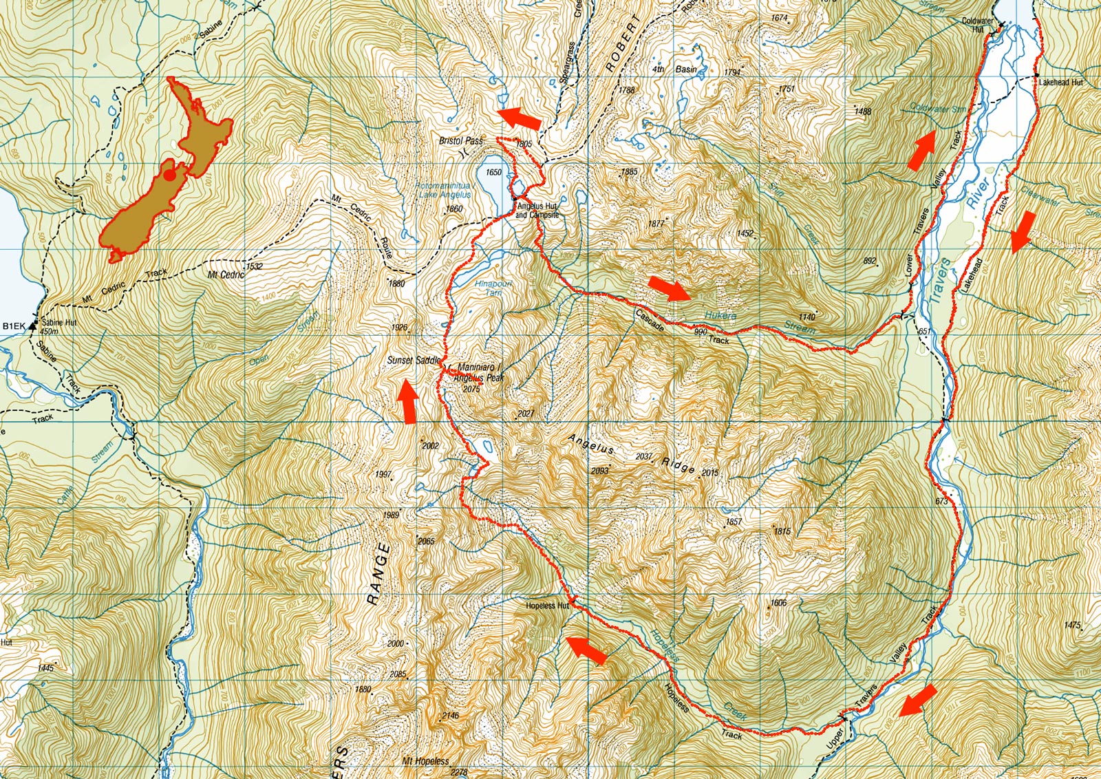
Sunset Saddle, Angelus Peak, Cascade Track, March 2025
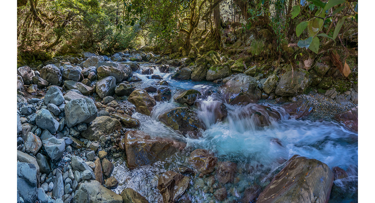
Hopeless Stream, at about 800m


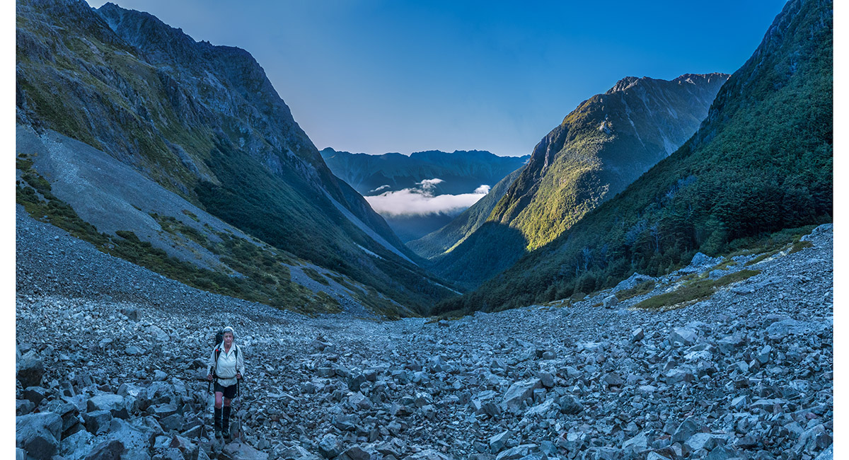
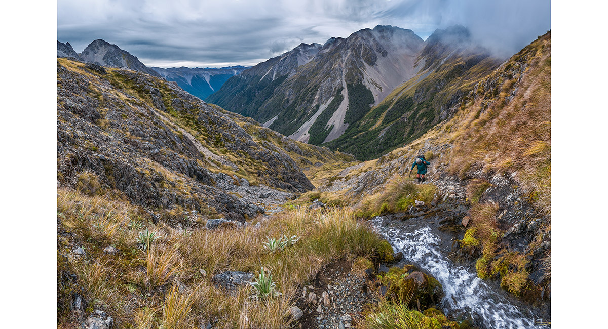
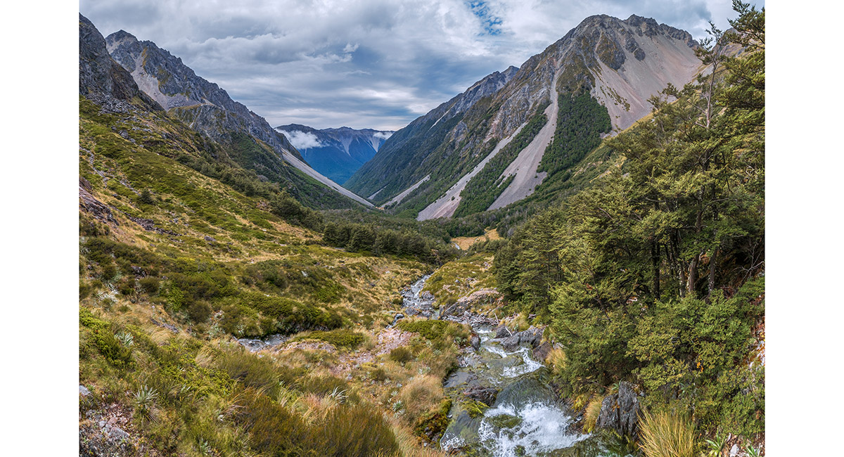
A view back to Hopeless Hut (1,100m) from the scree on the true left of Hopeless Stream

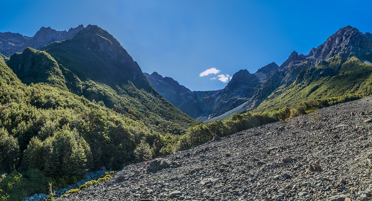
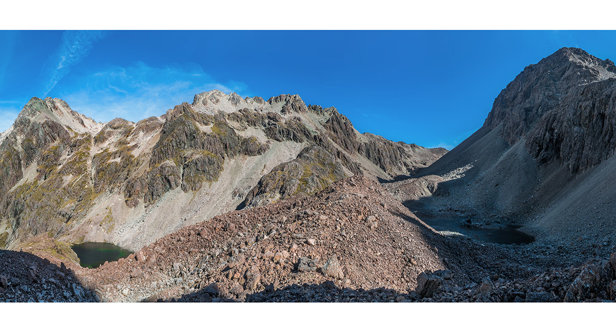
A view northwest to the head of Hopeless Stream and the Sunset Saddle route, to the 1,650m rolloff, from the scree on the true left of Hopeless Stream

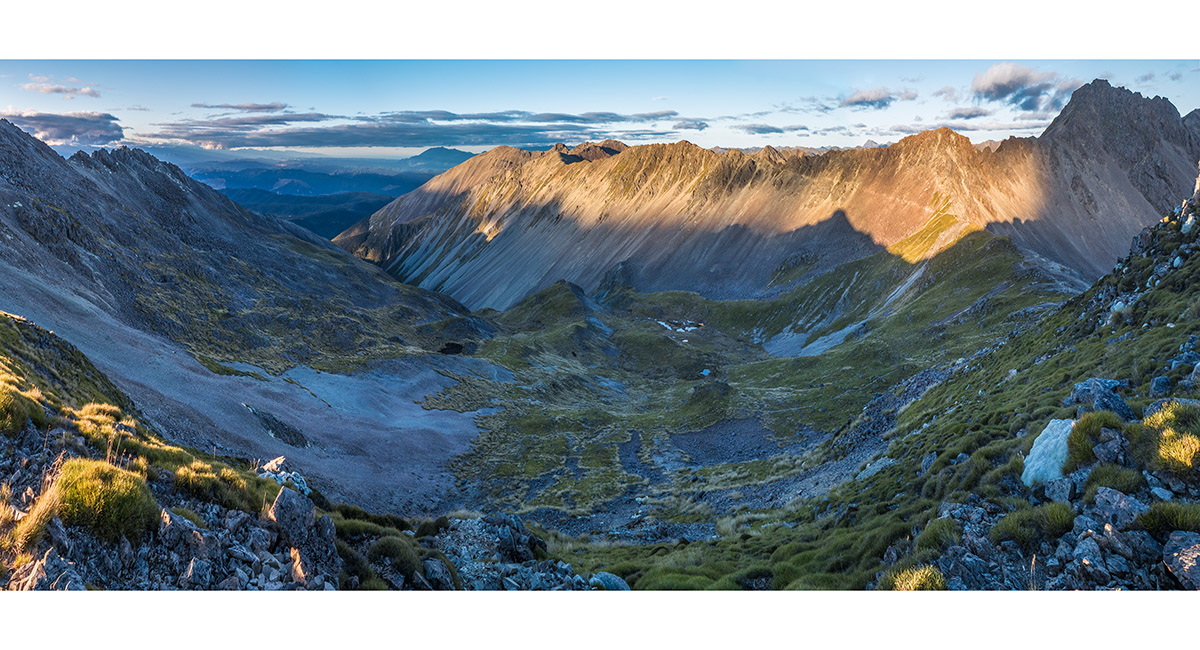
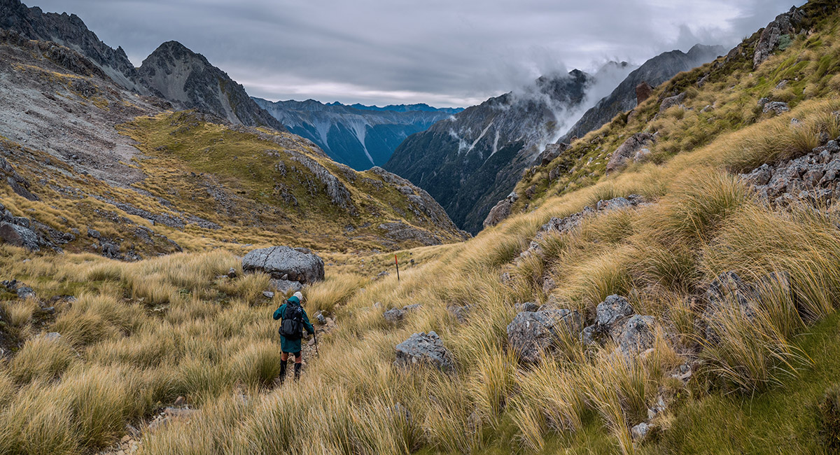
Dawn view from 1,250m back down Hopeless Stream from the scree basin beneath Sunset Saddle

Looking up the scree fan giving access to the Sunset Saddle route

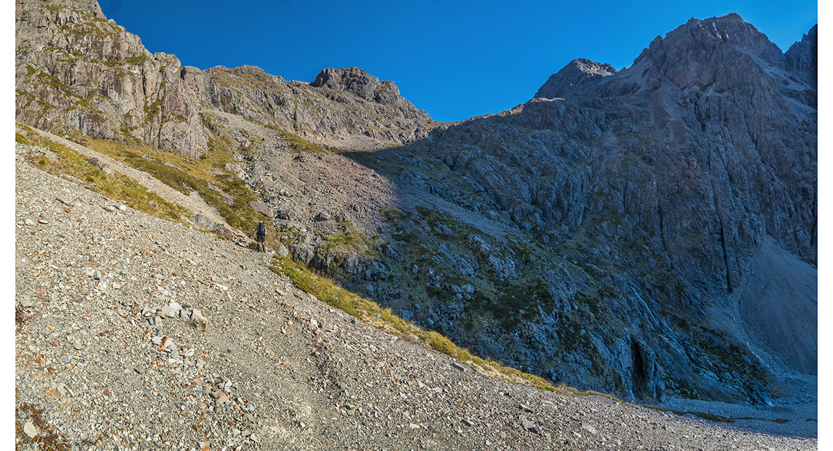
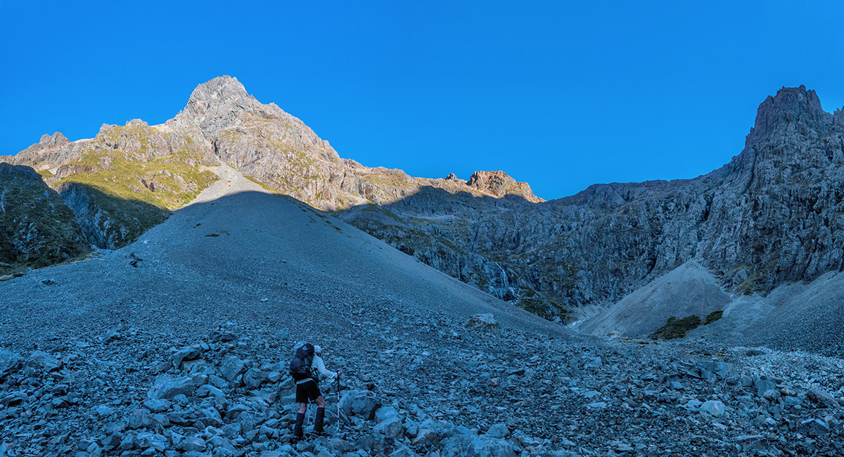
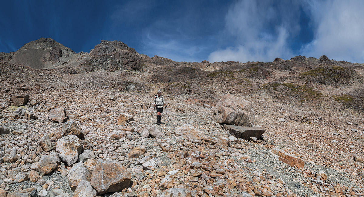
Nearing the top of the scree at about 1,450m

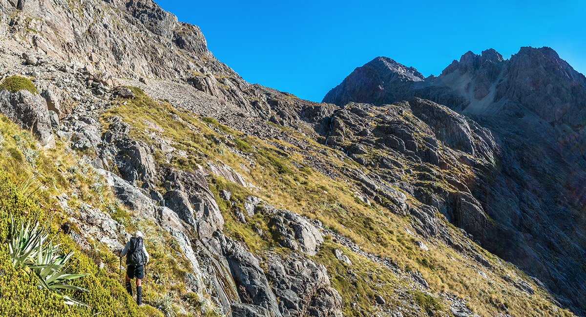
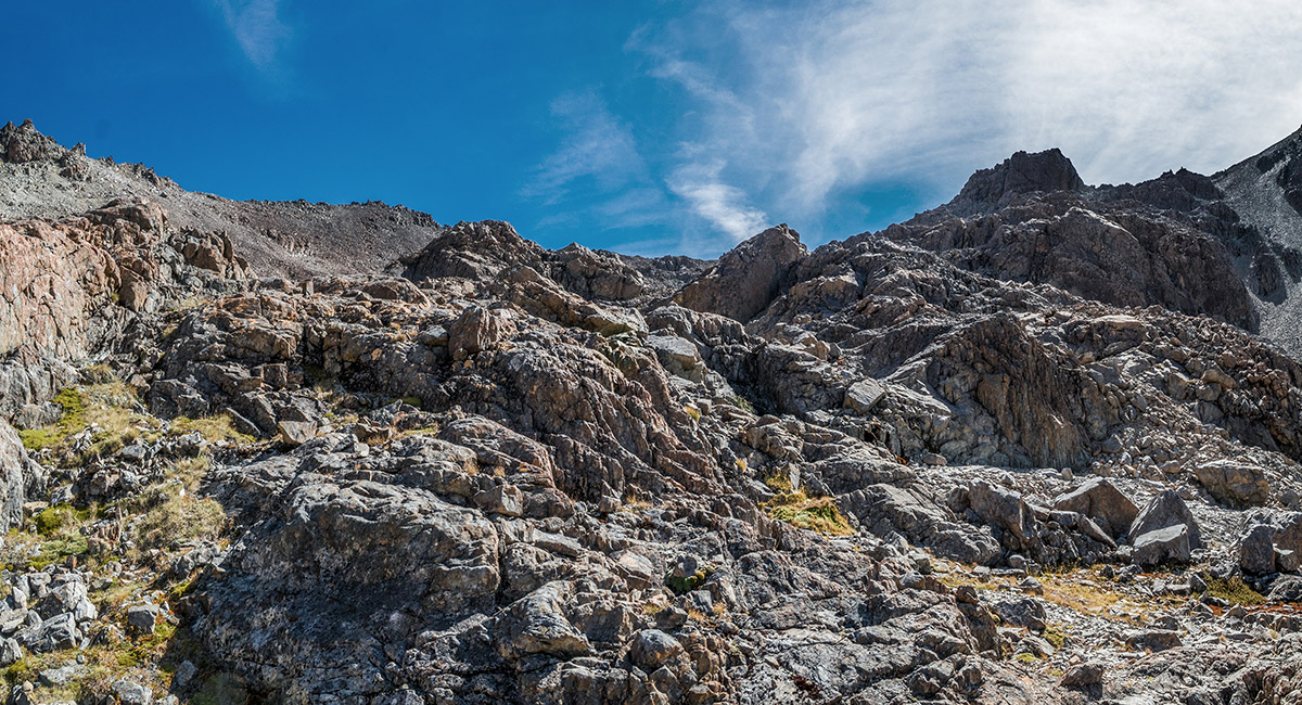
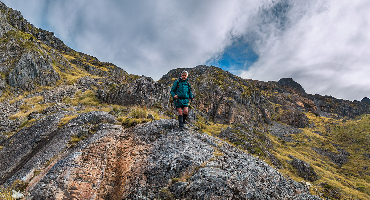
Beyond the scree at about 1,500m, on the steepest part of the route, with Maniniaro/Angelus Peak (2,075m) right of centre

At about 1,550m, enjoying the view back down Hopeless Stream

Nearing the top of the steepest section of the route, with the 1,620m tarn outlet point above right

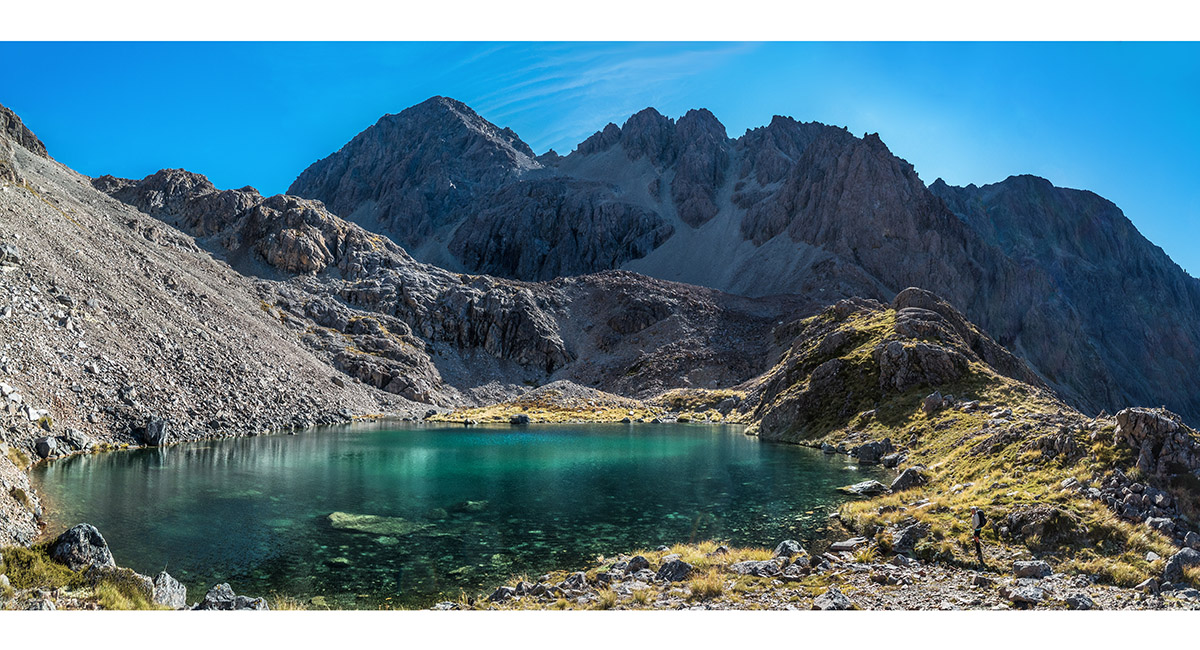
The 1,620m tarn. Another smaller one lies on the far side of the ridge above the tarn. Maniniaro/Angelus Peak left of centre

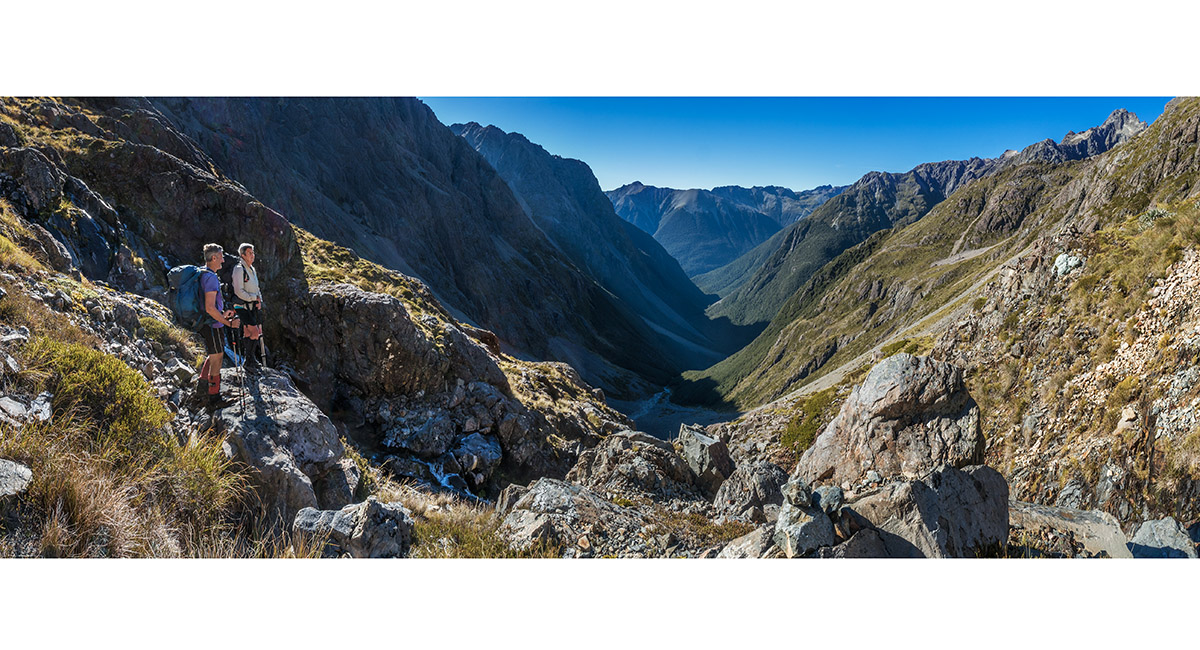
At 1,660m, looking up the route to Sunset Saddle (hidden behind Maniniaro/Angelus Peak)


At 1,660m, looking back down the route

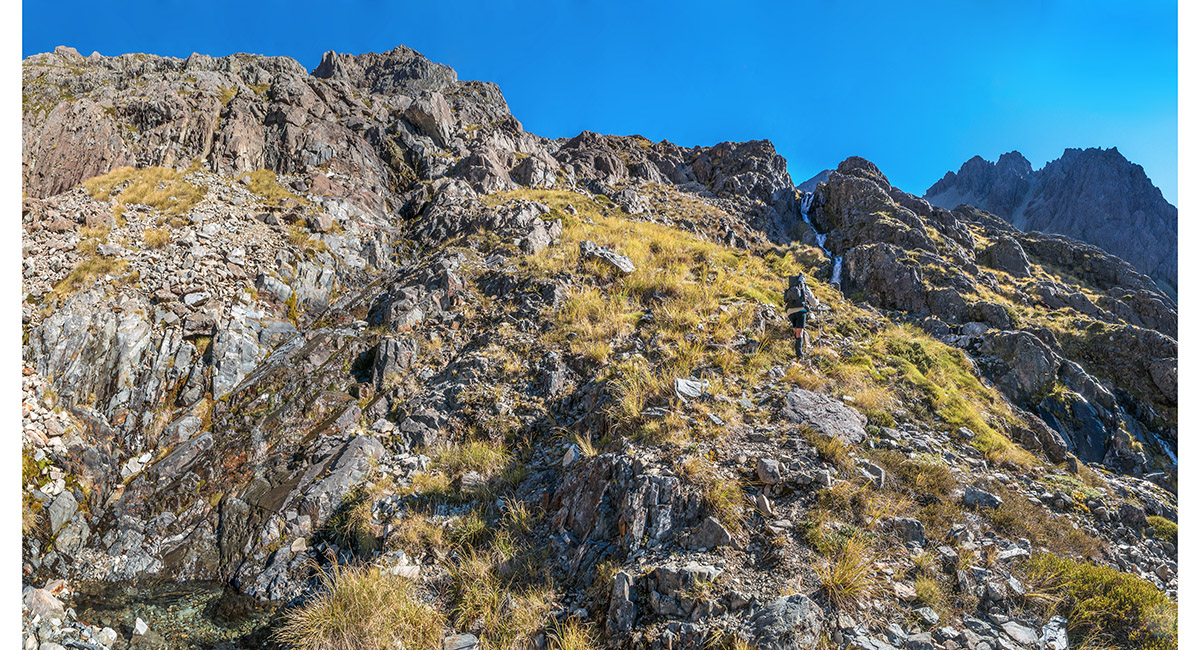
At about 1,750m, looking north up the route


At 1,800m, looking south back down the route. This small tarn, marked on the map, had nearly dried up

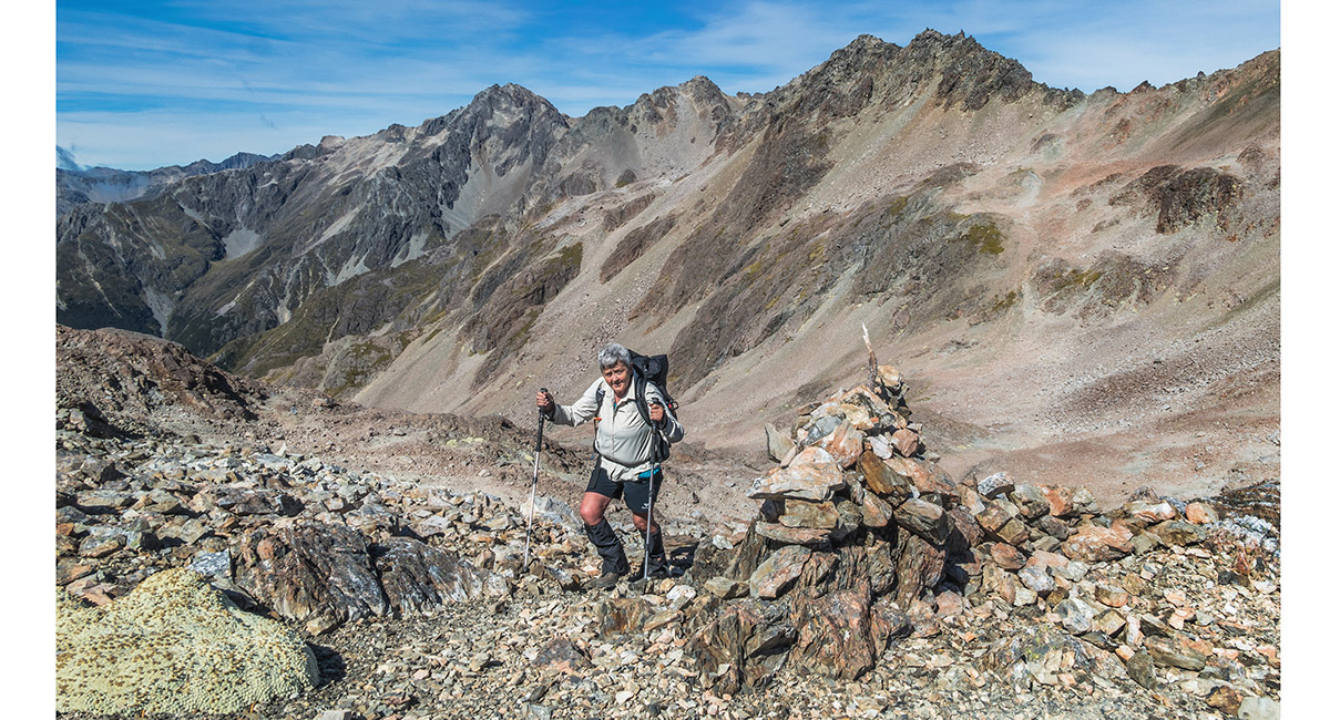
Kathy arrives on Sunset Saddle

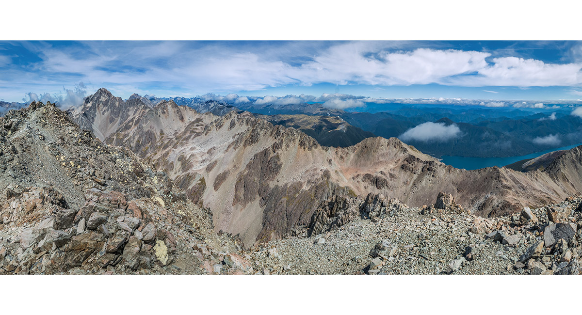
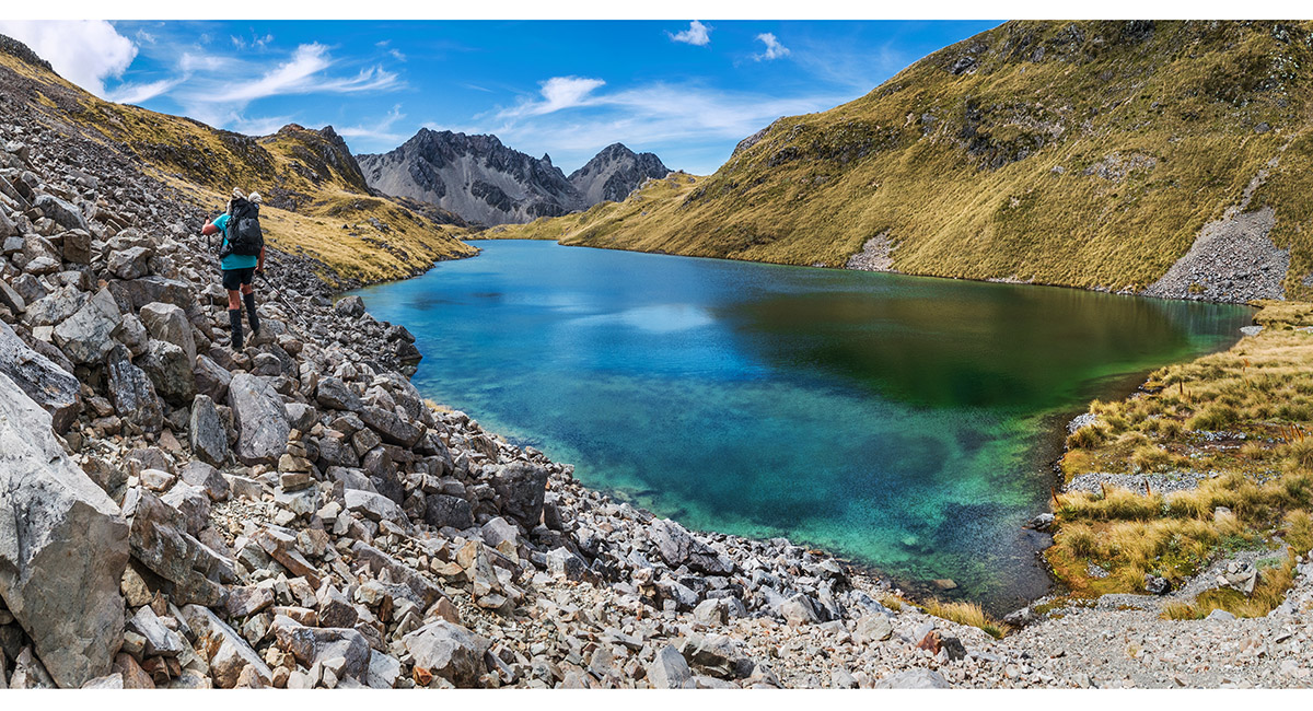
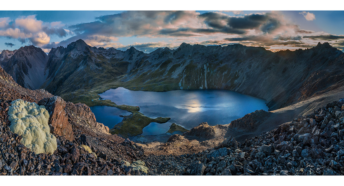
The view north from Sunset Saddle (1,900m) to Rotomaninitua/Lake Angelus (1,650m)

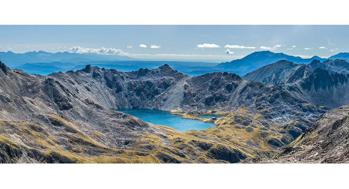
Maniniaro/Angelus Peak (2,075m) summit view south to Mt Hopeless (far left - 2,278m) and west to Lake Rotoroa (right - 460m)

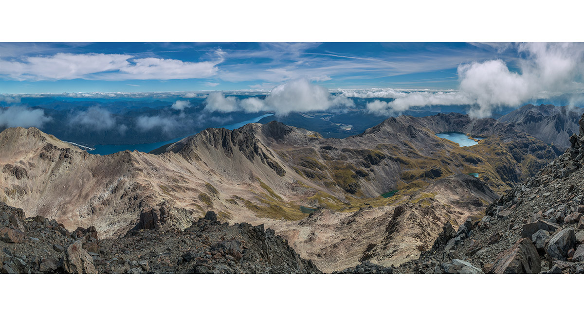
Maniniaro/Angelus Peak summit view north, over Hinapouri Tarn to Rotomaninitua/Lake Angelus and west to Lake Rotoroa

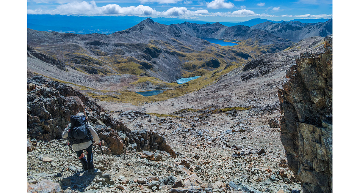
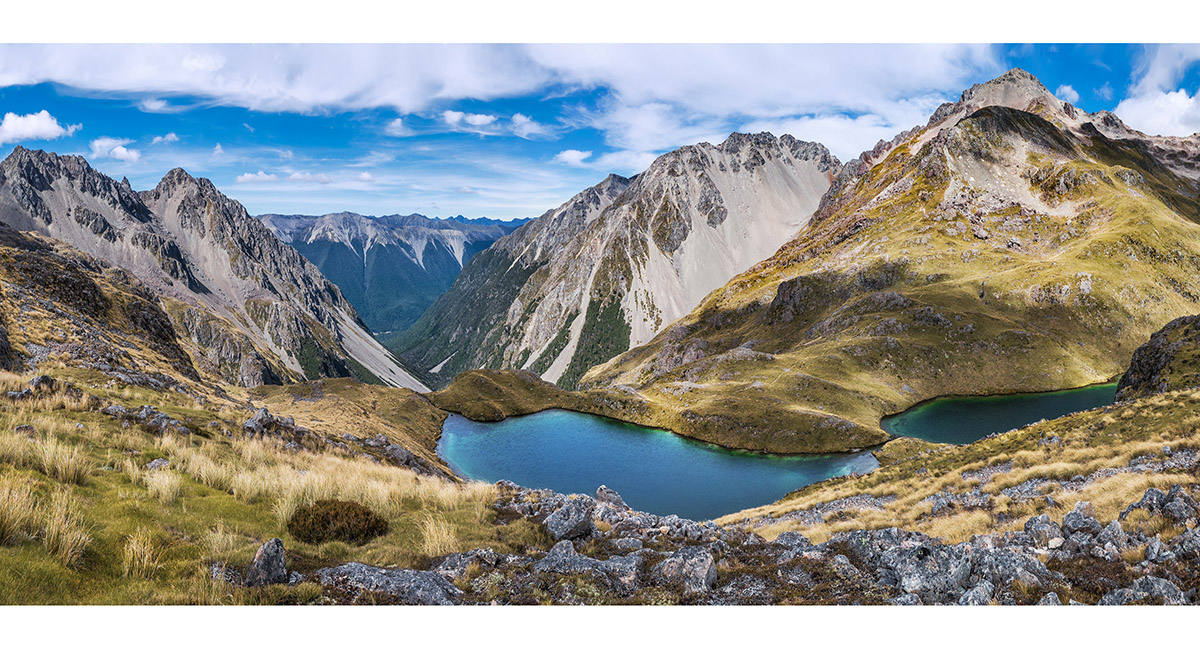
Beginning our descent towards Hinapouri Tarn (1,590m) and the small un-named tarn before it at 1,720m - a beautiful camp spot

A view back up towards Sunset Saddle from about 1,800m. Maniniaro/Angelus Peak far left


Approaching the small 1,720m tarn. Rotomaninitua/Lake Angelus top right

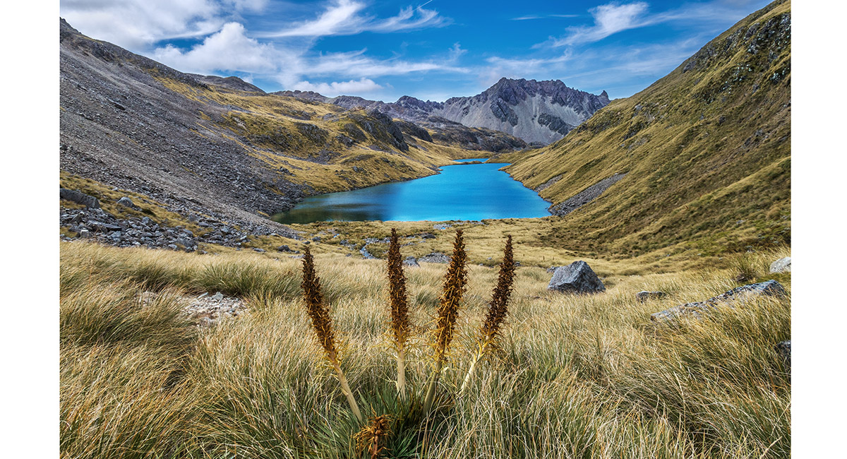
Approaching Hinapouri Tarn (1,590m)

Hinapouri Tarn (1,590m)

Hinapouri Tarn (1,590m) and Hukere Valley - the route of Cascade Track, viewed from about 1,650m


Approaching Angelus Hut

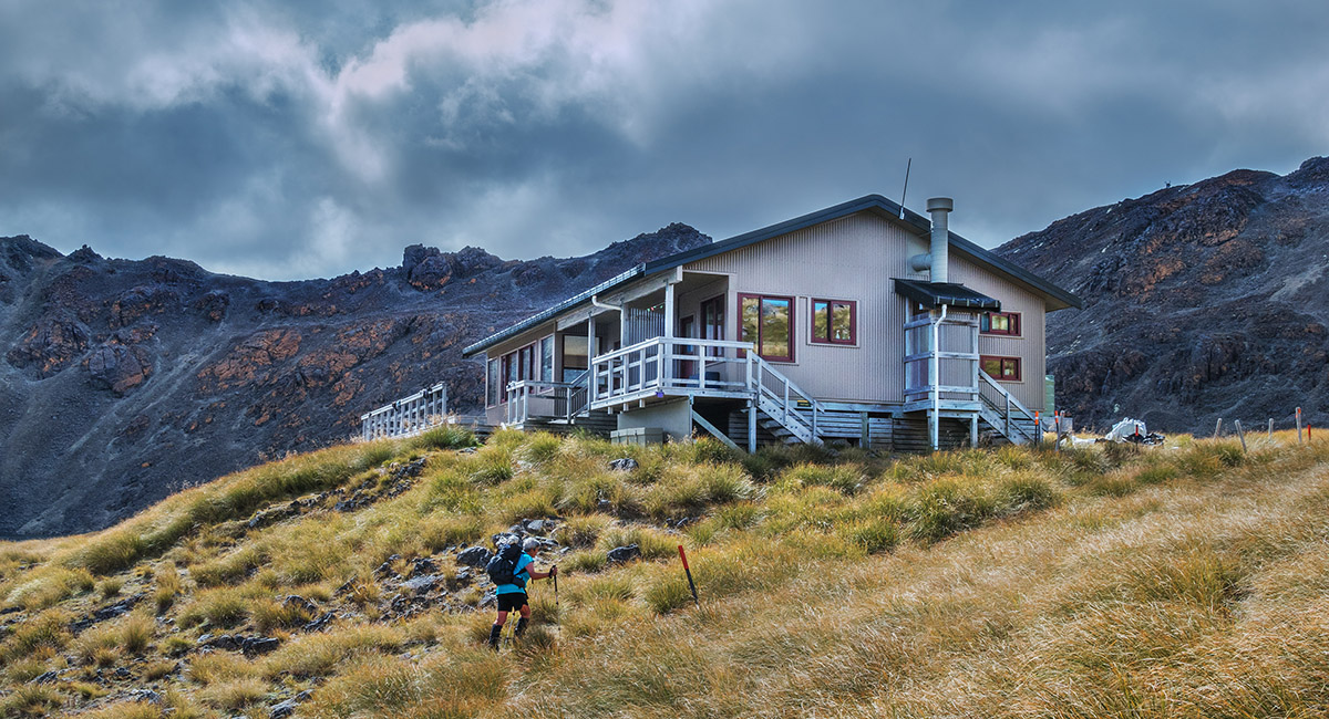
Angelus Hut

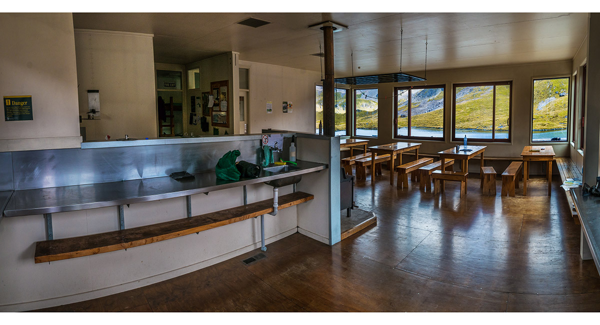
The cooking and dining space in Angelus Hut

A sunset view from the northern ridge above Rotomaninitua/Lake Angelus, looking northeast down the Speargrass Creek route and to Robert Ridge

A sunset view from the northern ridge at 1,780m, looking southeast across Rotomaninitua/Lake Angelus. Maniniaro/Angelus Peak at left


A sunset view from the north at 1,740m, looking southeast across Rotomaninitua/Lake Angelus. Maniniaro/Angelus Peak, left of centre

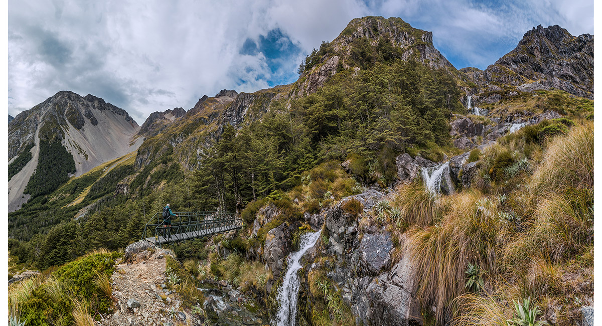
At the top of Cascade Track

Descending Cascade Track, here at about 1,500m

A view back up Cascade Track from about 1,450m

At the bridge crossing Hukere Stream at 1,340m

A view from the bridge down Hukere Stream at 1,340m


Looking back up Cascade Track from about 1,100m

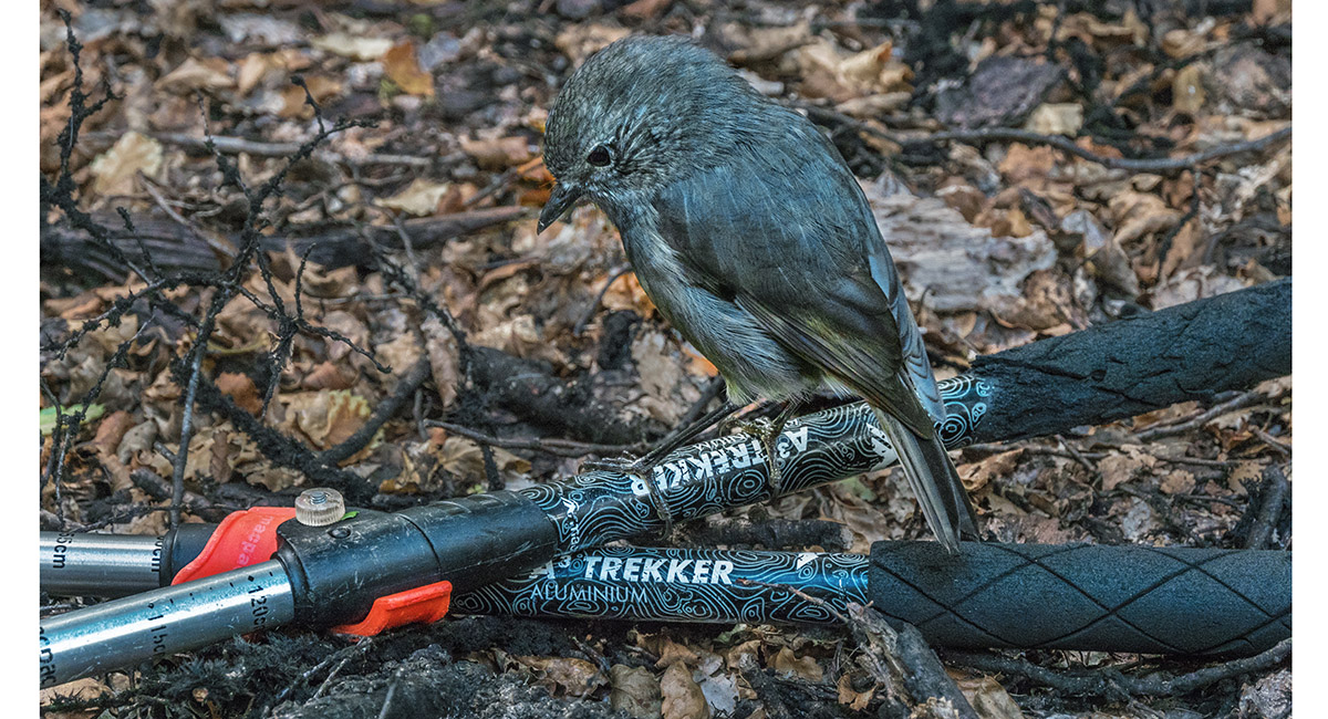
A Robin living up to its inquisitive reputation

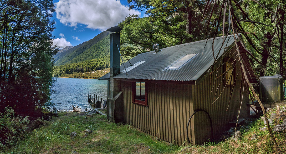
Coldwater Hut (620m)

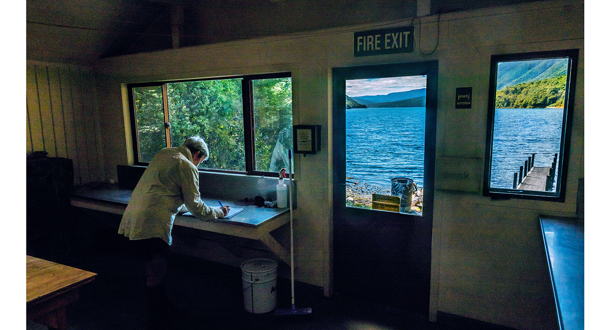
Book signing at Coldwater Hut

To order a print or web resolution file of any image you see in this slide show, just right click the image, click “Copy Image URL” and paste in to the “Your message” box of our Contact Us form. Please also note, for each image, if you want a print or web resolution file. We will get back to you as soon as possible to confirm price and payment details. Open Contact Us in a new window to paste Image URL(s) easily