Mountain landscapes – Roof of the World


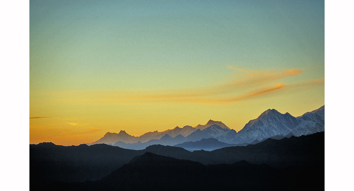
Himalayan view from the plane between Kathmandu and Lukla

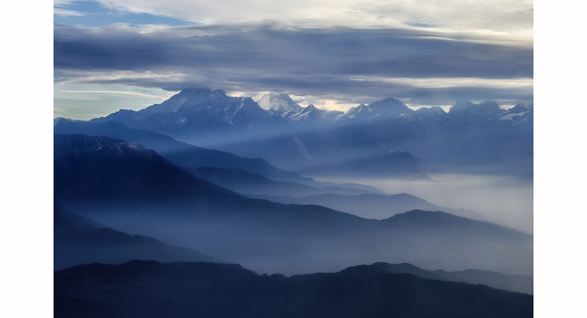
Himalayan view from the plane between Kathmandu and Lukla


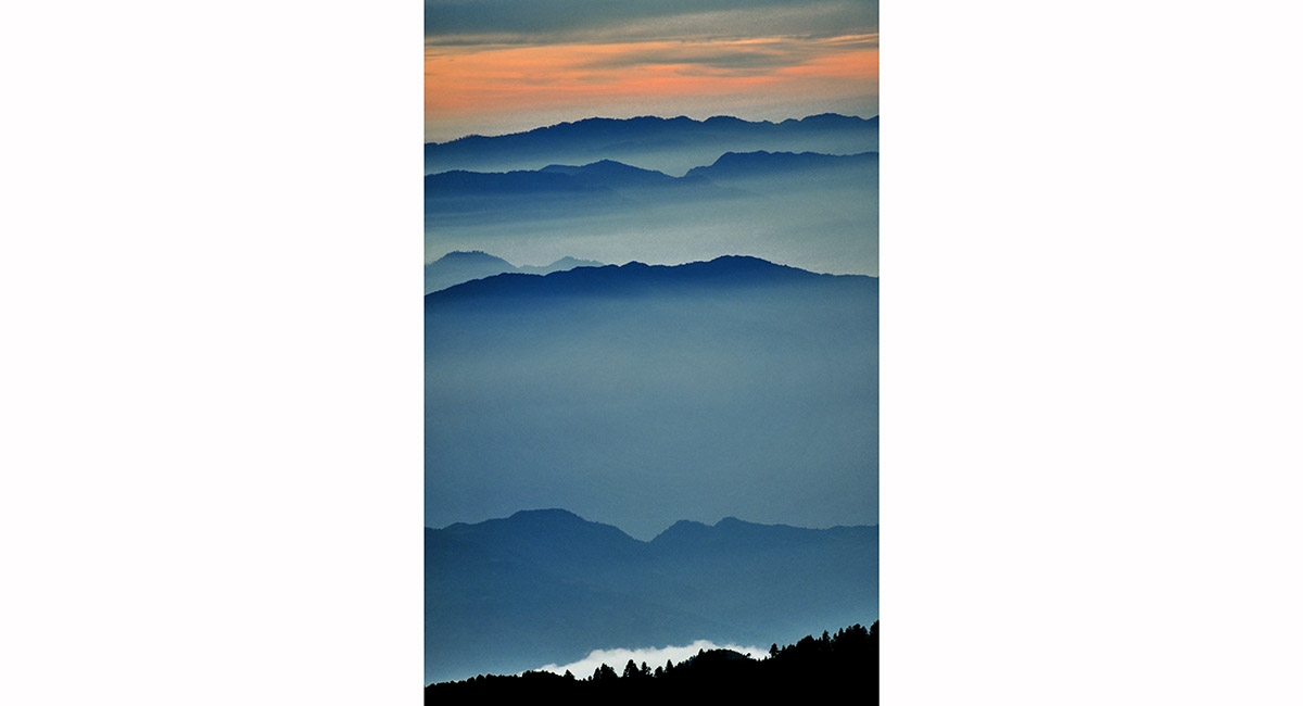
Himalayan foothills north east of Kathmandu en route to Lukla

Even from the relatively lowly 2,800m of Lukla the alpine views are beautiful, Khumbu

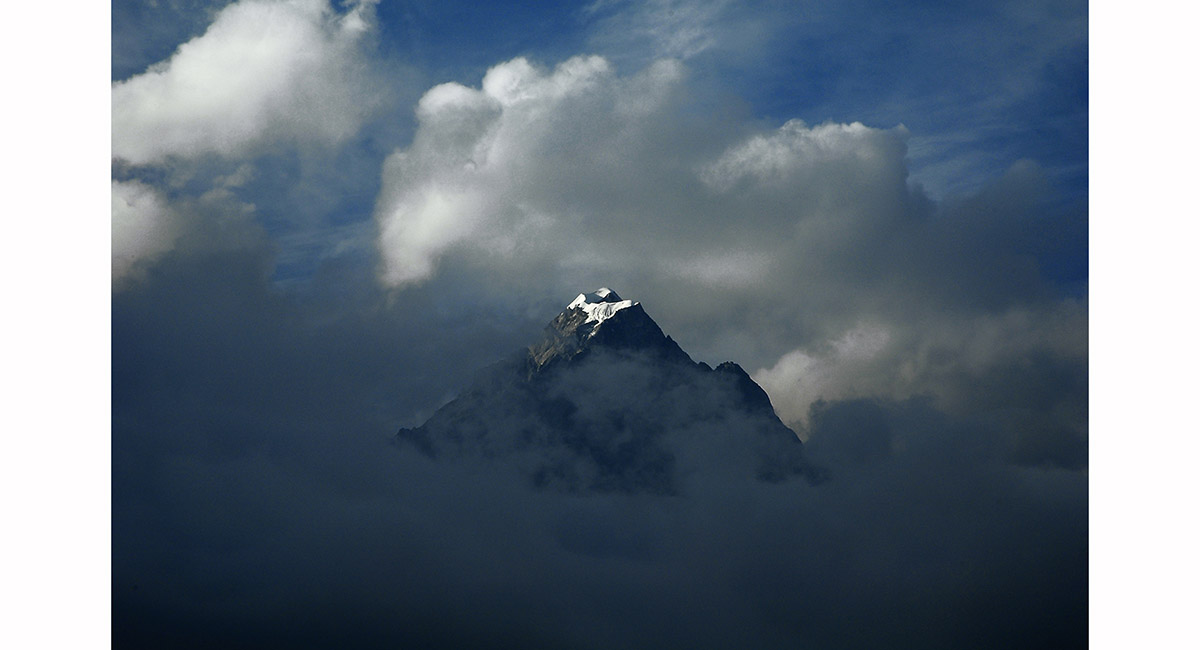
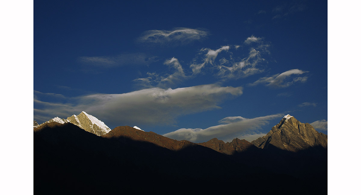
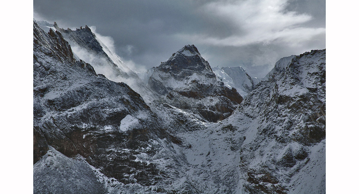
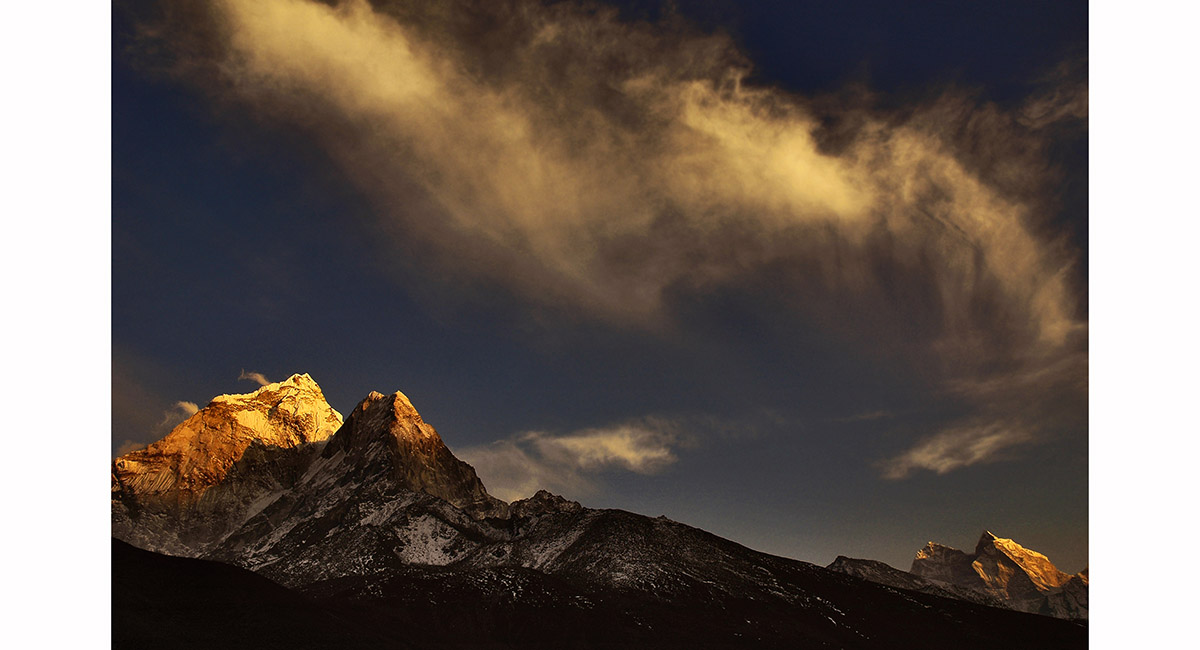
A peak hovers in swirling cloud above Lukla (2,800m), Khumbu

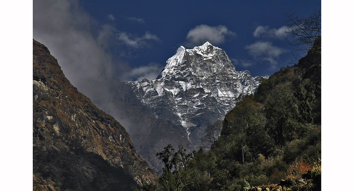
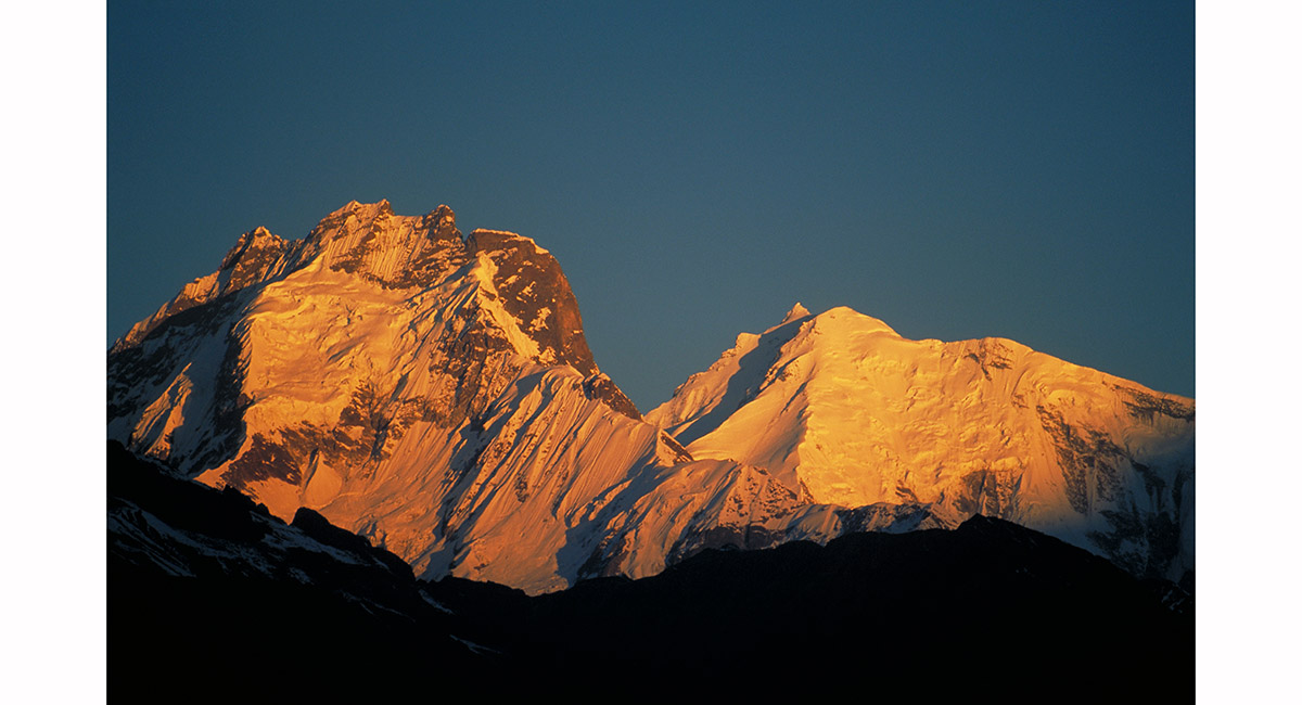
Kusum Kanguru (6,369m) from near Ghat, Khumbu

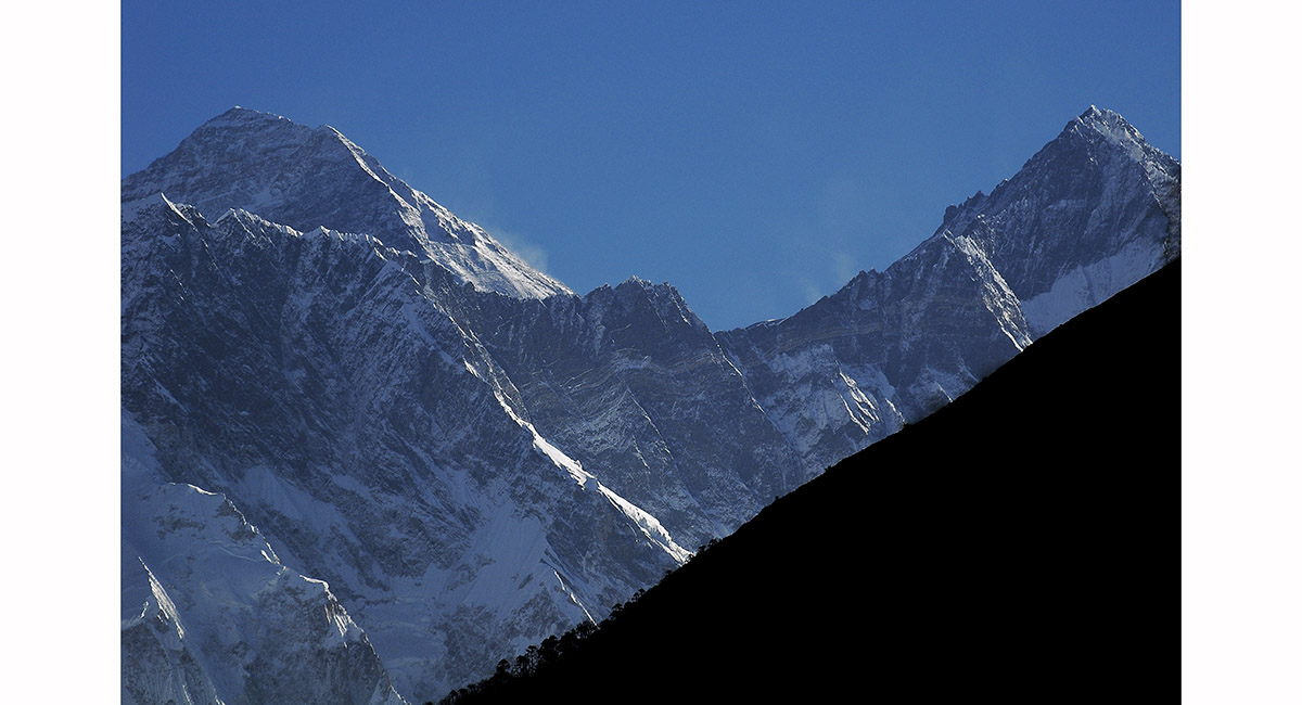
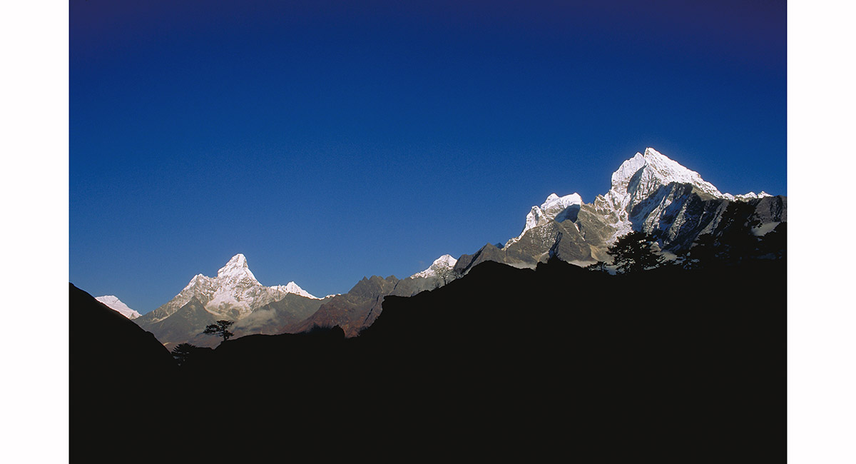
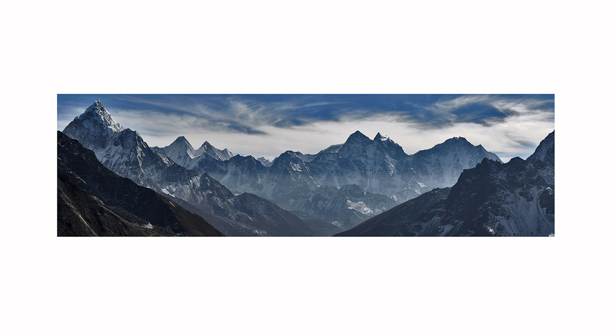
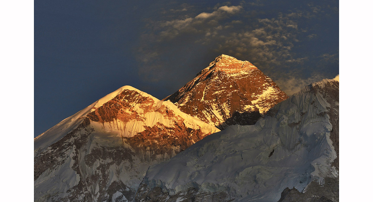
First sighting of Mt Everest below Namche Bazaar - main summit far left, then the Hillary Step and South Summit, behind the mighty wall of Nuptse, with Lhotse far right, Khumbu

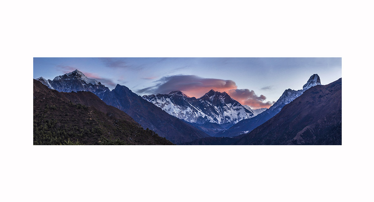
Khumbu dawn view from above Namche Bazaar - from left, Tawoche (6,367m), Nuptse (7,861m), Everest (8,850m), Lhotse (8,501m), Lhotse Shar (8,393m), Ama Dablam (6,856m)


Mount Everest peaks over the Nuptse wall, with Lhotse and Lhotse Shar to the right, Khumbu


From above Namche Bazaar at sunrise, the Kwangde Massif - from left, Nupla(5,886m), Kwangde Shar (6,093m), Kwangde Lho (6,187m)), Tengkang Poche (6,499m) and Ramdung (5,925m), Khumbu

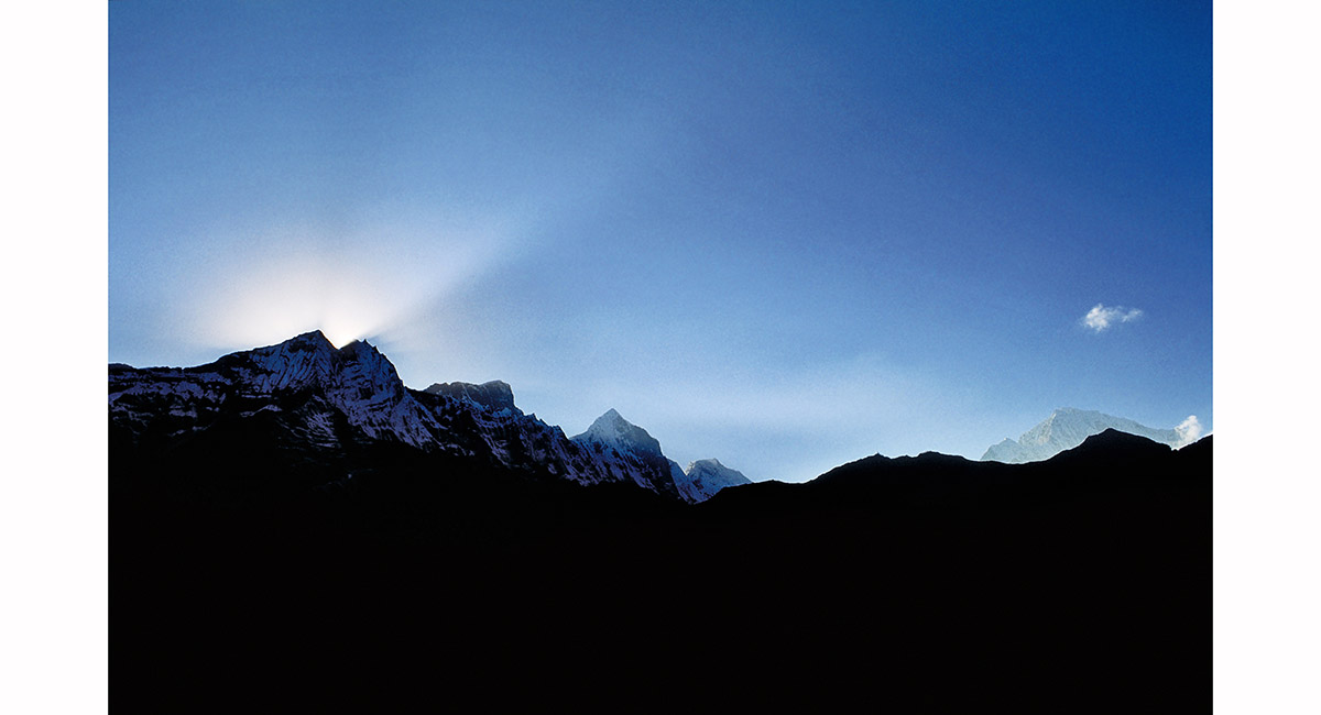
A sunburst over Tamserku, with other peaks from left, Peak 43 (6,356m), Nupla (5,886m), seen from below Everest View Hotel, Khumbu

Kangtega (left) and Tamserku, from Khumjung, Khumbu

Ama Dablam (left, 6,856m), with Kangtega (6,779m) and Tamserku (6,608m), seen from above Khunde, Khumbu

From left, Kangtega, Tamserku, Peak 43, Kusum Kanguru, seen at sunset above Thame, Khumbu

From left, Kangtega, Tamserku, Peak 43, Kusum Kanguru, seen at sunset above Thame, Khumbu

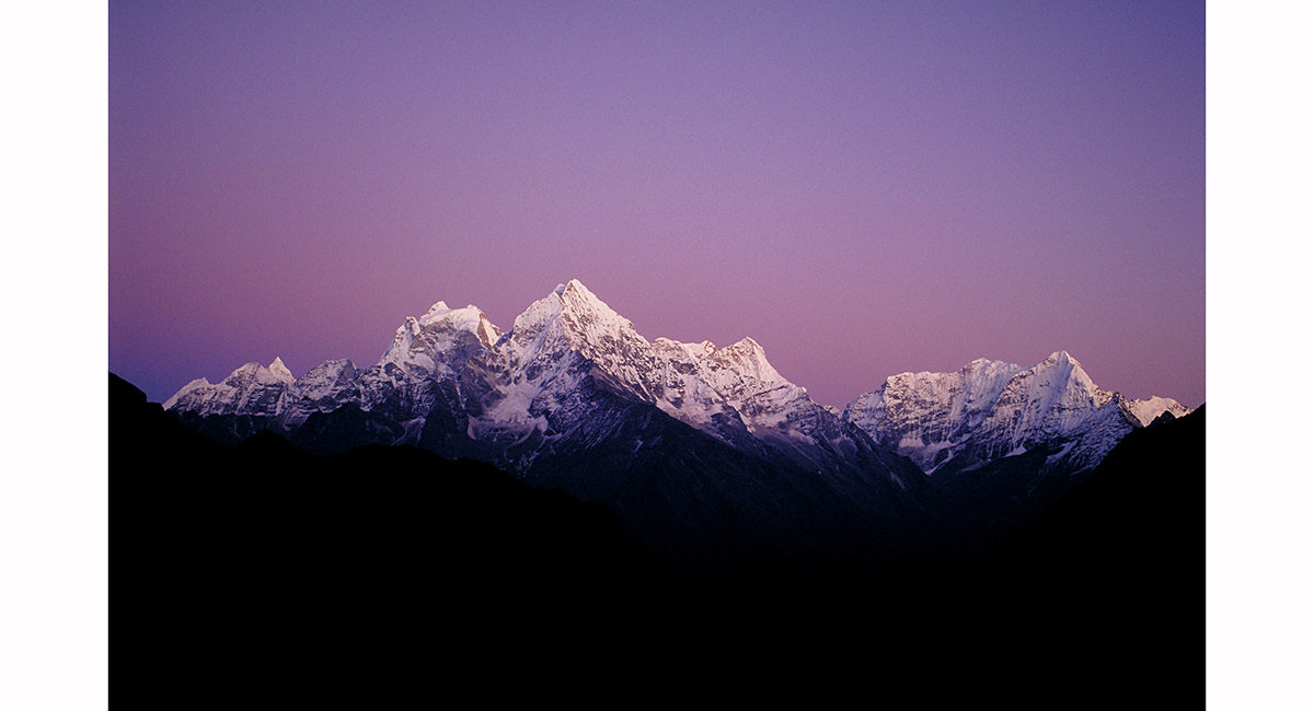
From left, Ama Dablam (6,856m), Malanphulan (6,573m), Kantega (6,685m) and Tamserku (6,770m) from Mong La (3,950m), Khumbu


Ama Dablam (6,856m) from Mong La (3,950m), Khumbu


Dawn view from the ridge above Dingboche, to Tawoche, Cholatse and Lobuje East, Khumbu

Ama Dablam, Kangtega, Tamserku and others, viewed from Lobuje Hill, Khumbu


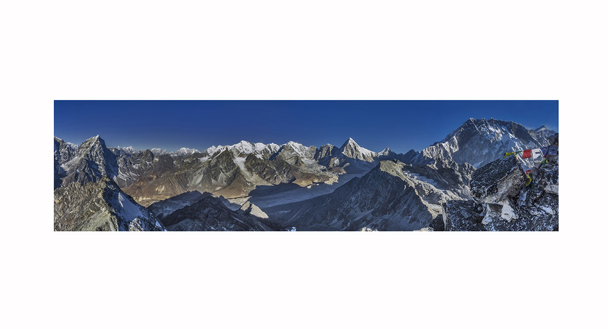
Gokyo Ri panorama, with Mt Everest just left of centre, Khumbu

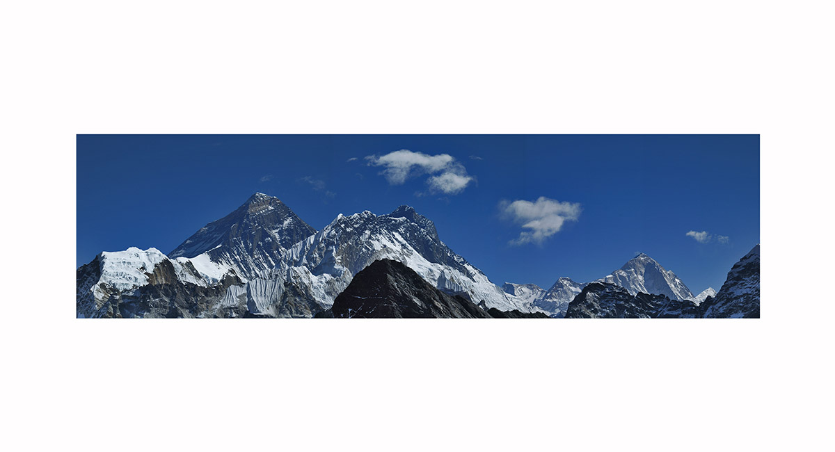
Mt Everest (8,850m), Nuptse (7,896m), Lhotse (8,501m) and Makalu (8,475m), viewed from Gokyo Ri, Khumbu


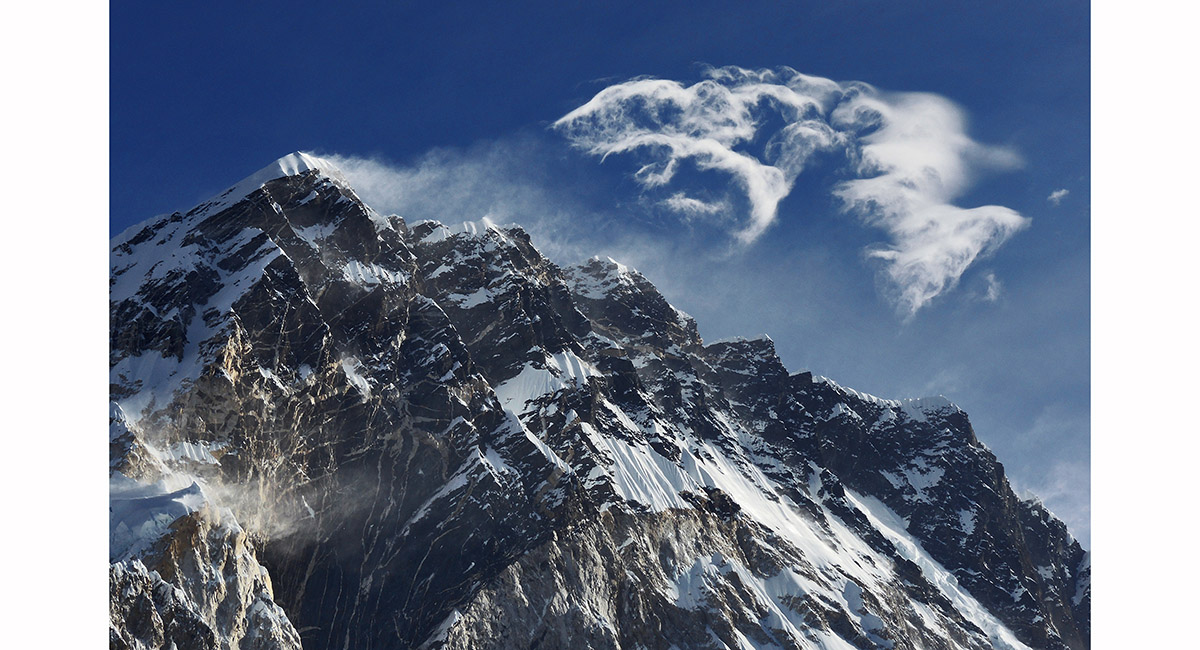
Mt Everest (8,850m), with its characteristic snow plume blasted from the summit by Jet Stream winds, viewed from Gokyo Ri, Khumbu

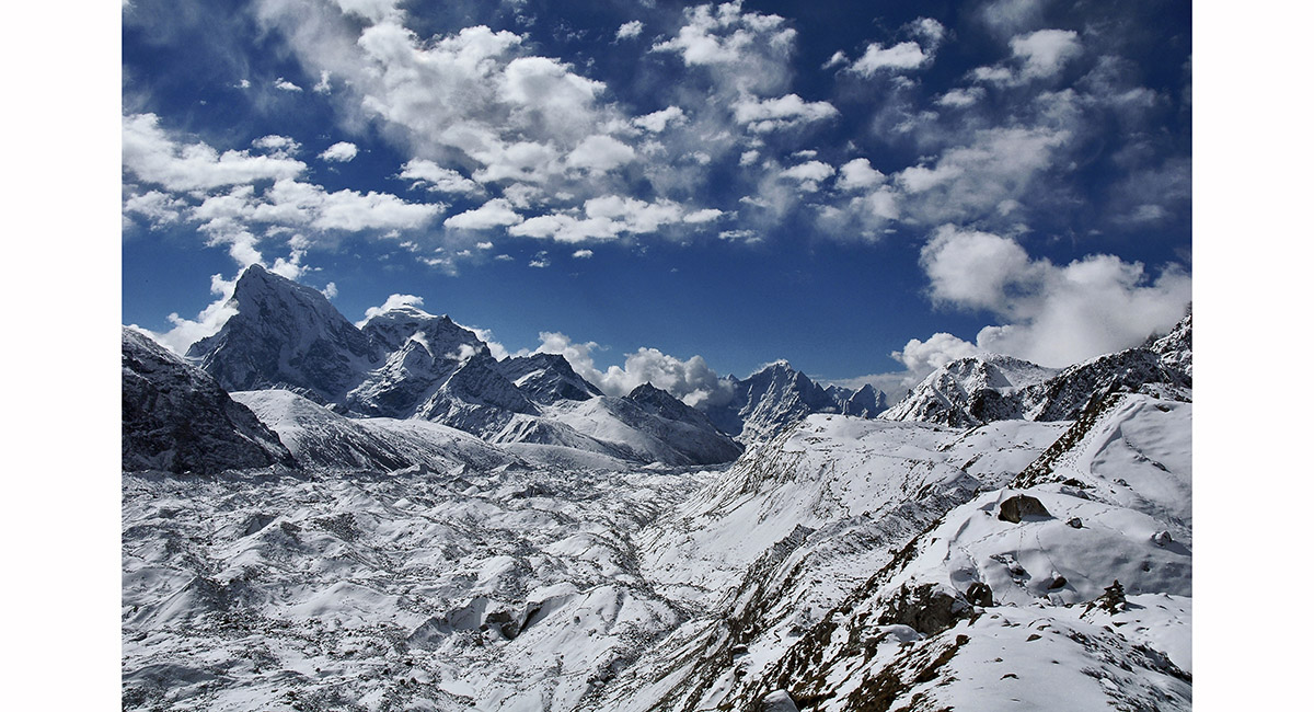
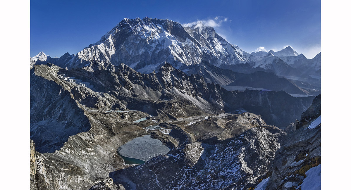
Ice, snow, water and vapour all come together on the Ngozumpa Glacier, viewed from the moraine above Gokyo, Khumbu

Cholatse (6,440m) and Tawoche (6,370m), viewed from Gokyo, Khumbu

Cho La (5,400m), viewed from 5,100m on the Dragnag side, Khumbu


Dusk view from Dzonglha (4,843m) towards Cho La, Khumbu

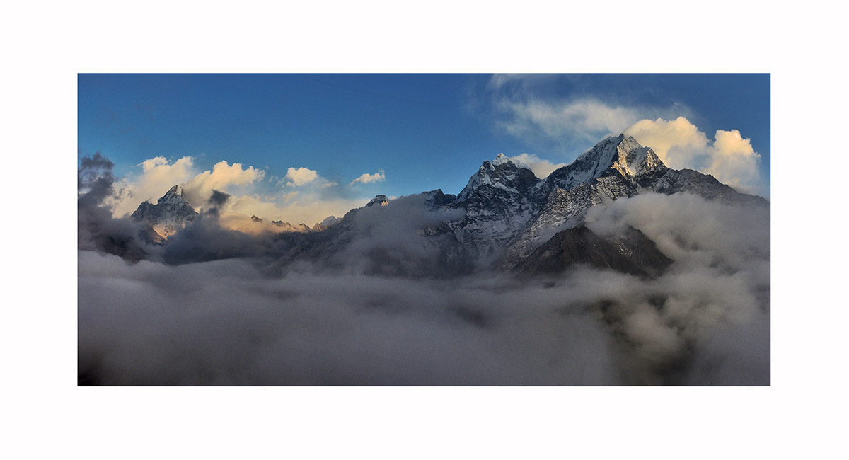
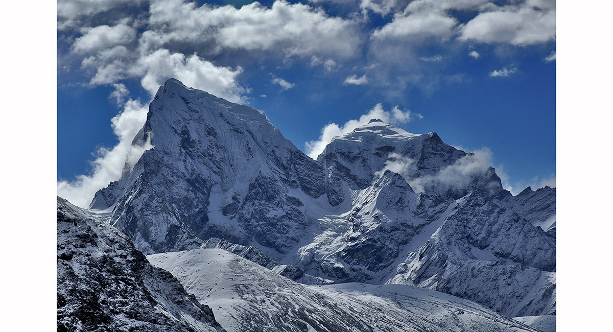
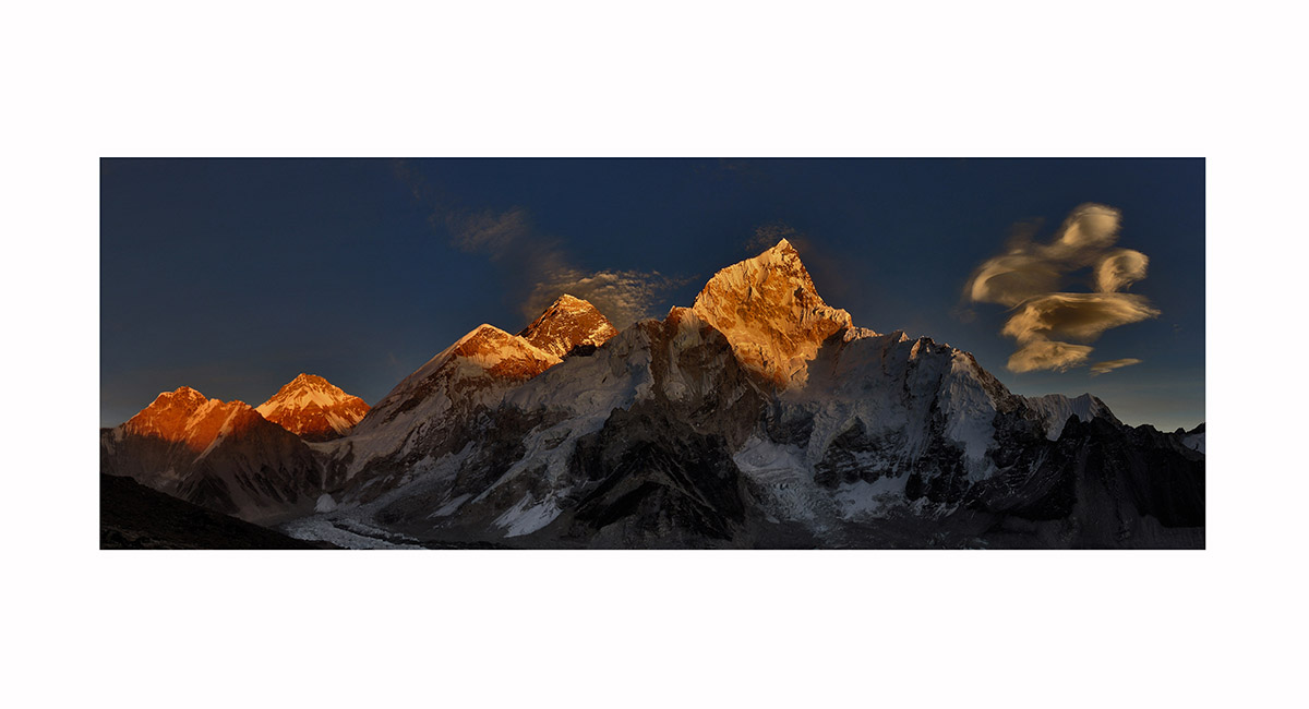
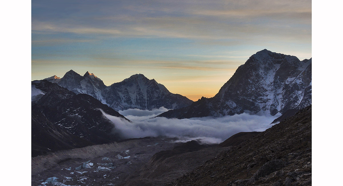
Fantastic cloud formations coming off Nuptse, viewed from Lobuje, Khumbu

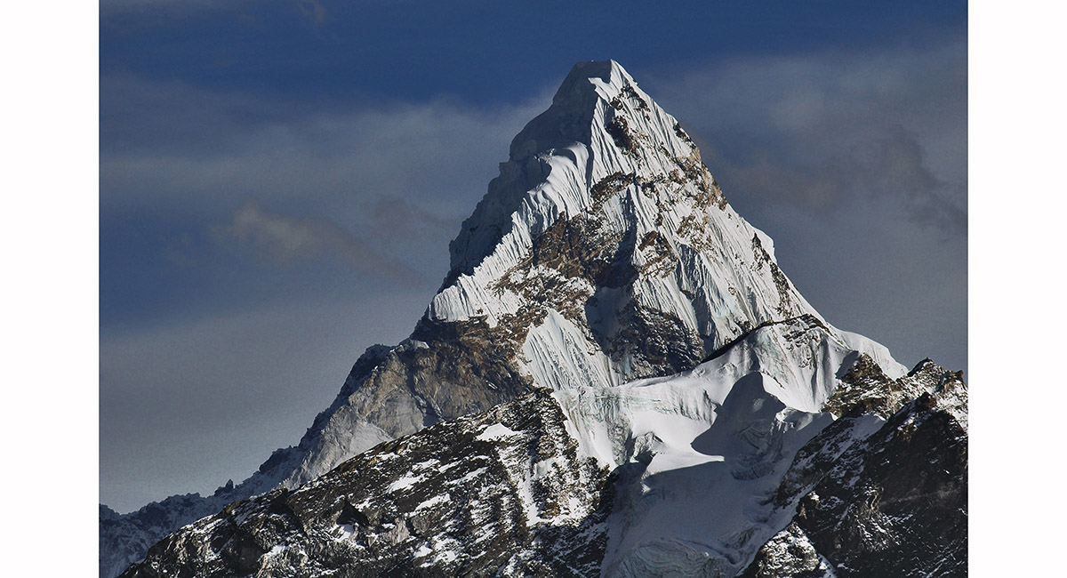
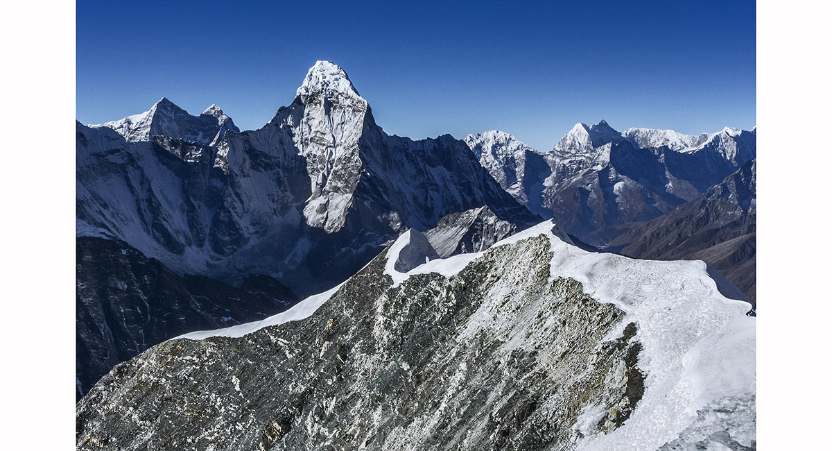
Ama Dablam (6,856m), viewed from Kala Pattar, Khumbu

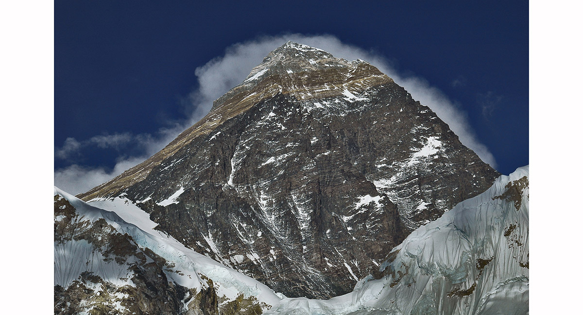
The top 1,000 metres of Mount Everest, viewed from the top of Kala Pattar (5,545m), across the Khumbu Glacier


A classic Khumbu vista from Kala Pattar just before sunset - from left, Khumbutse (6,665m), Changtse (7,553m), West shoulder, Everest summit (8,850m) and Nuptse (7,861m)

West shoulder and summit of Mount Everest (8,850m), from Kala Pattar, Khumbu

A classic Khumbu sunset vista from Kala Pattar - from left, Khumbutse (6,665m), Changtse (7,553m), West shoulder, Everest summit (8,850m) and Nuptse (7,861m)

The Everest group big view at sunset from Kala Pattar, Khumbu

The Everest group big view at sunset from Kala Pattar, Khumbu

View south to Kangtega, Tamserku and Tawoche, from Kala Pattar, Khumbu

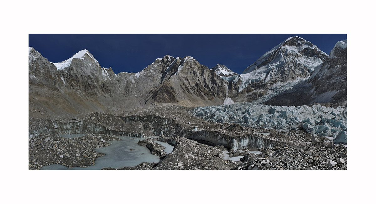
Across a sea of ice are Lingtren, Khumbutse, Changtse and Lho La; and Everest's west shoulder with the Khumbu Icefall spilling out beneath, Khumbu

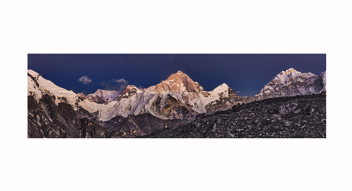
Makalu (8,485m, centre), with Imja Tse (6,189m) beneath and in front of it, viewed from beneath Kongma La at sunset, Khumbu


Makalu (8,485m, centre), with Imja Tse (6,189m) beneath and in front of it, viewed from beneath Kongma La at sunset, Khumbu

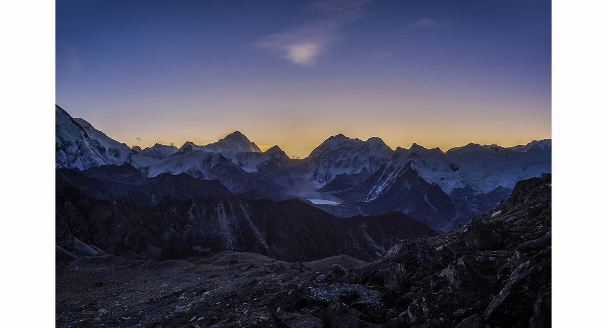
Dawn view of Makalu (left), viewed from beneath Kongma La, Khumbu

Pokhalde (5,806m) summit view north and west - spanning Cholatse (left) to Lhotse (right), Khumbu

Pokhalde summit view back down to our camp site. Kongma La is left, between shadow and light. Nuptse and Lhotse soar overhead and Makalu stands out on the right skyline, Khumbu

Looking south along the lower section of Imja Tse's summit ridge, towards Ama Dablam, Khumbu

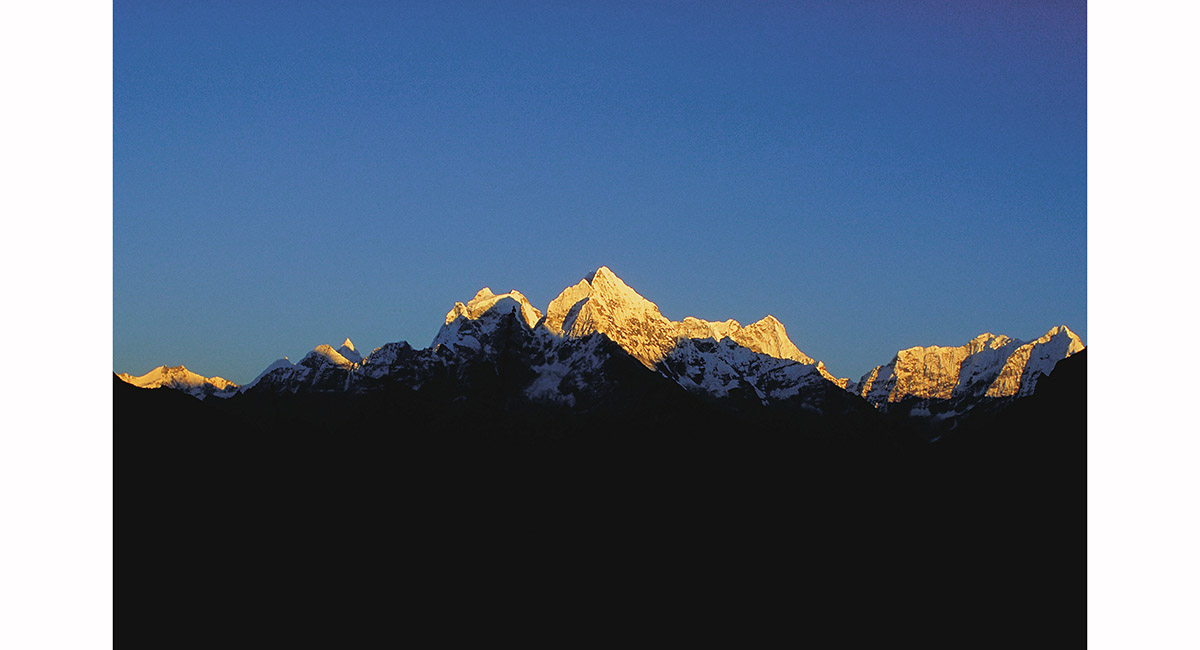
Kangtega (left, 6,779m), Tamserku (6,608m) and Kwangde (right, 6,187m) seen from Dingboche (4,410m) at dawn, Khumbu

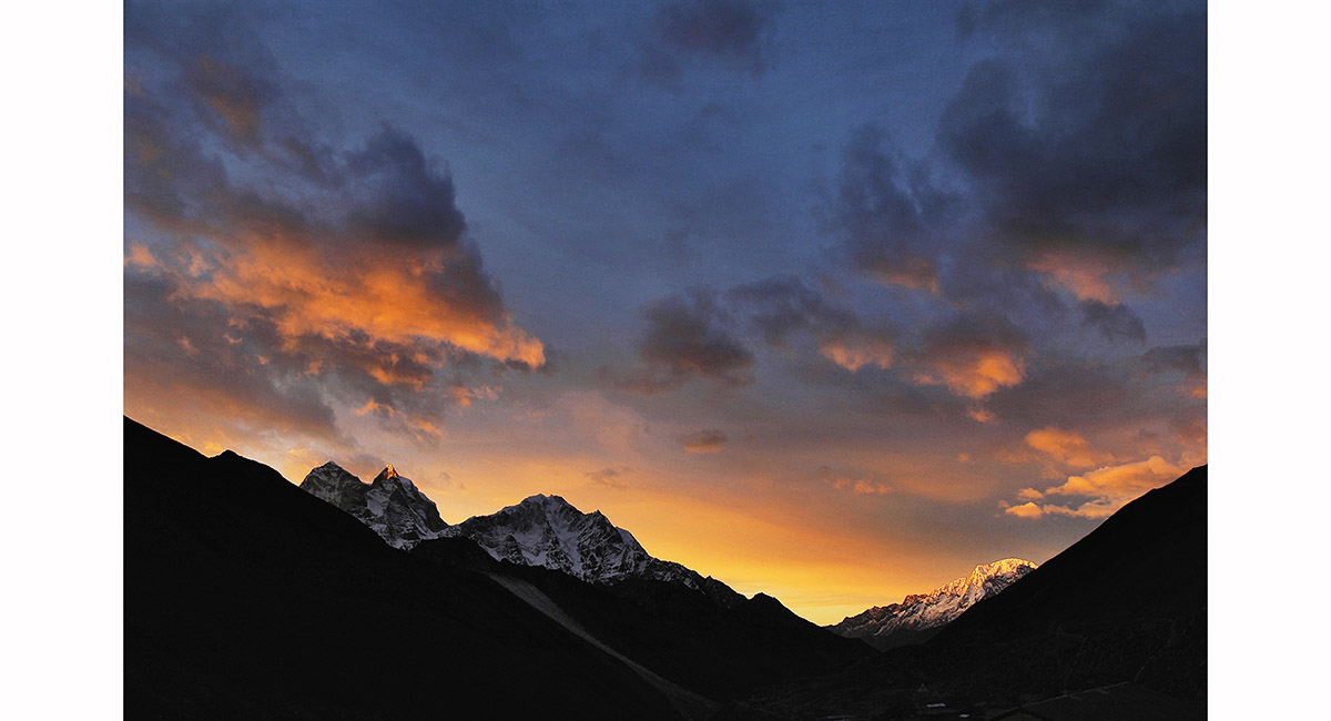
Seen from Dingboche (4,400m) at sunset, Ama Dablam (6,856m) appears to serenade Kangtega (6,779m), Khumbu

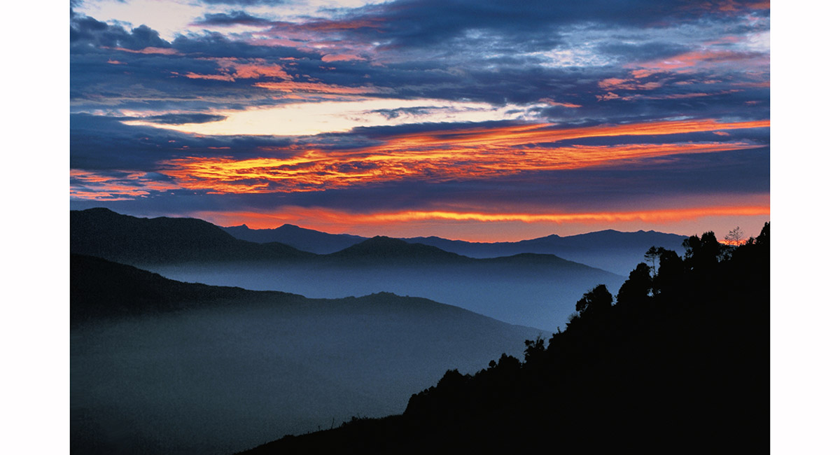
From Dusangang the setting sun bathed another mountain vista in warm light, Langtang/Helambu

Dragons swooping at sunset, Laurebina Yak (3,930m), Langtang/Helambu


Moonlit view from Laurebina Yak, Langtang/Helambu


The view southwards from Laurebina La towards Kathmandu, Helambu

At dusk the ridges between Therapati (3,490m) and Kathmandu, Helambu


Looking towards Dukpu, which lies at the base of the trail from Ganja La, Helambu

Dawn at Khutumsang (2,470m), Helambu


Dhaulagiri (8,167m) and range, viewed from Poon Hill (3,000m) at dawn, Annapurna

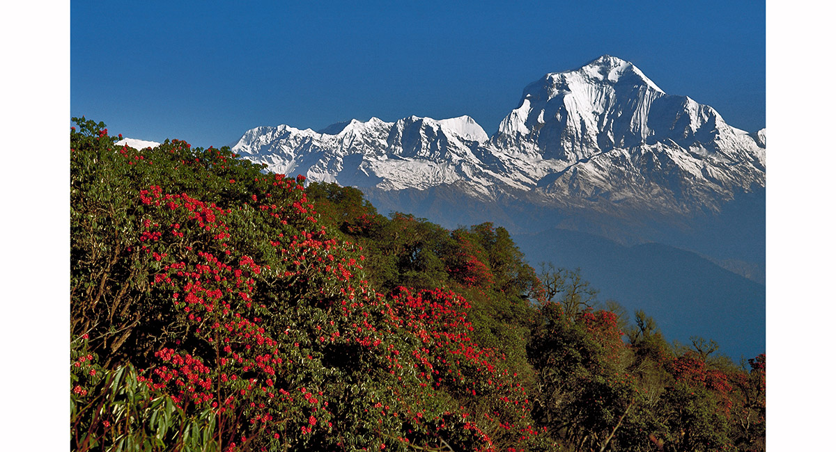
Dhaulagiri, with flowering rhododendron in the foreground, above Ghorapani, Annapurna

Looking back towards Manang en route to Tilicho Lake, Annapurna Circuit


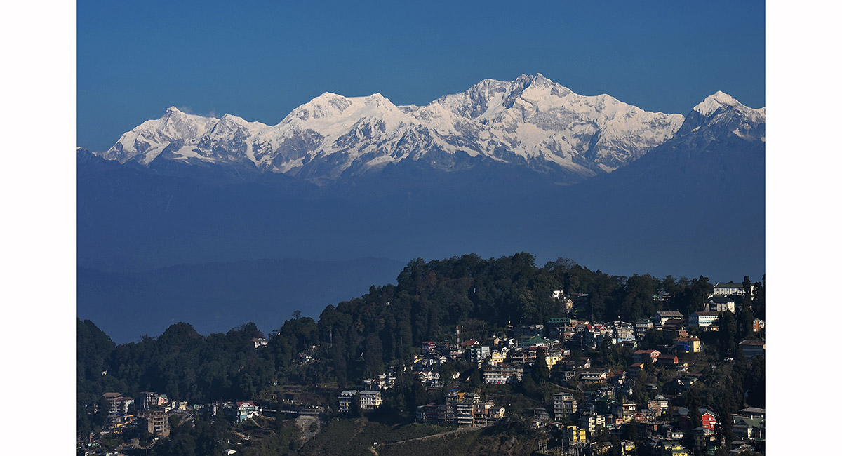
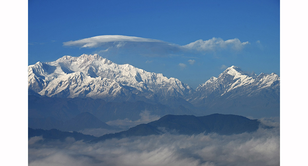
From left - Kumbakarna/Janu (7,710m), Kabru North (7,338m), Kanchenjunga (8,586m - the highest point), Kabru Dome (6,600m). Darjeeling is in the foreground

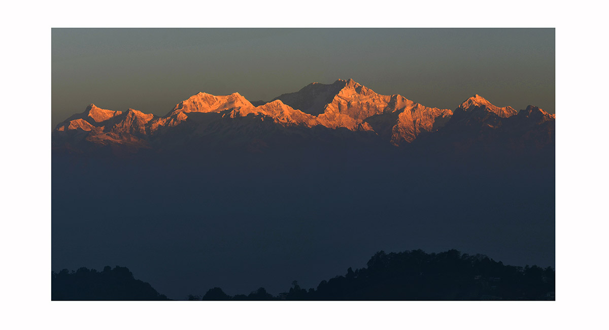
At dawn, from left - Kumbakarna/Janu (7,710m), Kabru North (7,338m), Kanchenjunga (8,586m - the highest point), Kabru Dome (6,600m). Viewed from Darjeeling

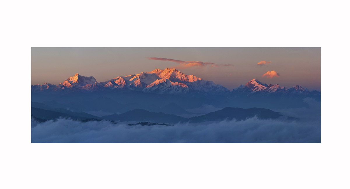
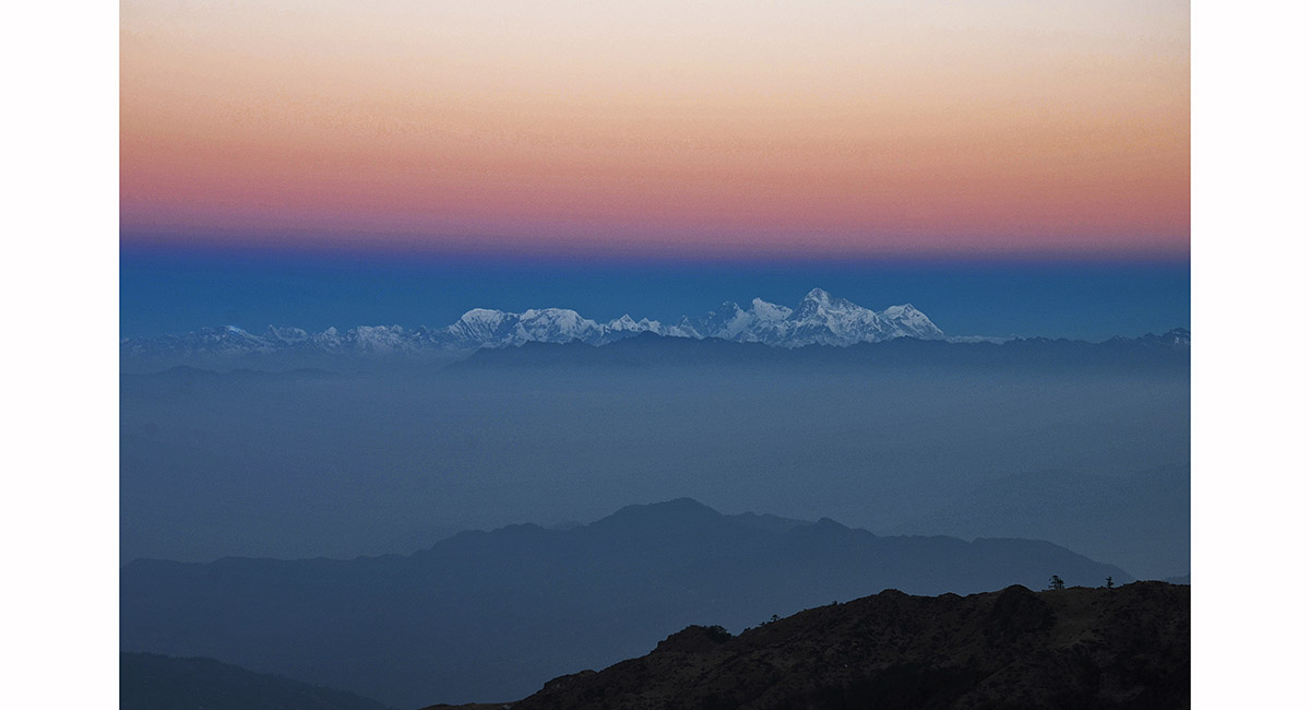
The Kanchenjunga massif at dawn, viewed from Pelling (2,083m), Sikkim

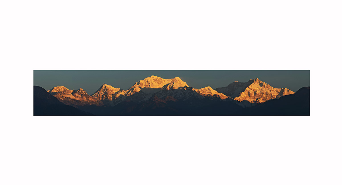
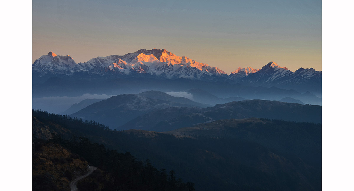
Sunset at Tumling. From left - Kumbakarna/Janu (7,710m), Kabru North (7,338m), Kanchenjunga (8,586m - the highest point), Kabru Dome (6,600m), Simvo (6,811m, in shadow) and Pandim (6,691m)

Kumbakarna/Janu (7,710m), Kanchenjunga (8,586m) and Pandim (6,691m), Singalila Ridge trek

Kanchenjunga (8,586m, left) and Pandim (6,691m, right), viewed from Tumling (3,000m)

The Everest group at dawn, near Sandakphu. The highest peak second from right is Makalu (8,481m). Further right is Chomolonzo (7,804m). Everest (8,850m) is left of Makalu, then Lhotse (8,516m), Nuptse (7,861m), Baruntse (7,129m) and Chamlang (7,319)

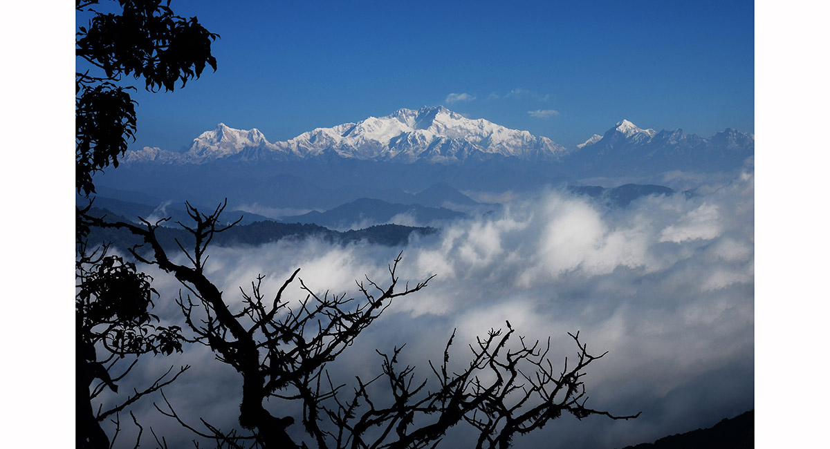
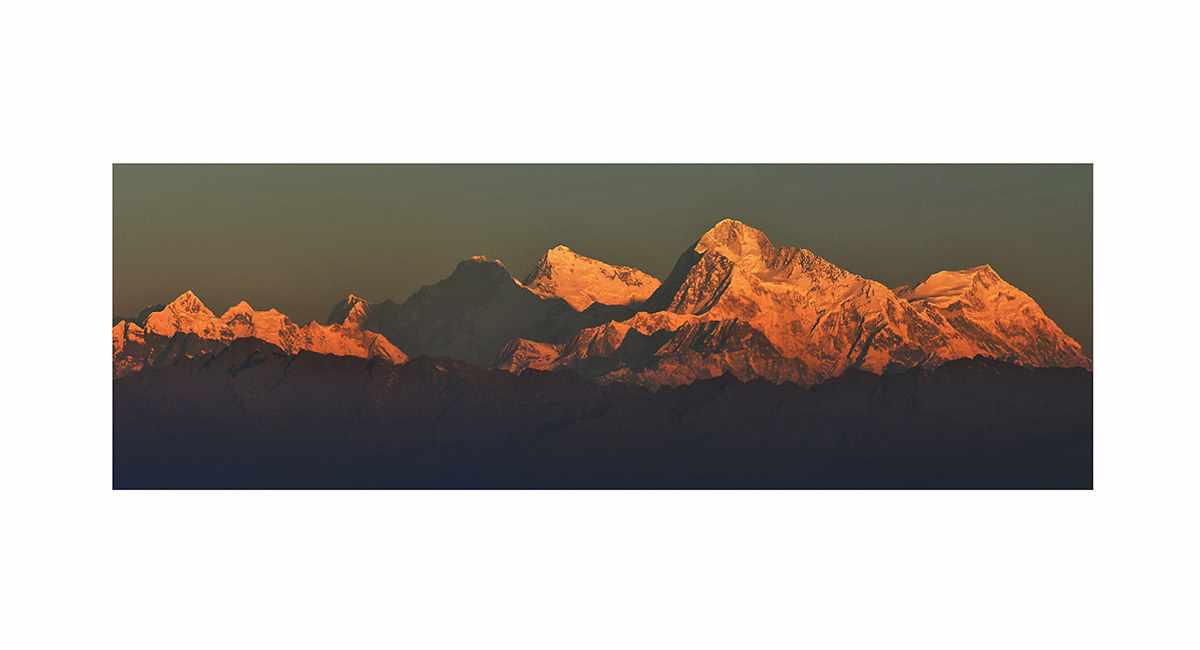
The star of the show on the trek that traces the India/Nepal border - the Kanchenjunga massif, seen here from Sandakphu (3,650m) at sunset

The Everest group at dawn, near Sandakphu. The highest peak second from right is Makalu (8,481m). Further right is Chomolonzo (7,804m). Everest (8,850m) is left of Makalu, then Lhotse (8,516m), Nuptse (7,861m) and Baruntse (7,129m)


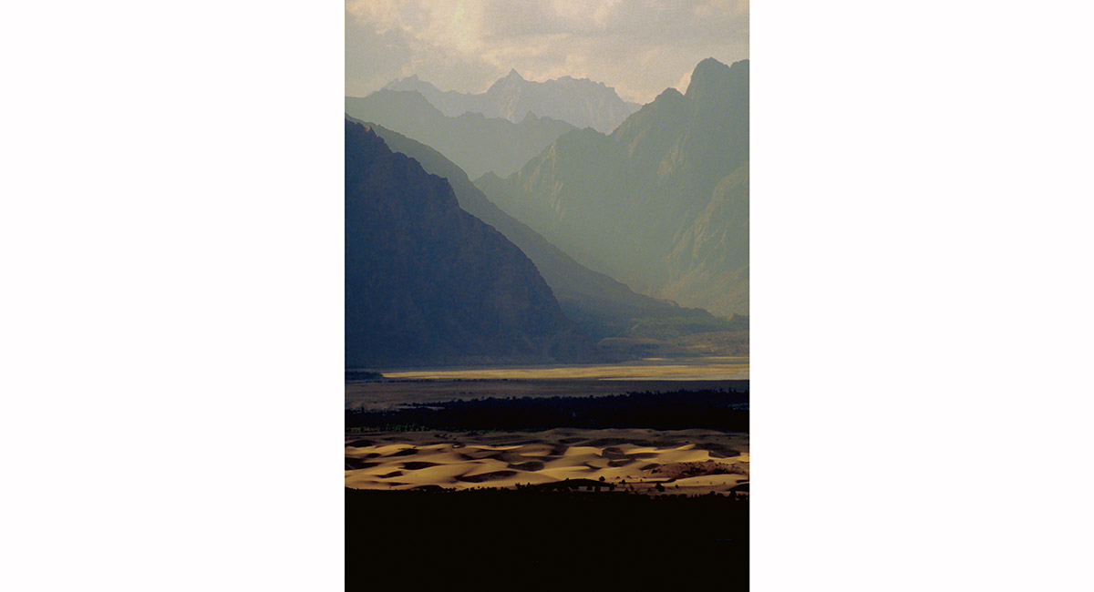
Viewed from the Satpara Road above Skardu, layers of trees and sand, whipped by the fierce winds into shapely dunes on the flats, are offset by layer upon layer of steeply rising, fortress-like ridges behind, Baltistan

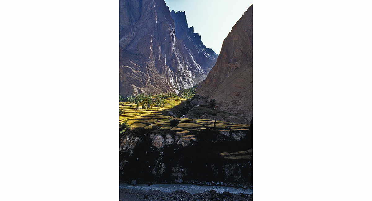
A side valley below Hushe reveals delicately terraced fields covering every usable space, Baltistan


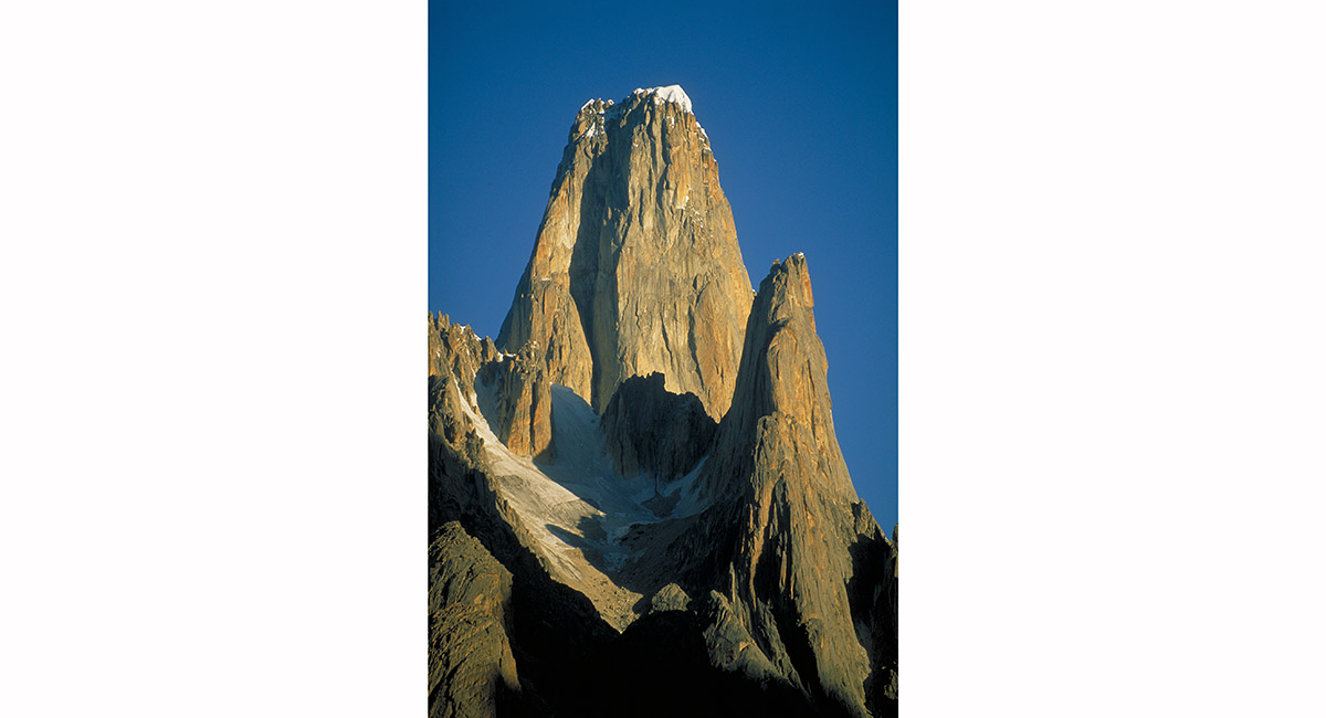
Paiju Peak at dawn, from Khoburtse, Baltistan

Uli Bihaho (6,417m) at dawn, from Khoburtse, Baltistan

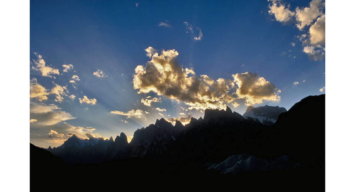
At sunrise, looking West down the Baltoro glacier, a magnificent sunburst over Uli Biaho and the Trangos, Baltistan

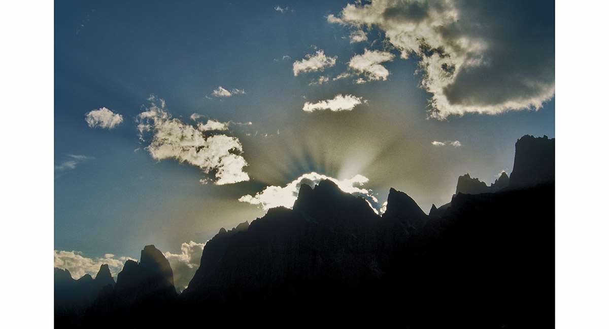
At sunrise, looking West down the Baltoro glacier, a magnificent sunburst over Uli Biaho and the Trangos, Baltistan


From left are Cristal Peak (6,252m), Marble Peak (6,256m), Angel Peak (6,858m) and K2 (8,611m), viewed from Concordia, Baltistan


The main event for most trekkers to Concordia begins to unfold – the summit of the gigantic pryramid of K2 (8,611m) flirts with my camera lens through swirling cloud, Baltistan

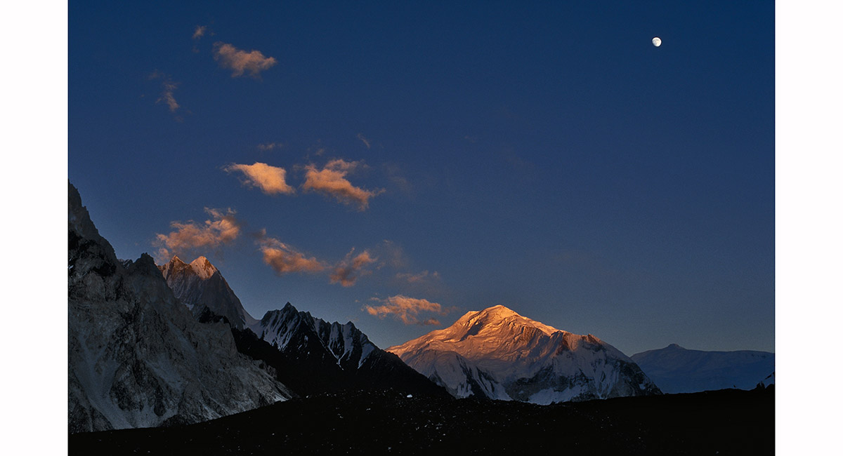
Moon over Snow Dome (7,160m), from K2 base camp (5,300m), Baltistan

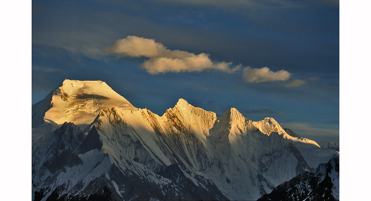
Chogolisa (7,665m, left) and Vigne (6,874m), viewed from K2 Base camp (5,300m), Baltistan

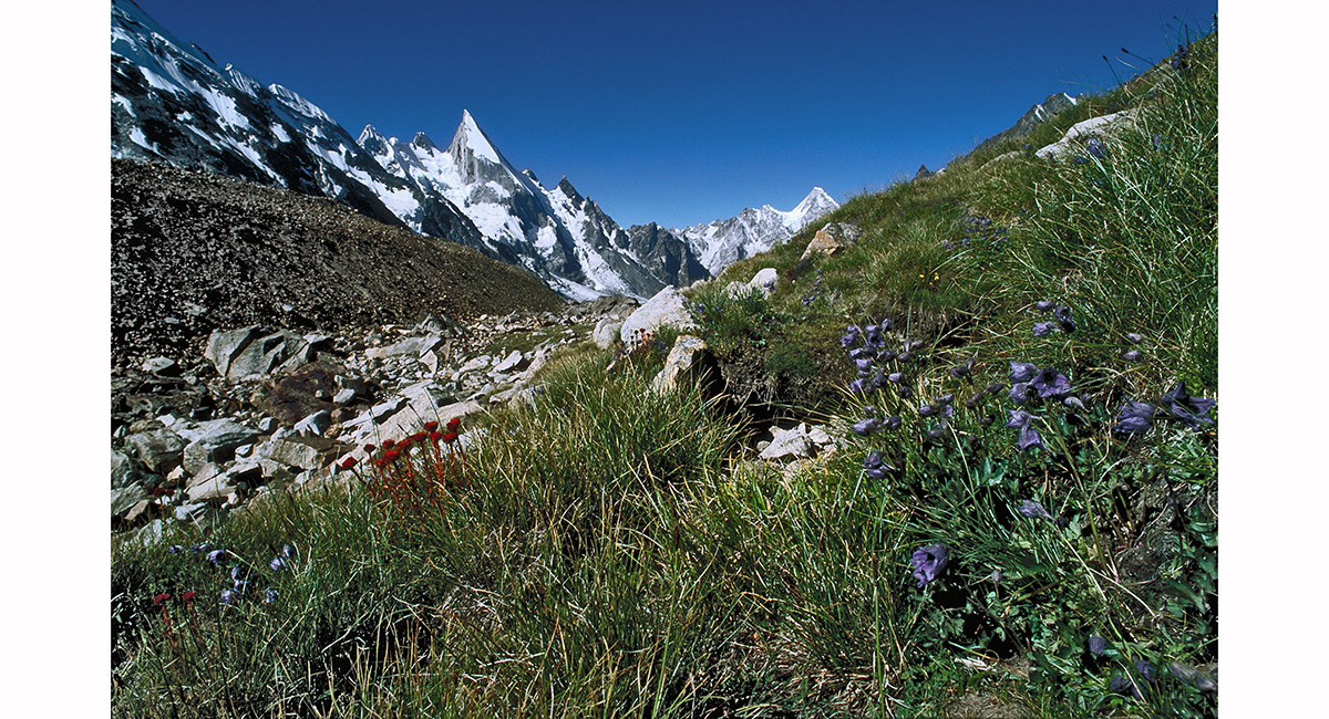
The first vegetation in many days – a welcomed relief to the stark rock and ice. Seen on the trail above Xhuspang, Baltistan > Landscapes NZ North Island > Landscapes NZ South Island

To order a print or web resolution file of any image you see in this slide show, just right click the image, click “Copy Image URL” and paste in to the “Your message” box of our Contact Us form. Please also note, for each image, if you want a print or web resolution file. We will get back to you as soon as possible to confirm price and payment details.
Open Contact Us in a new window to paste Image URL(s) easily