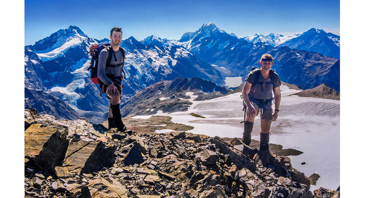
Annette Plateau and Mount Kitchener, March 2017

The craggy upper section of Sebastopol Ridge, and the steep snow field/head wall to its right that we used to access the Annette Plateau

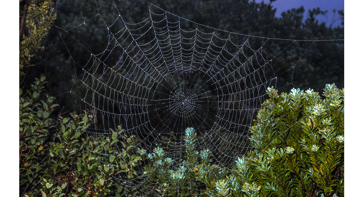
A spider web holds the morning dew at the Red Tarn

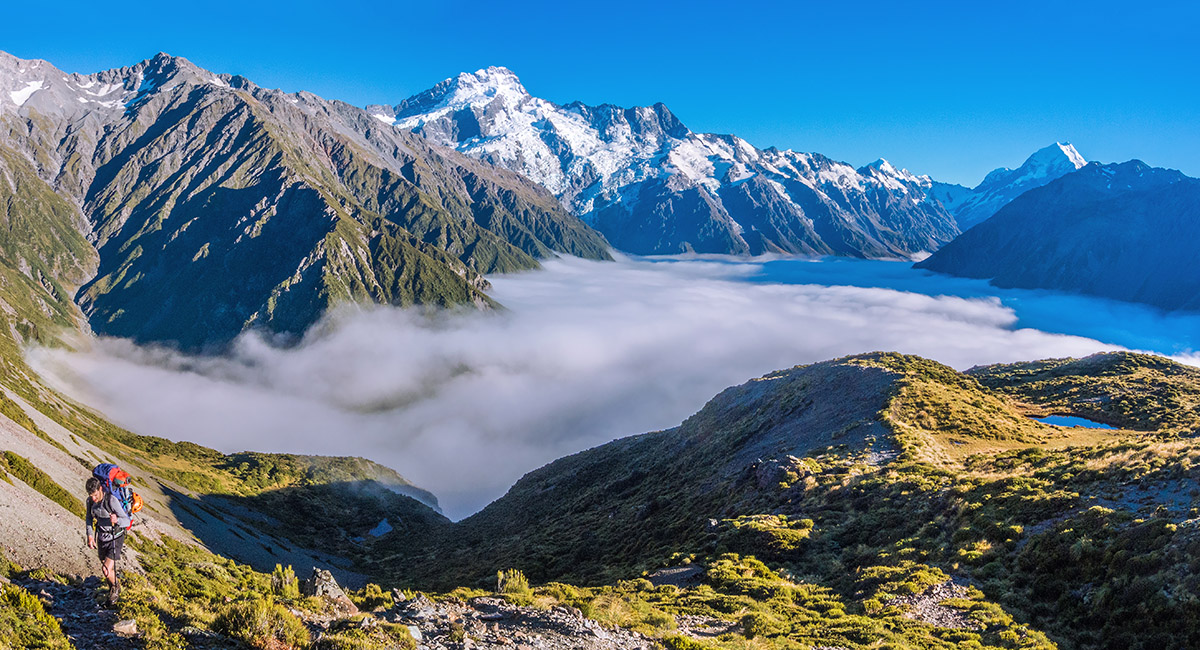
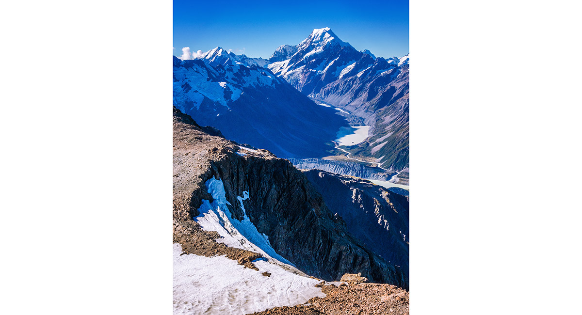
Above the Red Tarn, looking north to Mount Cook


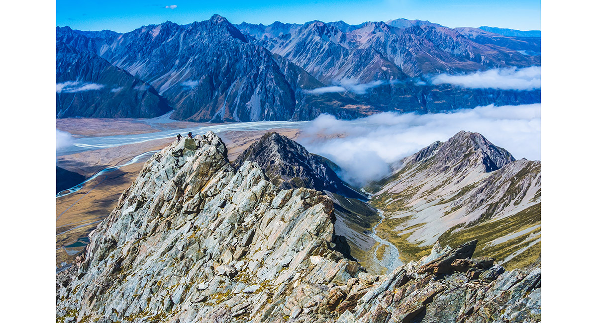
On top of Sebastopol (1,468m), looking north over Wakefield Ridge to Mt Cook

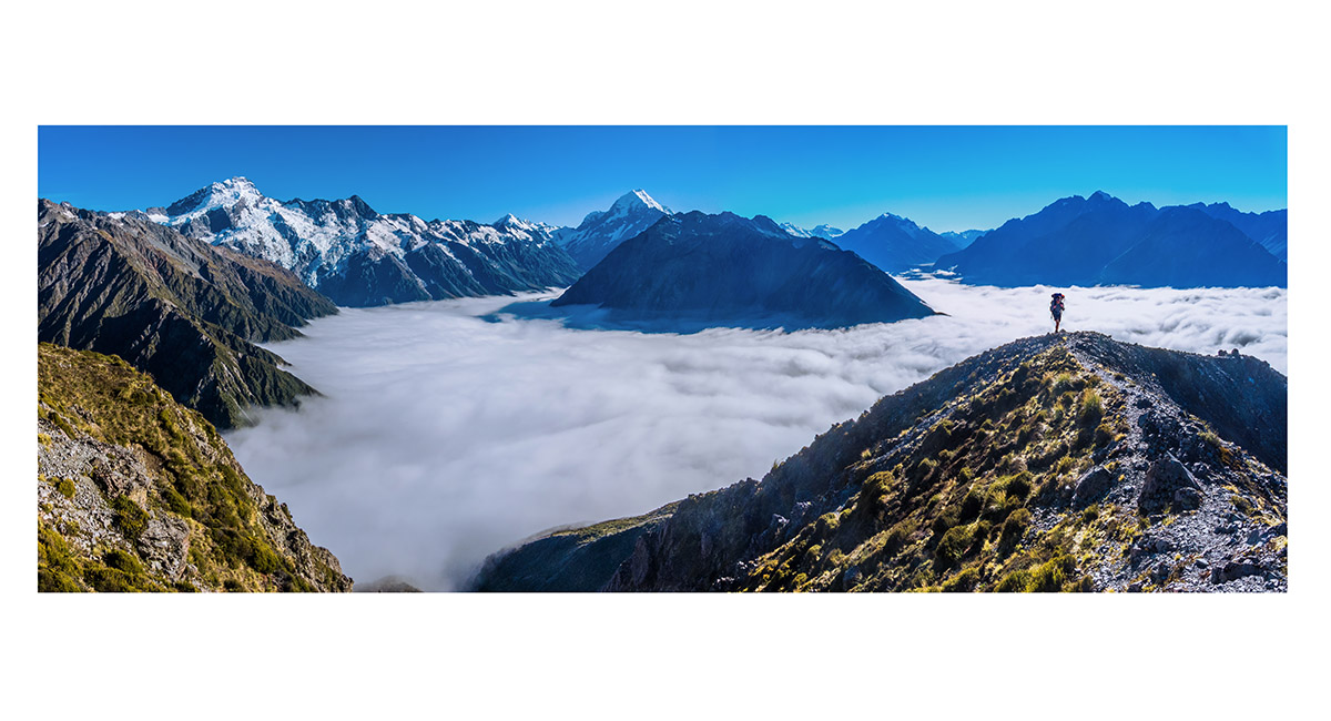
On top of Sebastopol (1,468m), looking north over Wakefield Ridge to Mt Sefton and Mt Cook


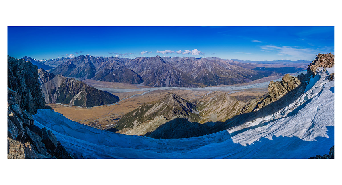
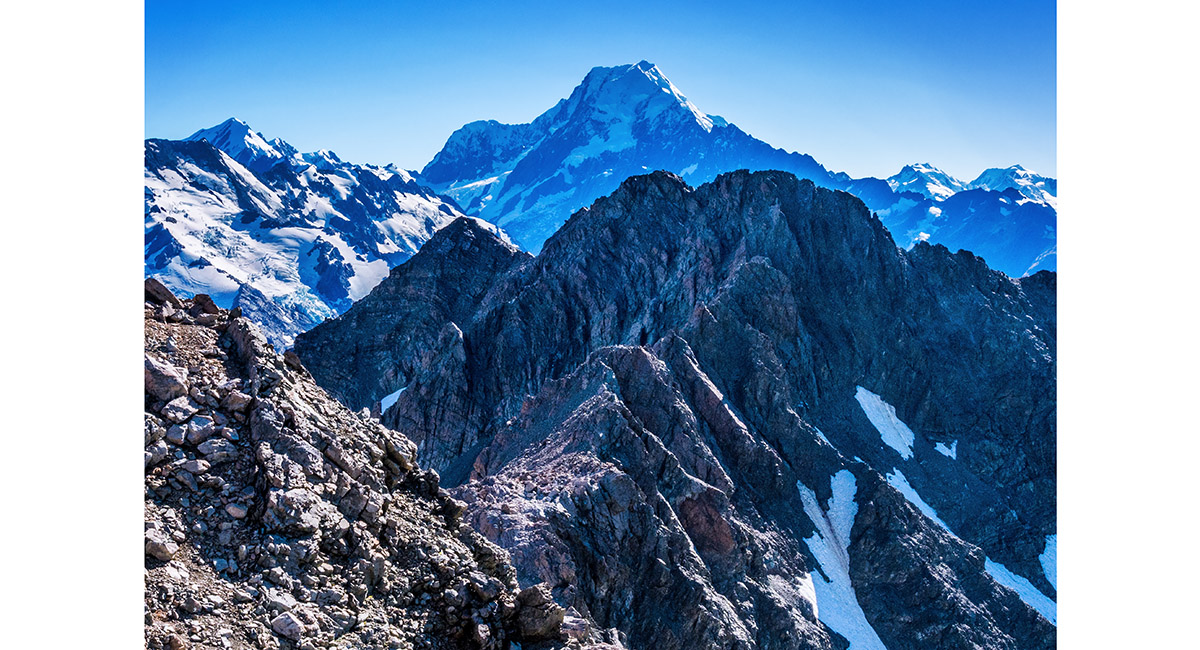
Looking up Sebastopol Ridge, which leads to Mt Annette (2,235m). We accessed the Annette Plateau up the steep snow field directly to the right of the ridge. Mt Sealy (2,627m) is far left


Passing crags on Sebastopol Ridge


Looking back to the top 100 metres of the west side of Sebastopol


A view from Sebastopol Ridge, north over Wakefield Ridge to Mt Cook

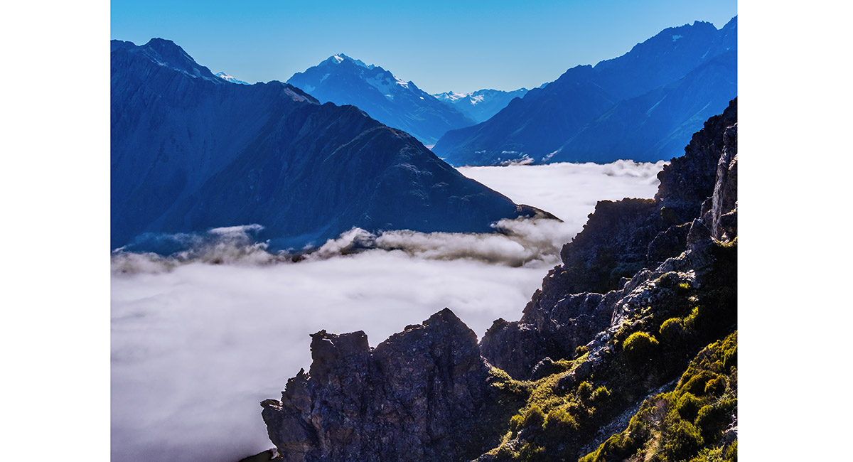
A view from Sebastopol Ridge, north over Wakefield Ridge to Malte Brun


At about 1,600m on Sebastopol Ridge, looking back over Sebastopol to the Burnett Mountains. Nuns Veil (2,749m) is far left


At about 1,600m on Sebastopol Ridge, looking up to the glacier coming off the east side of Annette


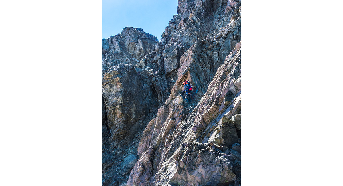
On the north side of the craggy upper section of Sebastopol Ridge

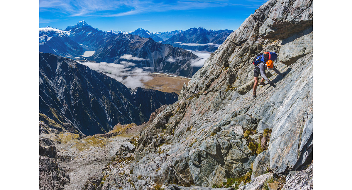
On the north side of the craggy upper section of Sebastopol Ridge

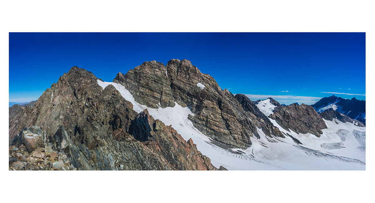
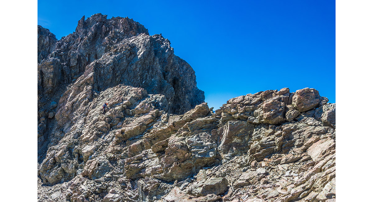
At about 1,700m on Sebastopol Ridge, looking back over the craggy upper section to Sebastopol below

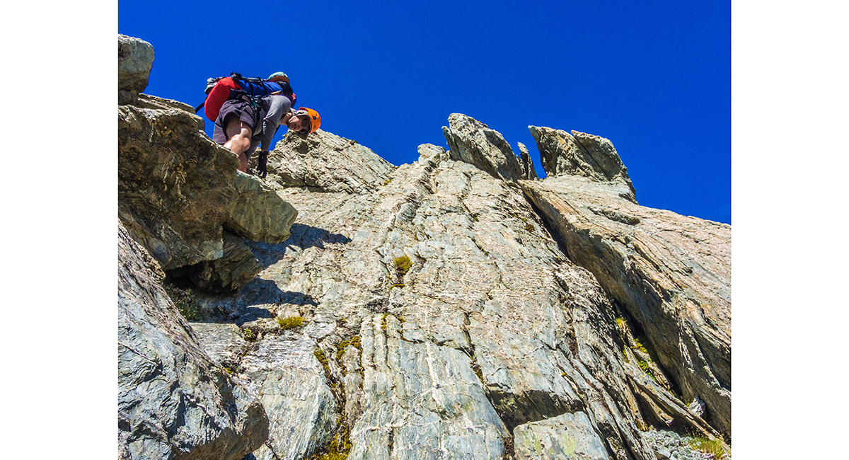
There are some steep sections on the upper part of Sebastopol Ridge


We even needed an adseil at this point to get past a tricky corner exposed to a nasty little chasm beneath ...


... Which we abseiled into

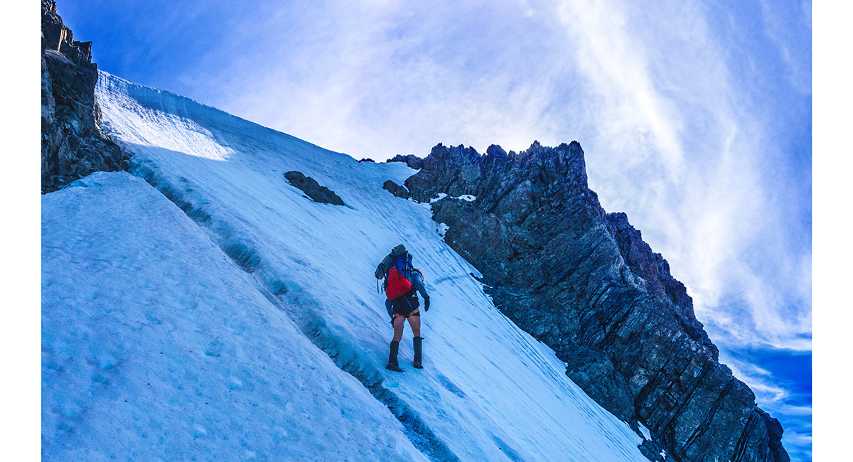
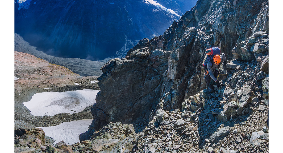
On the headwall right of Sebastopol Ridge. The very top was seamed with crevasses and topped out at about 70 degrees

Above the headwall that gave us access to Annette Plateau, looking east to the Burnett Mountains

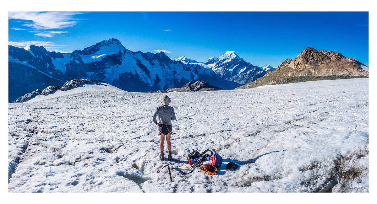
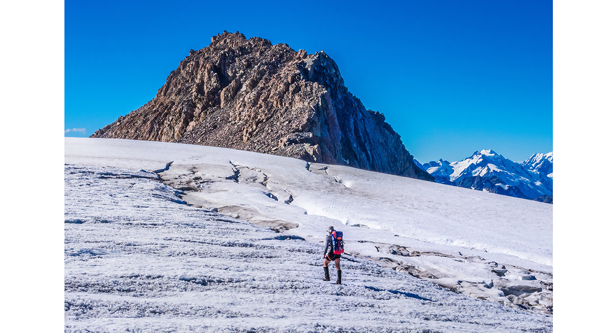
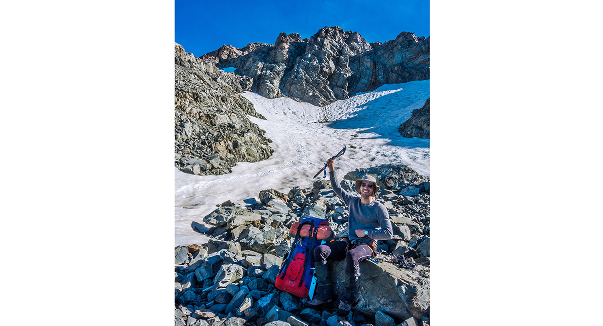
Up on the permanent ice of the Annette Plateau at about 2,100m. We stopped here to replenish our water from afternoon glacier melt. Mounts Sefton and Cook dominate the northern skyline

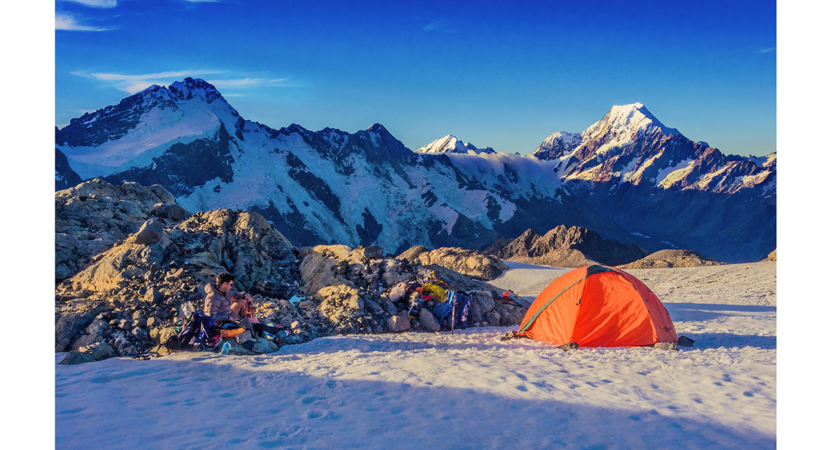
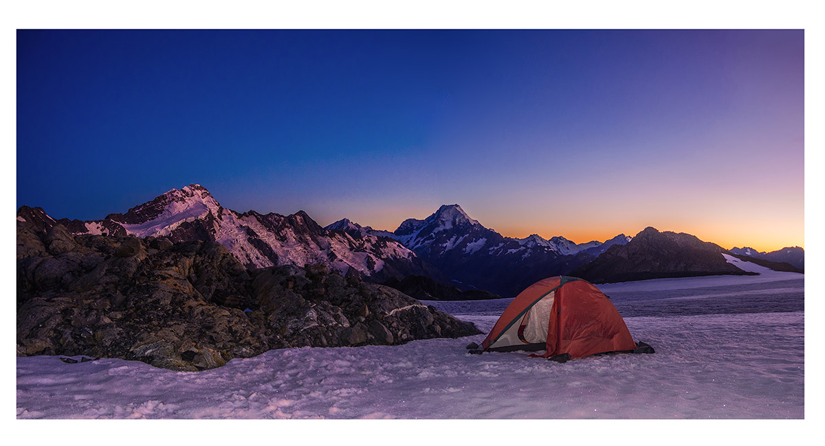
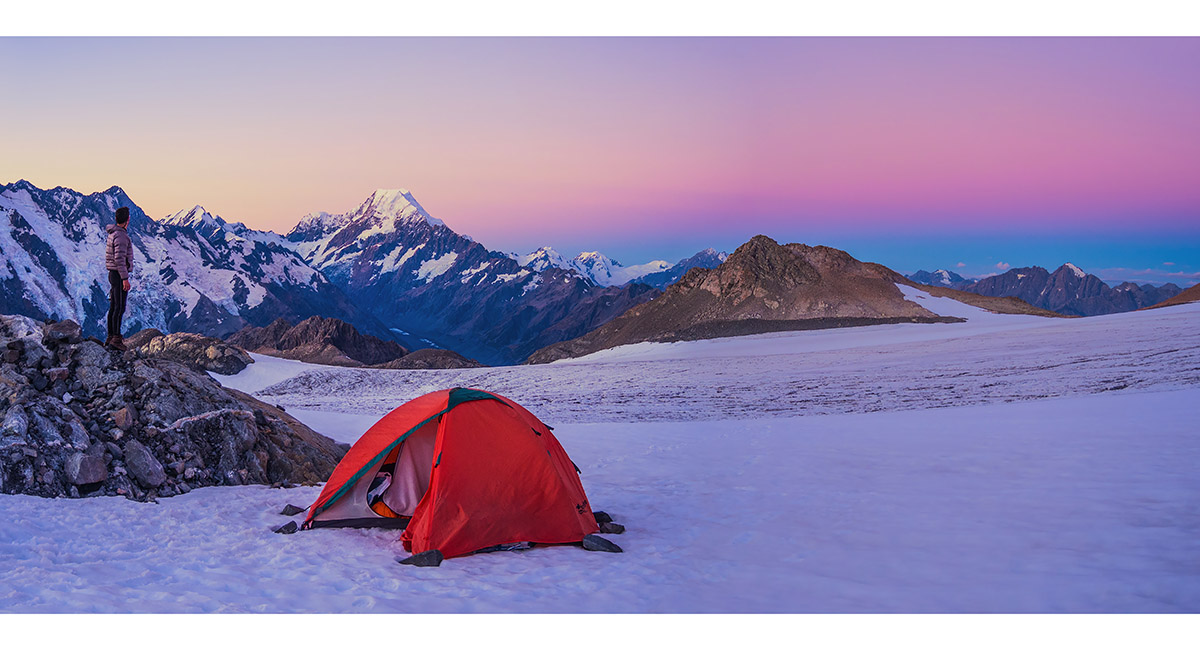
At our camp site (2,150m) on the west side of Annette Plateau, beside a rocky outcrop that held nice little pools of drinking water, affording a superb view of Mounts Sefton, Footstool, La Perouse, Hicks and Cook


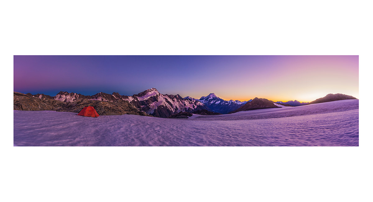
Dusk view north and east across the Annette Plateau, with Annette (2,235m) far right

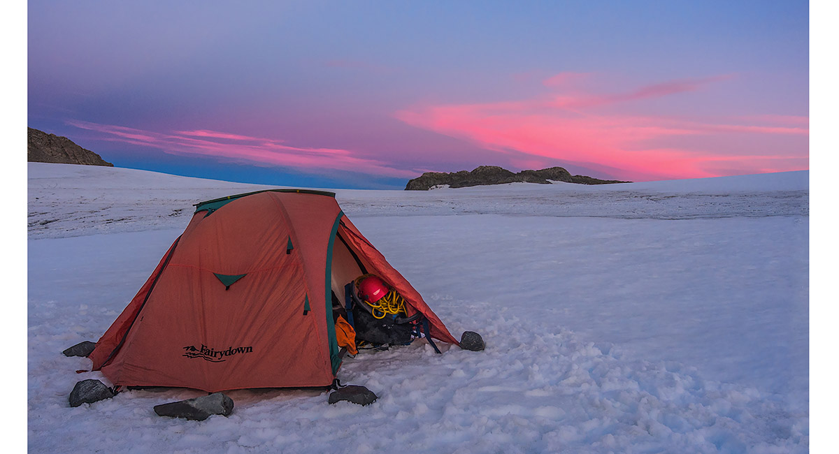
Home for two beautiful calm nights

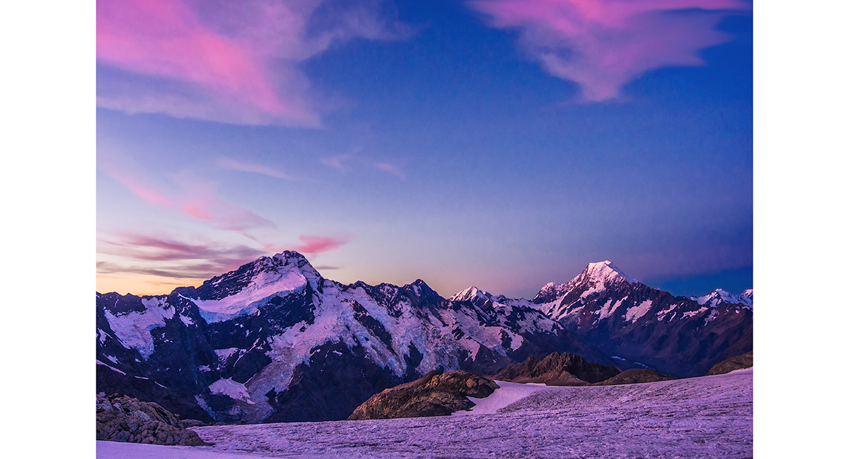
Dusk view of Mounts Sefton, Footstool, La Perouse, Hicks, Cook and the Minarets


Dusk view of La Perouse, Hicks, Cook, the Minarets, Elie De Beaumont and Tasman Saddle


3am view of Mounts Sefton, Footstool, La Perouse, Hicks, Cook, the Minarets and Elie De Beaumont

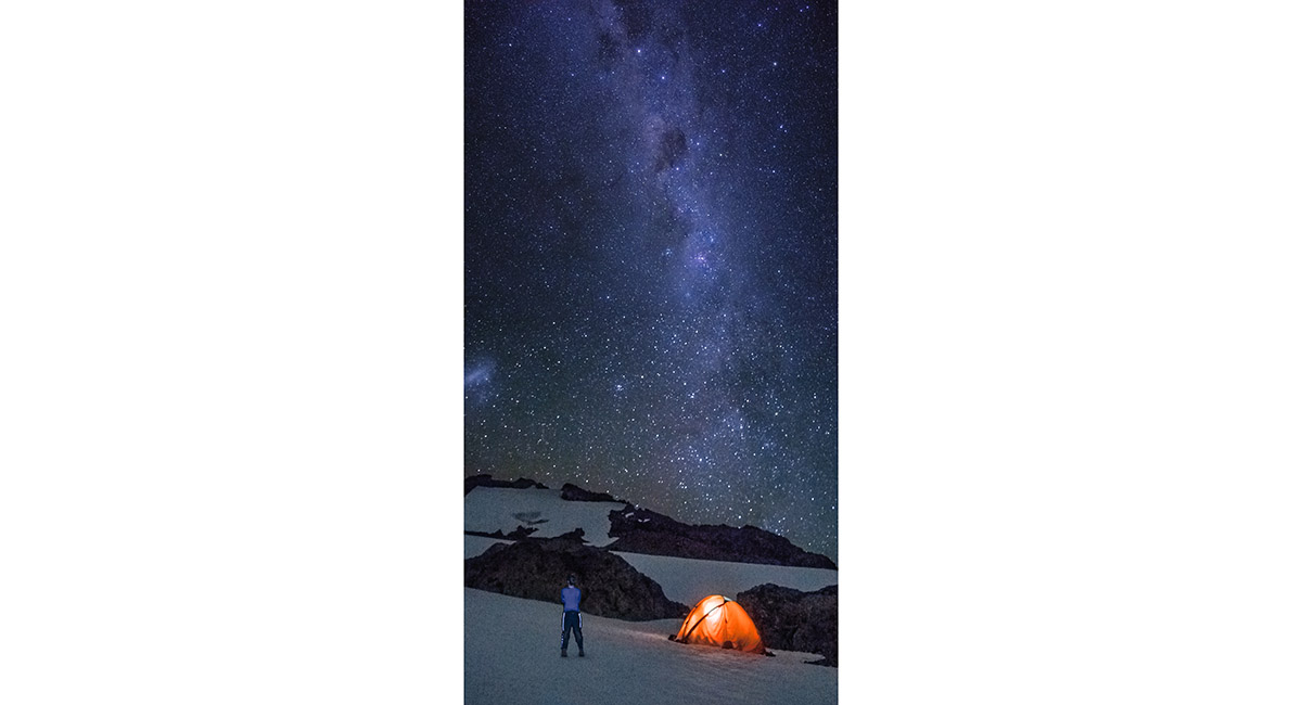
The Milky Way above our tent

Dawn view north

Dawn view north and east


Dawn view of Mounts Sefton, Footstool, La Perouse, Hicks, Cook, the Minarets and Elie De Beaumont


The suns first rays strike Mounts Sefton, Footstool, Cook, the Minarets and Elie De Beaumont. La Perouse and Hicks remain in shadow


Dawn view north and west to the Main Divide


Things are about to warm up as the sun breaches the eastern wall of Annette Plateau


Not a bad scene to wake up to!


A view from the western side of Annette Plateau, looking over the Metelille Glacier to Mt Sealy (2,627m - left), Sladden Saddle (2,344m), Mt Massey (2,436m) and the Main Divide


At about 2,300m on the south western rim of the Annette Plateau, looking north


At about 2,350m, climbing towards Barrow Col


A little north of Barrow Col, looking west across Metelille Glacier to Mt Massey


A little north of Barrow Col, looking west to Mike Neely and the Main divide


Looking towards Barrow Col (2,428m - left), Mt Sealy (2,627m - centre) and Mt Massey (2,436m - right)

Our high point at 2,450m, just above Barrow Col, looking north

In these dry, crumbling, difficult to protect conditions we weren't game to take on this route over Barrow Col to Sealy

So we settled for a circumnavigation of Annette Plateau - the remainder of our day's effort lies ahead


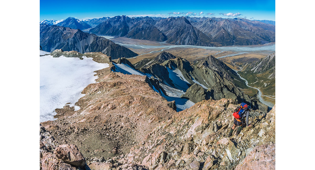
Descending the crags north east of Barrow Col, with Mt Annette between us and Mt Cook

Approaching the south side of Mt Annette (2,235m)

A view from Annette, looking down the steep headwall we climbed the day before to access the plateau


Looking across the Annette Plateau from its northern end to Mt Sealy (centre) and the Main Divide (right)

Another beautiful dusk


Heading north as we exit the Annette Plateau


Heading north as we exit the Annette Plateau

Back on the rocky ridgeline on the north eastern end of the plateau, leading towards Mt Kitchener (2,042m), with Mt Cook behind


Just above Waihi Pass (1,931m), with Kitchener beyond


The terrain all along this route was very crumbly and loose, so we took the rope option down this chute

The terrain all along this route was very crumbly and loose, so we took the rope option down this chute

Trying to figure out just where the route to the top of Kitchener was - not here at least!


Trying to figure out just where the route to the top of Kitchener was - not here at least!

Backing off a route that was beyond us


From near the top of Kitchener, looking back south to Annette Plateau. Mueller Glacier is on the right


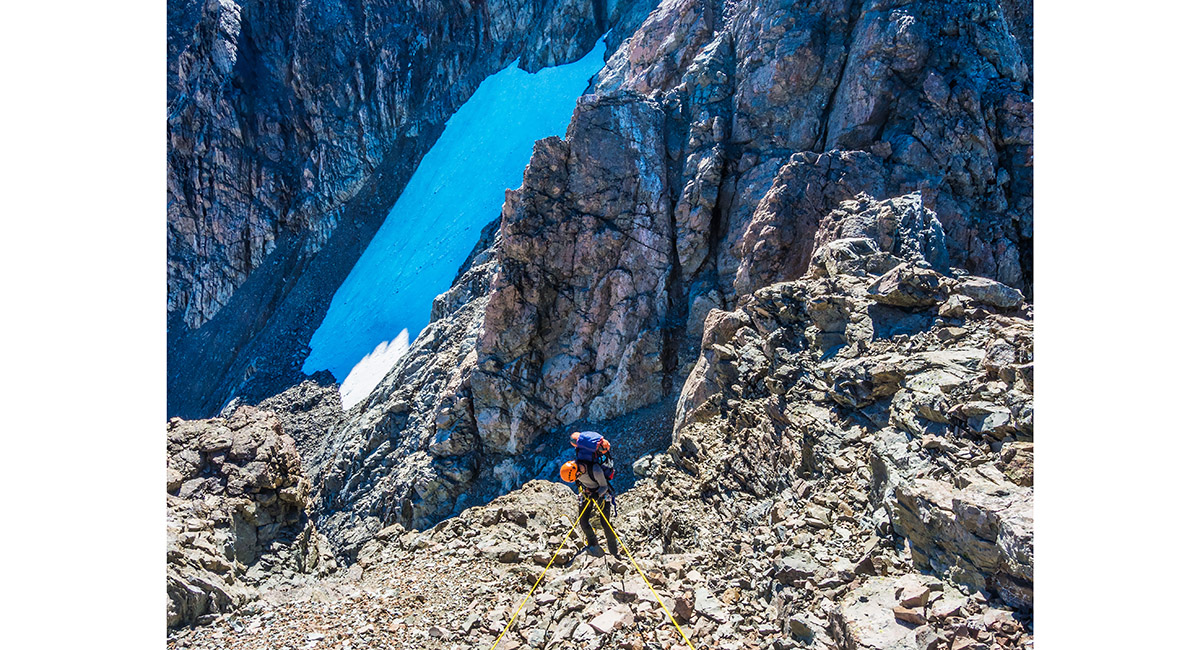
At the bottom of the crux section of our route


At the bottom of the crux section of our route

At the top of the crux section of our route


At the top of the crux section of our route


The summit of Mt Kitchener (2,042m)


Beginning our descent on the eastern side of Kitchener


At about 1,900m on our descent on the eastern side of Kitchener

Taking a breather beneath Kitchener, at a point where we felt we had a doable route back down to Mt Cook village


At about 1,700m on our descent on the eastern side of Kitchener


This treacherous little spur was between us and a gigantic scree and rock chute leading all the way to the valley floor 1,000 metres below


Looking down our exit chute - unfortunately for us, more loose rock than scree. It took us about 4 hours to get from this point down to the Hermitage - hard to believe looking at the photo, but the scale of the landscape is far bigger than it appears. Note the tiny pale green tussock triangle on the left, just before the end of the chute ...

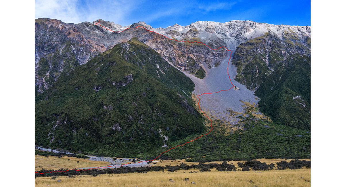
... because here it is again, viewed from the road next day. Our descent from Kitchener is traced in red

Read about it – Humbled again. A visit to Annette Plateau Vertigo Apr 17 If you think Mueller Hut is spectacular Wilderness Magazine June 2017
![]()
To order a print or web resolution file of any image you see in this slide show, just right click the image, click “Copy Image URL” and paste in to the “Your message” box of our Contact Us form. Please also note, for each image, if you want a print or web resolution file. We will get back to you as soon as possible to confirm price and payment details.
Open Contact Us in a new window to paste Image URL(s) easily